Rutki
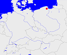
Diese Karte zeigt die Position oder den Umriss des Objekts. Haben Sie einen Fehler entdeckt? Dann würden wir uns über eine Nachricht freuen.
Übergeordnete Objekte
Legende
| | politische Verwaltung |
| | kirchliche Verwaltung |
| | gerichtliche Verwaltung |
| | Wohnplatz |
| | geographische Typen |
| | Verkehrswesen |
Übergeordnete Objekte
-
Żukowo
(Stadt- und Landgemeinde) (1999 -)
-
Powiat kartuski
(Landkreis) (1999 -)
-
Województwo pomorskie
(Wojewodschaft) (1999 -)
-
Polen (Dritte Republik), Polen, Polaca - Tercera República, Третья Речь Посполитая, La Pologne - IIIe République, Poland (Third Republic), Polska - III Rzeczpospolita
(Republik) (1999 -)
-
Europäische Wirtschaftsgemeinschaft, Europäische Gemeinschaft, Europäische Union, Comhphobal Eacnamaíochta na hEorpa, Euroopan talousyhteisö, Európske hospodárske spoločenstvo, Communauté économique européenne, Comunidad Económica Europea, European Economic Community, Comunità Economica Europea, Evropské hospodářské společenství, Europese Economische Gemeenschap, Európske spoločenstvo, Europese Gemeenschap, Euroopan Yhteisö, Comunidad Europea, European Community, Comunità Europea, Evropské společenství, Communauté européenne, Comhphobal Eorpach, Europese Unie, Aontais Eorpaigh, Unione Europea, European Union, Európska únia, Unión Europea, Euroopan Unioni, Evropská unie, Union européenne
(Staatenbund) (2004 -)
-
Vereinte Nationen, Verenigde Naties, Организация Объединённых Наций, Organización de las Naciones Unidas, Organisation des Nations unies, الأمم المتحدة, 联合国, Organizácia Spojených národov, United Nations
(Staatenbund) (1990 -)
Übergeordnete Objekte
| Name |
Zeitraum |
Typ |
Quelle |
|
Żukowo
|
(1999 -) |
Stadt- und Landgemeinde
|
Quelle
|
Bilder im GenWiki
Quicktext
RUTTKIJO94EH
	gehört ab 1999 zu object_1073449 sagt source_1079298,
	hat externe Kennung  SIMC:177164,
	heißt 2015  (auf pol) Rutki,
	ist (auf deu) Dorf,
	liegt bei 54.3308°N 18.3389°O;

