Hochbank Herve
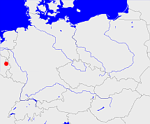
Diese Karte zeigt die Position oder den Umriss des Objekts. Haben Sie einen Fehler entdeckt? Dann würden wir uns über eine Nachricht freuen.
Übergeordnete Objekte
Legende
| | politische Verwaltung |
| | kirchliche Verwaltung |
| | gerichtliche Verwaltung |
| | Wohnplatz |
| | geographische Typen |
| | Verkehrswesen |
Übergeordnete Objekte
Übergeordnete Objekte
| Name |
Zeitraum |
Typ |
Quelle |
|
Limburg
|
(- 1793) |
Herzogtum
|
|
Untergeordnete Objekte
| Name |
Typ |
GOV-Kennung |
Zeitraum |
| Soiron |
Ort
|
SOIRONJO20VN |
(- 1793) |
| Dison |
Ort
|
object_261425 |
(- 1793) |
| Herve |
Ort
|
object_261435 |
(- 1793) |
| Clermont |
Ort
|
CLEONTJO20WP |
(- 1793) |
| Thimister |
Ort
|
THITERJO20WP |
(- 1793) |
| Chaineux |
Ort
|
CHAEUXJO20VP |
(- 1793) |
| Charneux |
Ort
|
CHAEUXJO20VQ |
(- 1793) |
Bilder im GenWiki
Quicktext
object_1023562
	gehört bis 1793 zu object_271837,
	heißt  (auf deu) Hochbank Herve,
	ist (auf deu) Gerichtsbezirk;

