Jülich-Kleve-Berg
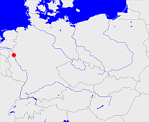
Diese Karte zeigt die Position oder den Umriss des Objekts. Haben Sie einen Fehler entdeckt? Dann würden wir uns über eine Nachricht freuen.
Übergeordnete Objekte
Legende
| | politische Verwaltung |
| | kirchliche Verwaltung |
| | gerichtliche Verwaltung |
| | Wohnplatz |
| | geographische Typen |
| | Verkehrswesen |
Übergeordnete Objekte
Übergeordnete Objekte
Untergeordnete Objekte
| Name |
Typ |
GOV-Kennung |
Zeitraum |
| Cleve, Kleve |
Regierungsbezirk
|
object_357317 |
(1815 - 1821-12-31) |
| Düsseldorf |
Regierungsbezirk
|
adm_369051 |
(1815 - 1822) |
| Köln, Cöln, Köln |
Regierungsbezirk
|
adm_369053 |
(1815 - 1822) |
Bilder im GenWiki
Quicktext
object_1047283
	gehört ab 1815-04-30 bis 1822-06-22 zu object_190317,
	hat 1817 Einwohner 1851570 sagt source_357315,
	heißt ab 1815-04-30 bis 1822-06-22  (auf deu) Jülich-Kleve-Berg,
	ist ab 1815-04-30 bis 1822-06-22 (auf deu) Provinz;

