Ovelgönne
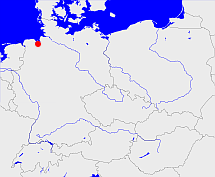
Diese Karte zeigt die Position oder den Umriss des Objekts. Haben Sie einen Fehler entdeckt? Dann würden wir uns über eine Nachricht freuen.
Übergeordnete Objekte
Legende
| | politische Verwaltung |
| | kirchliche Verwaltung |
| | gerichtliche Verwaltung |
| | Wohnplatz |
| | geographische Typen |
| | Verkehrswesen |
Übergeordnete Objekte
-
Oldenburg
(GrafschaftHerzogtumHerzogtumGroßherzogtumFreistaatLand) (1858 - 1879)
-
Dänemark, Denemarken, Dinamarca, Denmark, Danmark, Danemark, Danmark
(Königreich) (1667 - 1773)
-
Dänemark, Denemarken, Dinamarca, Denmark, Danemark, Danmark, Danmark
(Königreich)
-
Europäische Wirtschaftsgemeinschaft, Europäische Gemeinschaft, Europäische Union, Comhphobal Eacnamaíochta na hEorpa, Euroopan talousyhteisö, Európske hospodárske spoločenstvo, Communauté économique européenne, Comunidad Económica Europea, European Economic Community, Comunità Economica Europea, Evropské hospodářské společenství, Europese Economische Gemeenschap, Európske spoločenstvo, Europese Gemeenschap, Euroopan Yhteisö, Comunidad Europea, European Community, Comunità Europea, Evropské společenství, Communauté européenne, Comhphobal Eorpach, Europese Unie, Aontais Eorpaigh, Unione Europea, European Union, Európska únia, Unión Europea, Euroopan Unioni, Evropská unie, Union européenne
(Staatenbund) (1973 -)
-
Norddeutscher Bund
(StaatenbundBundesstaat) (1867 - 1870)
-
Britische Besatzungszone
(Besatzungszone) (1945 - 1946-10-31)
-
Deutscher Bund, German Confederation
(Staatenbund) (1814 - 1866)
-
Rheinbund, Confédération du Rhin
(Staatenbund) (1808 - 1810)
-
Deutsches Reich, German Empire, Duitse Rijk
(Bundesstaat) (1871 - 1945)
-
Niederländisch-Westfälischer Reichskreis, Westfälischer Reichskreis, Niederrheinisch-Westfälischer Reichskreis
(Reichskreis) (1500 - 1774)
Übergeordnete Objekte
| Name |
Zeitraum |
Typ |
Quelle |
|
Oldenburg
|
(1858 - 1879) |
Grafschaft
Herzogtum
Herzogtum
Großherzogtum
Freistaat
Land
|
|
Untergeordnete Objekte
| Name |
Typ |
GOV-Kennung |
Zeitraum |
| Schwei |
Gemeinde
Gemeinde
|
SCHWEIJO43EJ |
(1858 - 1879) |
| Strückhausen |
Gemeinde
|
STRSE2JO43EH |
(1858 - 1879) |
| Ovelgönne |
Gemeinde
|
OVENNEJO43FI |
(1858 - 1879) |
| Esenshamm |
Gemeinde
|
object_385304 |
(1858 - 1879) |
| Rodenkirchen |
Gemeinde
|
object_1143492 |
(1858 - 1879) |
Bilder im GenWiki
Quicktext
object_1049825
	gehört ab 1858 bis 1879 zu object_352387,
	heißt  (auf deu) Ovelgönne,
	ist ab 1858 bis 1879 (auf deu) Amt (kreisähnlich);

