Gräfenstein
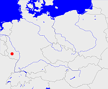
Diese Karte zeigt die Position oder den Umriss des Objekts. Haben Sie einen Fehler entdeckt? Dann würden wir uns über eine Nachricht freuen.
Übergeordnete Objekte
Legende
| | politische Verwaltung |
| | kirchliche Verwaltung |
| | gerichtliche Verwaltung |
| | Wohnplatz |
| | geographische Typen |
| | Verkehrswesen |
Übergeordnete Objekte
Übergeordnete Objekte
| Name |
Zeitraum |
Typ |
Quelle |
|
Baden-Baden
|
(1748 - 1771) |
Markgrafschaft
|
|
Untergeordnete Objekte
| Name |
Typ |
GOV-Kennung |
Zeitraum |
| Staffelhof |
Hof
|
STAHOF_W6588 |
(1775) |
| Leimen |
Ortsgemeinde
|
LEIMENJN39VG |
(1570 - 1798) |
| Clausen |
Dorf
Ortsgemeinde
|
CLASENJN39UG |
(1570 - 1798) |
| Rodalben |
Stadt
|
RODBE1JN39TF |
(1570 - 1798) |
| Merzalben |
Dorf
Ortsgemeinde
|
MERBENJN39UG |
(1570 - 1798) |
| Münchweiler an der Rodalb |
Dorf
Ortsgemeinde
|
MUNALBJN39UF |
(1570 - 1798) |
Bilder im GenWiki
Quicktext
object_1079542
	gehört ab 1748 bis 1771 zu object_307234,
	heißt ab 1570 bis 1969  (auf deu) Gräfenstein,
	ist bis 1801 (auf deu) Amt (Verwaltung) sagt source_1086835;

