Evangelisch-lutherische Kirche von Mecklenburg-Strelitz
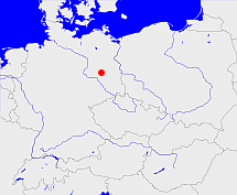
Diese Karte zeigt die Position oder den Umriss des Objekts. Haben Sie einen Fehler entdeckt? Dann würden wir uns über eine Nachricht freuen.
Bemerkungen
Fusionierte zum Jahreswechsel 1933/34 mit der „Evangelisch-lutherische Kirche von Mecklenburg-Schwerin“ zur „Evangelisch-Lutherischen Landeskirche Mecklenburgs“
Übergeordnete Objekte
Legende
| | politische Verwaltung |
| | kirchliche Verwaltung |
| | gerichtliche Verwaltung |
| | Wohnplatz |
| | geographische Typen |
| | Verkehrswesen |
Übergeordnete Objekte
Übergeordnete Objekte
Bilder im GenWiki
Quicktext
object_1157598
	 TEXT: Fusionierte zum Jahreswechsel 1933/34 mit der „Evangelisch-lutherische Kirche von Mecklenburg-Schwerin“ zur „Evangelisch-Lutherischen Landeskirche Mecklenburgs“
:TEXT,
	gehört ab 1922-05-25 bis 1933-07 zu object_1157477,
	gehört ab 1933-07 bis 1933-12-31 zu object_1157476,
	hat Konfession lu,
	heißt bis 1933-12-31  (auf deu) Evangelisch-lutherische Kirche von Mecklenburg-Strelitz,
	ist bis 1933-12-31 (auf deu) Landeskirche;

