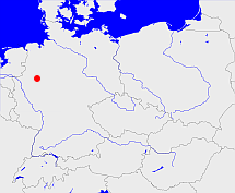
Beckum (Stadt- und Gogericht)

Diese Karte zeigt die Position oder den Umriss des Objekts. Haben Sie einen Fehler entdeckt? Dann würden wir uns über eine Nachricht freuen.
Bemerkungen
Die Verwaltungsfunktion wurde 1809 an die Mairie ausgegliedert
Übergeordnete Objekte
Legende
| | politische Verwaltung |
| | kirchliche Verwaltung |
| | gerichtliche Verwaltung |
| | Wohnplatz |
| | geographische Typen |
| | Verkehrswesen |
Übergeordnete Objekte
-
Beckumscher Kreis
(Kreis) (1804 - 1809)
-
Münster
(HochstiftFürstentum) (1806 - 1809)
-
Berg, Grand-Duché de Berg
(Großherzogtum) (1807 - 1808)
-
Preußen, Pruissen, Pruisen
(HerzogtumKönigreichFreistaat) (1803 - 1807)
-
Heiliges Römisches Reich, Heiliges Römisches Reich deutscher Nation, Heiliges Römisches Reich, Sacrum Imperium, Sacrum Romanum Imperium, Sacrum Romanum Imperium Nationis Germanicæ
(KönigreichKaiserreich) (- 1500)
-
Niederländisch-Westfälischer Reichskreis, Westfälischer Reichskreis, Niederrheinisch-Westfälischer Reichskreis
(Reichskreis) (1500 - 1802)
-
Wolbeck
(Amt) (- 1803)
-
Oberstift Münster
(Landesteil) (- 1802)
-
Münster
(HochstiftFürstentum) (- 1802)
-
Berg, Grand-Duché de Berg
(Großherzogtum) (1807 - 1808)
-
Preußen, Pruissen, Pruisen
(HerzogtumKönigreichFreistaat) (1803 - 1807)
-
Heiliges Römisches Reich, Heiliges Römisches Reich deutscher Nation, Heiliges Römisches Reich, Sacrum Imperium, Sacrum Romanum Imperium, Sacrum Romanum Imperium Nationis Germanicæ
(KönigreichKaiserreich) (- 1500)
-
Niederländisch-Westfälischer Reichskreis, Westfälischer Reichskreis, Niederrheinisch-Westfälischer Reichskreis
(Reichskreis) (1500 - 1802)
Übergeordnete Objekte
Untergeordnete Objekte
| Name |
Typ |
GOV-Kennung |
Zeitraum |
| Beckum Kirchspiel |
Landgemeinde
|
object_1158289 |
(- 1812) |
| Beckum |
Stadt
Stadtteil
|
BECKU1JO41AS |
(- 1803) |
| Vellern |
Landgemeinde
Stadtteil
|
VELERNJO41BS |
(- 1809) |
Bilder im GenWiki
Quicktext
object_1170704
	 TEXT:Die Verwaltungsfunktion wurde 1809 an die Mairie ausgegliedert:TEXT,
	gehört ab 1804 bis 1809 zu object_1170782,
	gehört bis 1803 zu object_1157741,
	heißt  (auf deu) Beckum (Stadt- und Gogericht),
	ist bis 1812 (auf deu) Gerichtsamt;

