Gramm, Grammby, Gram

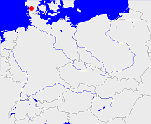
Diese Karte zeigt die Position oder den Umriss des Objekts. Haben Sie einen Fehler entdeckt? Dann würden wir uns über eine Nachricht freuen.
Übergeordnete Objekte
Legende
| | politische Verwaltung |
| | kirchliche Verwaltung |
| | gerichtliche Verwaltung |
| | Wohnplatz |
| | geographische Typen |
| | Verkehrswesen |
Übergeordnete Objekte
-
Hadersleben, Haderslev
(Amt) (1921 - 1970)
-
Dänemark, Denemarken, Dinamarca, Denmark, Danmark, Danemark, Danmark
(Königreich)
-
Dänemark, Denemarken, Dinamarca, Denmark, Danemark, Danmark, Danmark
(Königreich)
-
Europäische Wirtschaftsgemeinschaft, Europäische Gemeinschaft, Europäische Union, Comhphobal Eacnamaíochta na hEorpa, Euroopan talousyhteisö, Európske hospodárske spoločenstvo, Communauté économique européenne, Comunidad Económica Europea, European Economic Community, Comunità Economica Europea, Evropské hospodářské společenství, Europese Economische Gemeenschap, Európske spoločenstvo, Europese Gemeenschap, Euroopan Yhteisö, Comunidad Europea, European Community, Comunità Europea, Evropské společenství, Communauté européenne, Comhphobal Eorpach, Europese Unie, Aontais Eorpaigh, Unione Europea, European Union, Európska únia, Unión Europea, Euroopan Unioni, Evropská unie, Union européenne
(Staatenbund) (1973 -)
Übergeordnete Objekte
Untergeordnete Objekte
| Name |
Typ |
GOV-Kennung |
Zeitraum |
| Gröndallund, Grönballund, Grøndallund |
Hof
|
object_1260076 |
(1921 - 1966) |
| Skovgaard, Skovgård |
Hof
|
SKOARDJO45MG |
(1921 - 1966) |
| Billeslund |
Hof
|
BILUNDJO45MH |
(- 1920) |
| Billeslund |
Hof
|
BILUNDJO45MH |
(1921 - 1966) |
| Lundsgaard, Lundsgård |
Häusergruppe
|
LUNARDJO45LG |
(1921 - 1966) |
| Gjelsbro, Gelsbro |
Wohnplatz
|
GJEBROJO45LH |
(1921 - 1966) |
| Kastrupfeld, Kastrupmark |
Höfe
|
KASELDJO45MG |
(1921 - 1966) |
| Feldten, Felt |
Häusergruppe
|
FELTENJO45MG |
(1921 - 1966) |
| Hindballe |
Häusergruppe
|
HINLLEJO45MH |
(1921 - 1966) |
| Grammlund, Gramlund |
Wohnplatz
|
GRAUNDJO45MG |
(1921 - 1966) |
| Endrupskov, Enderupskov |
Dorf
|
ENDKOVJO45LG |
(1921 - 1966) |
| Brandenhof |
Hof
|
BRAHOFJO45MG |
(1921 - 1966) |
| Westerlinnet, Wester Linnet, Vester Lindet |
Dorf
|
VESDETJO45MH |
(1921 - 1966) |
| Westernübel, Wester-Nübbel, Wester Nübel, Vester Nybøl |
Wohnplatz
|
WESBELJO45LH |
(1921 - 1966) |
| Porsgeil, Porsgejl |
Häuser
|
POREILJO45NG |
(1921 - 1966) |
| Frismark, Friskmark |
Häusergruppe
|
FRIARKJO45MG |
(1921 - 1966) |
| Fohl, Fole |
sognekommune
|
object_1278705 |
(1966 - 1970) |
| Mögelballe, Møgelballe |
Hof
|
MOGLLEJO45MH |
(1921 - 1966) |
| Grammgaard, Gramgård |
Hof
|
GRAARDJO45MH |
(1921 - 1966) |
| Aaskov, Åskov |
Hof
|
object_1260108 |
(1921 - 1966) |
| Jenning |
Häusergruppe
|
JENINGJO45MG |
(1921 - 1966) |
| Holt |
Höfe
|
object_1260163 |
(1921 - 1966) |
| Schmidtfeld, Smedemark |
Hof
|
SCHELDJO45NG |
(1921 - 1966) |
| Thiset, Tiset |
Dorf
|
TISSETJO45MG |
(1921 - 1966) |
| Endrupskovostermark, Enderupskov Østermark |
Häuser
|
object_1260320 |
(1921 - 1966) |
| Laasled, Laasled, Forsthaus, Låsled |
Forsthaus
|
LAAAUSJO45MH |
(1921 - 1966) |
| Nübbelgaard, Nübbel, Nybølgård |
Hof
|
NYBGRDJO45LH |
(1921 - 1966) |
| Kastrup |
Dorf
|
KASRUPJO45MG |
(1921 - 1966) |
| Grammby, Gram |
Kirchdorf
|
GRAMBYJO45MG |
(1921 - 1966) |
| Demstrup |
Häusergruppe
|
object_1260311 |
(1921 - 1966) |
| Marbekgaard, Marbækgård |
Hof
|
MARARDJO45MG |
(1921 - 1966) |
| Gramm, Gram |
Ort
|
GRARAMJO45MG |
|
| Gramm, Gram |
Ort
|
GRARAMJO45MG |
(1921 - 1966) |
| Aarup, Årup |
Höfe
|
AARRUPJO45LH |
(1921 - 1966) |
| Hovgaardslund, Hovgårdlund |
Hof
|
HOVUNDJO45MG |
(1921 - 1966) |
| Krogslund |
Forsthaus
|
KROUNDJO45MH |
(1921 - 1966) |
| Aarupgaard, Årupgård |
Hof
|
RUPGRDJO45LH |
(1921 - 1966) |
| Nörgaard, Nørregård |
Hof
|
NORARDJO45MG |
(1921 - 1966) |
| Storlund |
Hof
|
STOUNDJO45LH |
(1921 - 1966) |
| Westerlinnet Birk, Birk |
Häuser
|
BIRIRKJO45NH |
(1921 - 1966) |
| Asdalgaard, Asdalgård |
Hof
|
ASDARDJO45MG |
(1921 - 1966) |
Bilder im GenWiki
Quicktext
object_1273698
	gehört ab 1921 bis 1970 zu object_282117,
	hat 1922 Einwohner 801 sagt source_1336800 (S. 1402),
	heißt  (auf dan) Gram,
	heißt  (auf deu) Gramm,
	heißt 1922  (auf deu) Grammby sagt source_1336800 (S. 1402),
	ist (auf deu) sognekommune;

