Nieder Salzbrunn, Salzbrunn
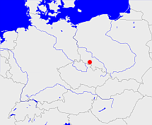
Diese Karte zeigt die Position oder den Umriss des Objekts. Haben Sie einen Fehler entdeckt? Dann würden wir uns über eine Nachricht freuen.
Übergeordnete Objekte
Legende
| | politische Verwaltung |
| | kirchliche Verwaltung |
| | gerichtliche Verwaltung |
| | Wohnplatz |
| | geographische Typen |
| | Verkehrswesen |
Übergeordnete Objekte
Übergeordnete Objekte
Untergeordnete Objekte
| Name |
Typ |
GOV-Kennung |
Zeitraum |
| Ober Salzbrunn, Bad Salzbrunn |
Stadt
|
object_188092 |
(1885) |
| Ober Salzbrunn, Bad Salzbrunn, Szczawno-Zdrój |
Kapelle
|
OBEUNNJO80DT |
|
| Nieder Salzbrunn, Szczawienko |
Dorf
Stadtteil
|
NIEUNNJO80DT |
(1885) |
| Seitendorf, Poniatów (Wałbrzych), Poniatów, Wałbrzych-Poniatów |
Dorf
Stadtteil
|
object_188112 |
(1885) |
| Seitendorf |
Landgemeinde
Gemeinde
|
object_1197800 |
(1885) |
| Salzbrunn, Nieder Salzbrunn, Szczawienko, Wałbrzych (Szczawienko) |
Kirche
Ruine
|
object_173941 |
(- 1960) |
| Nieder Salzbrunn |
Landgemeinde
Gemeinde
|
object_1197857 |
(1885) |
Bilder im GenWiki
Quicktext
object_173940
	gehört 1927 zu object_172426 sagt source_257642 (S. 264),
	hat 1927 Konfession ev sagt source_257642 (S. 264),
	heißt 1885  (auf deu) Nieder Salzbrunn sagt source_214893 (S. 168/169 ev. Kirchspiel zu Nr. 48),
	heißt 1927  (auf deu) Salzbrunn sagt source_257642 (S. 264),
	ist 1927 (auf deu) Kirchspiel sagt source_257642 (S. 264);

