Lingen
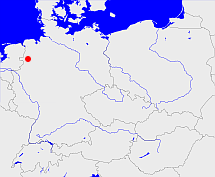
Diese Karte zeigt die Position oder den Umriss des Objekts. Haben Sie einen Fehler entdeckt? Dann würden wir uns über eine Nachricht freuen.
Übergeordnete Objekte
Legende
| | politische Verwaltung |
| | kirchliche Verwaltung |
| | gerichtliche Verwaltung |
| | Wohnplatz |
| | geographische Typen |
| | Verkehrswesen |
Übergeordnete Objekte
Übergeordnete Objekte
Untergeordnete Objekte
| Name |
Typ |
GOV-Kennung |
Zeitraum |
| Lingen |
Kirchengemeinde
|
object_178060 |
(- 1989) |
| Osnabrück |
Kirchengemeinde
|
object_178064 |
(- 1989) |
| Schapen |
Kirchengemeinde
|
object_178074 |
(- 1989) |
| Lengerich-Emsland |
Kirchengemeinde
|
object_178058 |
(- 1989) |
| Freren-Thuine |
Kirchengemeinde
|
object_178072 |
(- 1989) |
| Plantlünne, Lünne |
Kirchengemeinde
|
object_178066 |
(- 1989) |
| Baccum |
Kirchengemeinde
|
object_178062 |
(- 1989) |
Bilder im GenWiki
Quicktext
object_177971
	gehört zu object_177966,
	hat Konfession ev,
	heißt  (auf deu) Lingen,
	ist (auf deu) Kirchenkreis;

