Bonyhad
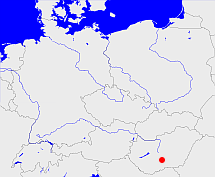
Diese Karte zeigt die Position oder den Umriss des Objekts. Haben Sie einen Fehler entdeckt? Dann würden wir uns über eine Nachricht freuen.
Übergeordnete Objekte
Legende
| | politische Verwaltung |
| | kirchliche Verwaltung |
| | gerichtliche Verwaltung |
| | Wohnplatz |
| | geographische Typen |
| | Verkehrswesen |
Übergeordnete Objekte
Übergeordnete Objekte
| Name |
Zeitraum |
Typ |
Quelle |
|
Bonyhád
|
|
Kirchspiel
|
|
Bilder im GenWiki
Quicktext
object_182025
	hat Konfession ev,
	heißt  (auf deu) Bonyhad,
	ist (auf deu) Kirche,
	repräsentiert  object_182024;

