Hohenzollern-Sigmaringen
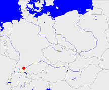
Diese Karte zeigt die Position oder den Umriss des Objekts. Haben Sie einen Fehler entdeckt? Dann würden wir uns über eine Nachricht freuen.
Bemerkungen
1849 im Regierungsbezirk Sigmaringen aufgegangen
Übergeordnete Objekte
Legende
| | politische Verwaltung |
| | kirchliche Verwaltung |
| | gerichtliche Verwaltung |
| | Wohnplatz |
| | geographische Typen |
| | Verkehrswesen |
Übergeordnete Objekte
Übergeordnete Objekte
Untergeordnete Objekte
| Name |
Typ |
GOV-Kennung |
Zeitraum |
| Trochtelfingen |
Oberamt
|
object_406229 |
(1806-07-12 - 1849-12-07) |
| Hohenzollern-Sigmaringen |
Grafschaft
|
object_1194748 |
(- 1806-07-11) |
| Hohenfels |
Oberamt
|
object_406226 |
(1806-07-12 - 1822-04-16) |
| Wald |
Oberamt
|
object_406230 |
(1806-07-12 - 1849-12-07) |
| Glatt |
Oberamt
|
object_406231 |
(1803-03-10 - 1849-12-07) |
| Gammertingen |
Oberamt
|
object_308894 |
(1806-07-12 - 1849-12-06) |
| Jungnau |
Oberamt
|
object_406227 |
(1806-07-12 - 1840-10-31) |
| Achberg |
Oberamt
|
object_406222 |
(1806-07-12 - 1849-12-07) |
| Ostrach |
Oberamt
|
object_406225 |
(1806-07-12 - 1849-12-06) |
| Sigmaringen |
Oberamt
|
object_308893 |
(1806-07-12 - 1849-12-07) |
| Straßberg |
Oberamt
|
object_406228 |
(1806-07-12 - 1849-12-07) |
| Hettingen |
Oberamt
|
object_406224 |
(1806-07-12 - 1814) |
| Beuron |
Oberamt
|
object_406223 |
(1802-12-19 - 1830-05-01) |
| Haigerloch |
Oberamt
|
object_308896 |
(1806-07-12 - 1849-12-07) |
Bilder im GenWiki
Quicktext
object_284443
	 TEXT: 1849 im Regierungsbezirk Sigmaringen aufgegangen :TEXT,
	gehört ab 1806-07-12 bis 1813 zu object_265445,
	gehört ab 1815 bis 1849 zu object_218127,
	gehört bis 1806-07-11 zu object_218167,
	heißt  (auf deu) Hohenzollern-Sigmaringen,
	ist ab 1623 bis 1849 (auf deu) Fürstentum;

