Wredenhagen
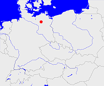
Diese Karte zeigt die Position oder den Umriss des Objekts. Haben Sie einen Fehler entdeckt? Dann würden wir uns über eine Nachricht freuen.
Übergeordnete Objekte
Legende
| | politische Verwaltung |
| | kirchliche Verwaltung |
| | gerichtliche Verwaltung |
| | Wohnplatz |
| | geographische Typen |
| | Verkehrswesen |
Übergeordnete Objekte
Übergeordnete Objekte
Untergeordnete Objekte
| Name |
Typ |
GOV-Kennung |
Zeitraum |
| Karbow |
Gemeinde
Ortsteil
|
KARBOW_O2071 |
(- 1921-03-31) |
| Roggentin |
Wüstung
|
ROGTINJO63JI |
(- 1921-03-31) |
| Leizen |
Gemeinde
|
LEIZENJO63FI |
(- 1921-03-31) |
| Leizen |
Ortsteil
|
LEIZE1JO63FI |
(- 1921-03-31) |
| Leppin |
Wüstung
|
LEPPINJO63JI |
(- 1921-03-31) |
| Ludorf |
Gemeinde
|
LUDORFJO63IJ |
(- 1921-03-31) |
| Massow |
Gemeinde
|
MASSOWJO63FH |
(- 1921-03-31) |
| Solzow |
Gemeinde
Ortsteil
|
SOLZOW_O2071 |
(- 1921-03-31) |
| Zielow |
Gemeinde
Ortsteil
|
ZIELOWJO63II |
(- 1921-03-31) |
| Buchholz |
Gemeinde
|
BUCOLZJO63HG |
(- 1921-03-31) |
| Nätebow |
Gemeinde
Wohnplatz
|
NATBOWJO63GI |
(- 1921-03-31) |
| Wendhof |
Gemeinde
Ortsteil
|
WENHOF_O2071 |
(- 1921-03-31) |
| Dambeck |
Gemeinde
Ortsteil
|
DAMECKJO63GI |
(- 1921-03-31) |
| Wildkuhl |
Gemeinde
Ortsteil
|
WILUHL_O2071 |
(- 1921-03-31) |
| Jaebetz |
Gemeinde
Ortsteil
|
JABITZJO63EH |
(- 1921-03-31) |
| Netzeband |
Landgemeinde
Gemeinde
|
NETANDJO62HX |
(- 1921-03-31) |
| Melz |
Gemeinde
Ortsteil
|
MELEL1JO63HH |
(- 1921-03-31) |
| Hinrichsberg |
Gemeinde
Ortsteil
|
HINERG_O2071 |
(- 1921-03-31) |
| Below |
Gemeinde
Ortsteil
|
BELLOWJO63FG |
(- 1921-03-31) |
| Spitzkuhn |
Gemeinde
Ortsteil
|
SPIUHN_O2071 |
(- 1921-03-31) |
| Klink |
Ortsteil
|
KLIIN2JO63HL |
(- 1921-03-31) |
| Dammwolde |
Gemeinde
Ortsteil
|
DAMLDEJO63EI |
(- 1921-03-31) |
| Wackstow |
Gemeinde
Ortsteil
|
WACTOWJO63GI |
(- 1921-03-31) |
| Grabenitz |
Gemeinde
Ortsteil
|
GRAITZJO63GL |
(- 1921-03-31) |
| Blücher, Lebbin |
Gemeinde
Ortsteil
|
LEBBINJO63GL |
(- 1921-03-31) |
| Groß Kelle |
Gemeinde
|
KELLLEJO63GJ |
(- 1921-03-31) |
| Ahrensberg |
Gemeinde
Ortsteil
|
AHRERGJO63MG |
(- 1921-03-31) |
| Karchow |
Gemeinde
Wohnplatz
|
KARHOWJO63GI |
(- 1921-03-31) |
| Fincken |
Gemeinde
|
FINKENJO63FI |
(- 1921-03-31) |
| Klopzow |
Wüstung
|
KLOZOWJO63JI |
(- 1921-03-31) |
| Krümmel |
Gemeinde
Ortsteil
|
KRUMELJO63IG |
(- 1921-03-31) |
| Priborn |
Gemeinde
|
PRIORNJO63IH |
(- 1921-03-31) |
| Zierzow |
Gemeinde
Ortsteil
|
ZIEROWJO63GK |
(- 1921-03-31) |
| Bollewick |
Gemeinde
Ortsteil
|
BOLICK_O2071 |
(- 1921-03-31) |
| Schönberg |
Landgemeinde
Gemeinde
|
SCHERGJO62GX |
(- 1921-03-31) |
| Gotthun |
Gemeinde
|
GOTHUNJO63HK |
(- 1921-03-31) |
| Grabow |
Gemeinde
Ortsteil
|
GRABOWJO63FG |
(- 1921-03-31) |
Bilder im GenWiki
Quicktext
object_333736
	gehört bis 1921-03-31 zu object_217750,
	hat 1907 Fläche 379.18 sagt source_265044,
	hat 1910-12-01 Einwohner 5273 sagt source_265044,
	hat 1912 Fläche 379.18 sagt source_265044,
	heißt  (auf deu) Wredenhagen,
	ist bis 1921-03-31 (auf deu) Ritterschaftliches Amt sagt source_317506 (Seite 111);

