Wasserburg am Inn
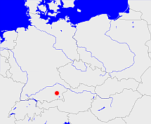
Diese Karte zeigt die Position oder den Umriss des Objekts. Haben Sie einen Fehler entdeckt? Dann würden wir uns über eine Nachricht freuen.
Übergeordnete Objekte
Legende
| | politische Verwaltung |
| | kirchliche Verwaltung |
| | gerichtliche Verwaltung |
| | Wohnplatz |
| | geographische Typen |
| | Verkehrswesen |
Übergeordnete Objekte
-
Isarkreis, Oberbayern, Upper Bavaria
(KreisRegierungsbezirk) (1862-07-01 - 1972-06-30)
-
Baiern, Kurpfalz-Bayern, Churpfalz-Baiern, Pfalz-Baiern, Bayern, Bavaria
(HerzogtumKönigreichFreistaat) (1808-10-01 - 1946)
-
Bayern, Bavière, Bavaria, Beieren, Бавария
(Bundesland) (1946 -)
-
Südostzone, amerikanische Besatzungszone, US-Besatzungszone, American Zone of Occupation
(Besatzungszone) (1945 - 1949-05-23)
-
Deutschland, Bundesrepublik Deutschland, Allemagne, Duitsland, Vokietija, Niemcy, Nemecká spolková republika, Federal Republic of Germany, Tyskland, Germany, Герма́ния
(Staat) (1949-05-24 -)
-
Europäische Wirtschaftsgemeinschaft, Europäische Gemeinschaft, Europäische Union, Comhphobal Eacnamaíochta na hEorpa, Euroopan talousyhteisö, Európske hospodárske spoločenstvo, Communauté économique européenne, Comunidad Económica Europea, European Economic Community, Comunità Economica Europea, Evropské hospodářské společenství, Europese Economische Gemeenschap, Európske spoločenstvo, Europese Gemeenschap, Euroopan Yhteisö, Comunidad Europea, European Community, Comunità Europea, Evropské společenství, Communauté européenne, Comhphobal Eorpach, Europese Unie, Aontais Eorpaigh, Unione Europea, European Union, Európska únia, Unión Europea, Euroopan Unioni, Evropská unie, Union européenne
(Staatenbund) (1958 -)
-
Vereinte Nationen, Verenigde Naties, Организация Объединённых Наций, Organización de las Naciones Unidas, Organisation des Nations unies, الأمم المتحدة, 联合国, Organizácia Spojených národov, United Nations
(Staatenbund) (1973-09-18 -)
Übergeordnete Objekte
Untergeordnete Objekte
| Name |
Typ |
GOV-Kennung |
Zeitraum |
| Babensham |
Gemeinde
|
object_257268 |
(- 1972-06-30) |
| Rott a.Inn, Rott am Inn |
Gemeinde
|
ROTINNJN67BX |
(- 1972-06-30) |
| Reichertsheim |
Gemeinde
|
object_300423 |
(- 1972-06-30) |
| Titlmoos |
Gemeinde
|
object_397798 |
(- 1971-03-31) |
| Allmannsau |
Gemeinde
|
object_397821 |
(- 1971-06-30) |
| Winden |
Gemeinde
|
object_397820 |
(- 1971-06-30) |
| Evenhausen |
Gemeinde
|
object_397809 |
(- 1971-03-31) |
| Gatterberg |
Gemeinde
|
object_397801 |
(- 1971-03-31) |
| Westach |
Gemeinde
|
object_397812 |
(- 1971-03-31) |
| Bachmehring |
Gemeinde
|
object_397794 |
(- 1971-03-31) |
| Sankt Christoph |
Gemeinde
|
object_397476 |
(- 1972-06-30) |
| Obertaufkirchen |
Gemeinde
|
object_300420 |
(- 1879-12-31) |
| Mittbach |
Gemeinde
|
object_397477 |
(- 1972-06-30) |
| Schleefeld |
Gemeinde
|
object_397819 |
(- 1971-03-31) |
| Kronberg |
Gemeinde
|
object_397800 |
(- 1971-03-31) |
| Haag in Oberbayern |
Markt
|
object_301064 |
(1862-07-01 - 1972-06-30) |
| Kirchensur |
Gemeinde
|
object_397810 |
(- 1971-03-31) |
| Gars am Inn |
Markt
|
GARARSJN68DD |
(- 1972-06-30) |
| Schlicht |
Gemeinde
|
object_397822 |
(- 1971-06-30) |
| Maitenbeth |
Gemeinde
|
object_299124 |
(- 1972-06-30) |
| Wasserburg am Inn |
Stadt
|
object_257311 |
(1862-07-01 - 1972-06-30) |
| Rosenberg |
Gemeinde
|
object_397797 |
(- 1971-03-31) |
| Aham |
Gemeinde
|
object_397793 |
(- 1971-03-31) |
| Berg |
Gemeinde
|
object_397807 |
(1862-07-01 - 1971-03-31) |
| Isen |
Markt
|
object_300294 |
(- 1972-06-30) |
| Wang |
Gemeinde
|
object_397818 |
(- 1971-03-31) |
| Elsbeth |
Gemeinde
|
object_397816 |
(- 1971-03-31) |
| Jeßling |
Gemeinde
|
object_397802 |
(- 1971-03-31) |
| Attel |
Gemeinde
|
object_397725 |
(- 1972-06-30) |
| Kling |
Gemeinde
|
object_397726 |
(- 1972-06-30) |
| Soyen |
Gemeinde
|
object_257274 |
(- 1972-06-30) |
| Mittergars |
Gemeinde
|
object_397815 |
(- 1971-03-31) |
| Eiselfing |
Gemeinde
|
object_257278 |
(- 1972-06-30) |
| Griesstätt |
Gemeinde
|
object_257282 |
(- 1972-06-30) |
| Schwindegg |
Gemeinde
|
object_299123 |
(- 1879-12-31) |
| Grünthal |
Gemeinde
|
object_397817 |
(- 1971-03-31) |
| Fürholzen |
Gemeinde
|
object_397808 |
(- 1971-03-31) |
| Ramerberg |
Gemeinde
|
object_257296 |
(- 1972-06-30) |
| Schwindkirchen |
Gemeinde
|
object_397122 |
(- 1879-12-31) |
| Oberornau |
Gemeinde
|
object_397710 |
(- 1972-06-30) |
| Amerang |
Gemeinde
|
object_257266 |
(- 1972-06-30) |
| Rechtmehring |
Gemeinde
|
object_299126 |
(- 1972-06-30) |
| Pfaffing |
Gemeinde
|
object_257293 |
(- 1972-06-30) |
| Penzing |
Gemeinde
|
object_397789 |
(- 1970-06-30) |
| Freiham |
Gemeinde
|
object_397795 |
(- 1971-03-31) |
| Pyramoos |
Gemeinde
|
object_397804 |
(- 1971-03-31) |
| Kirchdorf |
Gemeinde
|
KIRORFJN68CE |
(- 1972-06-30) |
| Dachberg |
Gemeinde
|
object_397799 |
(- 1971-03-31) |
| Zillham |
Gemeinde
|
object_397791 |
(- 1970-12-31) |
| Schönbrunn |
Gemeinde
|
object_397805 |
(- 1971-03-31) |
| Steppach |
Gemeinde
|
object_397806 |
(- 1971-03-31) |
| Sankt Wolfgang |
Gemeinde
|
SANANGJN68BF |
(- 1972-06-30) |
| Lappach |
Gemeinde
|
object_397803 |
(- 1971-03-31) |
| Albaching |
Gemeinde
|
ALBINGJN68BC |
(- 1972-06-30) |
| Schönberg |
Gemeinde
|
object_397796 |
(- 1971-03-31) |
| Schambach |
Gemeinde
|
object_397790 |
(- 1970-12-31) |
| Au am Inn |
Gemeinde
|
object_397813 |
(- 1971-03-31) |
| Utzenbichl |
Gemeinde
|
object_397792 |
(- 1971-03-31) |
| Schonstett |
Gemeinde
|
object_257304 |
(- 1972-06-30) |
| Schiltern |
Gemeinde
|
object_397823 |
(- 1972-06-30) |
| Schnaupping |
Gemeinde
|
object_397811 |
(- 1971-03-31) |
| Lengmoos |
Gemeinde
|
object_397814 |
(- 1971-03-31) |
| Edling |
Gemeinde
Gemeinde
|
object_257276 |
(- 1972-06-30) |
Bilder im GenWiki
Quicktext
object_397115
	gehört ab 1862-07-01 bis 1972-06-30 zu adm_369091,
	hat 1900 Einwohner 36148 sagt source_394481 (S. IX),
	hat 1903 Fläche 654.37 sagt source_394481 (S. IX),
	hat 1910 Einwohner 38581 sagt source_1341051 (Tab. III S. 38),
	hat 1910 Fläche 654.38 sagt source_1341051 (Tab. III S. 39),
	hat 1925 Einwohner 39677 sagt source_395211 (S. 8*),
	hat 1928 Fläche 654.37 sagt source_395211 (S. 8*),
	hat 1933 Einwohner 39490 sagt source_1267338 (S. 12),
	hat 1939 Einwohner 39151 sagt source_298730 (S. 15),
	hat 1941 Fläche 651.36 sagt source_298730 (S. 15),
	hat 1950 Einwohner 54790 sagt source_394864 (S. 18),
	hat 1952 Fläche 651.38 sagt source_394864 (S. 18),
	hat 1961 Einwohner 48839 sagt source_379404 (Sp. 229),
	hat 1964 Fläche 651.38 sagt source_379404 (Sp. 229),
	hat 1970 Einwohner 52670 sagt source_1343040 (A S. 2),
	hat 1970 Fläche 651.15 sagt source_1343040 (A S. 2),
	hat URL  https://de.wikipedia.org/wiki/Landkreis_Wasserburg_am_Inn,
	heißt  (auf deu) Wasserburg am Inn,
	ist ab 1862-07-01 bis 1938-12-31 (auf deu) Bezirksamt,
	ist ab 1939-01-01 bis 1972-06-30 (auf deu) Landkreis;

