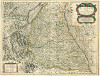
Brötzingen
Diese Karte zeigt die Position oder den Umriss des Objekts. Haben Sie einen Fehler entdeckt? Dann würden wir uns über eine Nachricht freuen.
| GOV-Kennung | http://gov.genealogy.net/BROGENJN48HV |
| Name |
|
| Typ |
|
| Postleitzahl |
|
| externe Kennung | |
| Artikel zu diesem Objekt im GenWiki | |
| Geographische Position |
|
| Kontaktmöglichkeiten |
Wenn Sie mit anderen Personen, die sich für Baden-Württemberg interessieren, in Kontakt treten wollen, empfehlen wir unser Baden-Württemberg Regional-Forum.. |
Übergeordnete Objekte
Legende
| politische Verwaltung | |
| kirchliche Verwaltung | |
| gerichtliche Verwaltung | |
| Wohnplatz | |
| geographische Typen | |
| Verkehrswesen |
Übergeordnete Objekte
-
Pforzheim (Landamt), Amt Pforzheim
(OberamtAmtOberamt) (1786 - 1809)
-
Untere Markgrafschaft
(Markgrafschaft) (1535 - 1803)
-
Baden
(Markgrafschaft) (1771 - 1803)
- Schwäbischer Reichskreis (Reichskreis) (1771 - 1803)
-
Baden-Durlach
(Markgrafschaft) (1748 - 1771)
- Schwäbischer Reichskreis (Reichskreis) (1535 - 1806)
-
Baden
(Markgrafschaft) (1771 - 1803)
-
Mittelrheinkreis (Rastatt, ab 1847 Karlsruhe)
(Kreis) (1845)
-
Baden
(KurfürstentumGroßherzogtumFreistaat) (1832-02-18 - 1864-09-30)
- Deutscher Bund, German Confederation (Staatenbund) (1815 - 1866)
- Deutsches Reich, German Empire, Duitse Rijk (Bundesstaat) (1871 - 1945)
- Rheinbund, Confédération du Rhin (Staatenbund) (1806 - 1813)
- Heiliges Römisches Reich, Heiliges Römisches Reich deutscher Nation, Heiliges Römisches Reich, Sacrum Imperium, Sacrum Romanum Imperium, Sacrum Romanum Imperium Nationis Germanicæ (KönigreichKaiserreich) (1803 - 1806)
-
Baden
(KurfürstentumGroßherzogtumFreistaat) (1832-02-18 - 1864-09-30)
-
Karlsburg
(Vogtei) (1803 - 1807)
-
Badische Markgrafschaft
(Provinz) (1803 - 1807)
-
Baden
(KurfürstentumGroßherzogtumFreistaat) (1803-03-09 - 1807-08-09)
- Deutscher Bund, German Confederation (Staatenbund) (1815 - 1866)
- Deutsches Reich, German Empire, Duitse Rijk (Bundesstaat) (1871 - 1945)
- Rheinbund, Confédération du Rhin (Staatenbund) (1806 - 1813)
- Heiliges Römisches Reich, Heiliges Römisches Reich deutscher Nation, Heiliges Römisches Reich, Sacrum Imperium, Sacrum Romanum Imperium, Sacrum Romanum Imperium Nationis Germanicæ (KönigreichKaiserreich) (1803 - 1806)
-
Baden
(KurfürstentumGroßherzogtumFreistaat) (1803-03-09 - 1807-08-09)
-
Badische Markgrafschaft
(Provinz) (1803 - 1807)
-
Provinz des Mittelrheins oder der badischen Markgrafschaft (Karlsruhe)
(Provinz) (1807 - 1809)
-
Baden
(KurfürstentumGroßherzogtumFreistaat) (1807-08-10 - 1809-12-31)
- Deutscher Bund, German Confederation (Staatenbund) (1815 - 1866)
- Deutsches Reich, German Empire, Duitse Rijk (Bundesstaat) (1871 - 1945)
- Rheinbund, Confédération du Rhin (Staatenbund) (1806 - 1813)
- Heiliges Römisches Reich, Heiliges Römisches Reich deutscher Nation, Heiliges Römisches Reich, Sacrum Imperium, Sacrum Romanum Imperium, Sacrum Romanum Imperium Nationis Germanicæ (KönigreichKaiserreich) (1803 - 1806)
-
Baden
(KurfürstentumGroßherzogtumFreistaat) (1807-08-10 - 1809-12-31)
-
Pfinz und Enz (Durlach), Murg und Pfinzkreis (Durlach)
(Kreis) (1810 - 1832)
-
Baden
(KurfürstentumGroßherzogtumFreistaat) (1810-01-01 - 1832-02-17)
- Deutscher Bund, German Confederation (Staatenbund) (1815 - 1866)
- Deutsches Reich, German Empire, Duitse Rijk (Bundesstaat) (1871 - 1945)
- Rheinbund, Confédération du Rhin (Staatenbund) (1806 - 1813)
- Heiliges Römisches Reich, Heiliges Römisches Reich deutscher Nation, Heiliges Römisches Reich, Sacrum Imperium, Sacrum Romanum Imperium, Sacrum Romanum Imperium Nationis Germanicæ (KönigreichKaiserreich) (1803 - 1806)
-
Baden
(KurfürstentumGroßherzogtumFreistaat) (1810-01-01 - 1832-02-17)
-
Untere Markgrafschaft
(Markgrafschaft) (1535 - 1803)
-
Pforzheim (Stadtamt)
(Amt) (1809 - 1819)
-
Pfinz und Enz (Durlach), Murg und Pfinzkreis (Durlach)
(Kreis) (1809 - 1819)
-
Baden
(KurfürstentumGroßherzogtumFreistaat) (1810-01-01 - 1832-02-17)
- Deutscher Bund, German Confederation (Staatenbund) (1815 - 1866)
- Deutsches Reich, German Empire, Duitse Rijk (Bundesstaat) (1871 - 1945)
- Rheinbund, Confédération du Rhin (Staatenbund) (1806 - 1813)
- Heiliges Römisches Reich, Heiliges Römisches Reich deutscher Nation, Heiliges Römisches Reich, Sacrum Imperium, Sacrum Romanum Imperium, Sacrum Romanum Imperium Nationis Germanicæ (KönigreichKaiserreich) (1803 - 1806)
-
Baden
(KurfürstentumGroßherzogtumFreistaat) (1810-01-01 - 1832-02-17)
-
Pfinz und Enz (Durlach), Murg und Pfinzkreis (Durlach)
(Kreis) (1809 - 1819)
-
Pforzheim
(Stadt) (1905 -)
-
Pforzheim (Landamt), Amt Pforzheim
(OberamtAmtOberamt) (1786 - 1809)
-
Untere Markgrafschaft
(Markgrafschaft) (1535 - 1803)
-
Baden
(Markgrafschaft) (1771 - 1803)
- Schwäbischer Reichskreis (Reichskreis) (1771 - 1803)
-
Baden-Durlach
(Markgrafschaft) (1748 - 1771)
- Schwäbischer Reichskreis (Reichskreis) (1535 - 1806)
-
Baden
(Markgrafschaft) (1771 - 1803)
-
Mittelrheinkreis (Rastatt, ab 1847 Karlsruhe)
(Kreis) (1845)
-
Baden
(KurfürstentumGroßherzogtumFreistaat) (1832-02-18 - 1864-09-30)
- Deutscher Bund, German Confederation (Staatenbund) (1815 - 1866)
- Deutsches Reich, German Empire, Duitse Rijk (Bundesstaat) (1871 - 1945)
- Rheinbund, Confédération du Rhin (Staatenbund) (1806 - 1813)
- Heiliges Römisches Reich, Heiliges Römisches Reich deutscher Nation, Heiliges Römisches Reich, Sacrum Imperium, Sacrum Romanum Imperium, Sacrum Romanum Imperium Nationis Germanicæ (KönigreichKaiserreich) (1803 - 1806)
-
Baden
(KurfürstentumGroßherzogtumFreistaat) (1832-02-18 - 1864-09-30)
-
Karlsburg
(Vogtei) (1803 - 1807)
-
Badische Markgrafschaft
(Provinz) (1803 - 1807)
-
Baden
(KurfürstentumGroßherzogtumFreistaat) (1803-03-09 - 1807-08-09)
- Deutscher Bund, German Confederation (Staatenbund) (1815 - 1866)
- Deutsches Reich, German Empire, Duitse Rijk (Bundesstaat) (1871 - 1945)
- Rheinbund, Confédération du Rhin (Staatenbund) (1806 - 1813)
- Heiliges Römisches Reich, Heiliges Römisches Reich deutscher Nation, Heiliges Römisches Reich, Sacrum Imperium, Sacrum Romanum Imperium, Sacrum Romanum Imperium Nationis Germanicæ (KönigreichKaiserreich) (1803 - 1806)
-
Baden
(KurfürstentumGroßherzogtumFreistaat) (1803-03-09 - 1807-08-09)
-
Badische Markgrafschaft
(Provinz) (1803 - 1807)
-
Provinz des Mittelrheins oder der badischen Markgrafschaft (Karlsruhe)
(Provinz) (1807 - 1809)
-
Baden
(KurfürstentumGroßherzogtumFreistaat) (1807-08-10 - 1809-12-31)
- Deutscher Bund, German Confederation (Staatenbund) (1815 - 1866)
- Deutsches Reich, German Empire, Duitse Rijk (Bundesstaat) (1871 - 1945)
- Rheinbund, Confédération du Rhin (Staatenbund) (1806 - 1813)
- Heiliges Römisches Reich, Heiliges Römisches Reich deutscher Nation, Heiliges Römisches Reich, Sacrum Imperium, Sacrum Romanum Imperium, Sacrum Romanum Imperium Nationis Germanicæ (KönigreichKaiserreich) (1803 - 1806)
-
Baden
(KurfürstentumGroßherzogtumFreistaat) (1807-08-10 - 1809-12-31)
-
Pfinz und Enz (Durlach), Murg und Pfinzkreis (Durlach)
(Kreis) (1810 - 1832)
-
Baden
(KurfürstentumGroßherzogtumFreistaat) (1810-01-01 - 1832-02-17)
- Deutscher Bund, German Confederation (Staatenbund) (1815 - 1866)
- Deutsches Reich, German Empire, Duitse Rijk (Bundesstaat) (1871 - 1945)
- Rheinbund, Confédération du Rhin (Staatenbund) (1806 - 1813)
- Heiliges Römisches Reich, Heiliges Römisches Reich deutscher Nation, Heiliges Römisches Reich, Sacrum Imperium, Sacrum Romanum Imperium, Sacrum Romanum Imperium Nationis Germanicæ (KönigreichKaiserreich) (1803 - 1806)
-
Baden
(KurfürstentumGroßherzogtumFreistaat) (1810-01-01 - 1832-02-17)
-
Untere Markgrafschaft
(Markgrafschaft) (1535 - 1803)
-
Pforzheim (Stadtamt)
(Amt) (1809 - 1819)
-
Pfinz und Enz (Durlach), Murg und Pfinzkreis (Durlach)
(Kreis) (1809 - 1819)
-
Baden
(KurfürstentumGroßherzogtumFreistaat) (1810-01-01 - 1832-02-17)
- Deutscher Bund, German Confederation (Staatenbund) (1815 - 1866)
- Deutsches Reich, German Empire, Duitse Rijk (Bundesstaat) (1871 - 1945)
- Rheinbund, Confédération du Rhin (Staatenbund) (1806 - 1813)
- Heiliges Römisches Reich, Heiliges Römisches Reich deutscher Nation, Heiliges Römisches Reich, Sacrum Imperium, Sacrum Romanum Imperium, Sacrum Romanum Imperium Nationis Germanicæ (KönigreichKaiserreich) (1803 - 1806)
-
Baden
(KurfürstentumGroßherzogtumFreistaat) (1810-01-01 - 1832-02-17)
-
Pfinz und Enz (Durlach), Murg und Pfinzkreis (Durlach)
(Kreis) (1809 - 1819)
-
Pforzheim
(Stadtkreis)
-
Nordschwarzwald
(Region)
-
Karlsruhe
(Regierungsbezirk)
-
Baden-Württemberg
(Bundesland) (1973-01-01 -)
-
Deutschland, Bundesrepublik Deutschland, Allemagne, Duitsland, Vokietija, Niemcy, Nemecká spolková republika, Federal Republic of Germany, Tyskland, Germany, Герма́ния
(Staat) (1952-04-25 -)
- Europäische Wirtschaftsgemeinschaft, Europäische Gemeinschaft, Europäische Union, Comhphobal Eacnamaíochta na hEorpa, Euroopan talousyhteisö, Európske hospodárske spoločenstvo, Communauté économique européenne, Comunidad Económica Europea, European Economic Community, Comunità Economica Europea, Evropské hospodářské společenství, Europese Economische Gemeenschap, Európske spoločenstvo, Europese Gemeenschap, Euroopan Yhteisö, Comunidad Europea, European Community, Comunità Europea, Evropské společenství, Communauté européenne, Comhphobal Eorpach, Europese Unie, Aontais Eorpaigh, Unione Europea, European Union, Európska únia, Unión Europea, Euroopan Unioni, Evropská unie, Union européenne (Staatenbund) (1958 -)
- Vereinte Nationen, Verenigde Naties, Организация Объединённых Наций, Organización de las Naciones Unidas, Organisation des Nations unies, الأمم المتحدة, 联合国, Organizácia Spojených národov, United Nations (Staatenbund) (1973-09-18 -)
-
Deutschland, Bundesrepublik Deutschland, Allemagne, Duitsland, Vokietija, Niemcy, Nemecká spolková republika, Federal Republic of Germany, Tyskland, Germany, Герма́ния
(Staat) (1952-04-25 -)
-
Baden-Württemberg
(Bundesland) (1973-01-01 -)
-
Karlsruhe
(Regierungsbezirk)
-
Karlsruhe
(Landeskommissärbezirk ) (1939 - 1945)
-
Baden
(KurfürstentumGroßherzogtumFreistaat) (1864-10-01 - 1945-09-18)
- Deutscher Bund, German Confederation (Staatenbund) (1815 - 1866)
- Deutsches Reich, German Empire, Duitse Rijk (Bundesstaat) (1871 - 1945)
- Rheinbund, Confédération du Rhin (Staatenbund) (1806 - 1813)
- Heiliges Römisches Reich, Heiliges Römisches Reich deutscher Nation, Heiliges Römisches Reich, Sacrum Imperium, Sacrum Romanum Imperium, Sacrum Romanum Imperium Nationis Germanicæ (KönigreichKaiserreich) (1803 - 1806)
-
Baden
(KurfürstentumGroßherzogtumFreistaat) (1864-10-01 - 1945-09-18)
-
Karlsruhe
(Regierungsbezirk) (1973 -)
-
Baden-Württemberg
(Bundesland) (1973-01-01 -)
-
Deutschland, Bundesrepublik Deutschland, Allemagne, Duitsland, Vokietija, Niemcy, Nemecká spolková republika, Federal Republic of Germany, Tyskland, Germany, Герма́ния
(Staat) (1952-04-25 -)
- Europäische Wirtschaftsgemeinschaft, Europäische Gemeinschaft, Europäische Union, Comhphobal Eacnamaíochta na hEorpa, Euroopan talousyhteisö, Európske hospodárske spoločenstvo, Communauté économique européenne, Comunidad Económica Europea, European Economic Community, Comunità Economica Europea, Evropské hospodářské společenství, Europese Economische Gemeenschap, Európske spoločenstvo, Europese Gemeenschap, Euroopan Yhteisö, Comunidad Europea, European Community, Comunità Europea, Evropské společenství, Communauté européenne, Comhphobal Eorpach, Europese Unie, Aontais Eorpaigh, Unione Europea, European Union, Európska únia, Unión Europea, Euroopan Unioni, Evropská unie, Union européenne (Staatenbund) (1958 -)
- Vereinte Nationen, Verenigde Naties, Организация Объединённых Наций, Organización de las Naciones Unidas, Organisation des Nations unies, الأمم المتحدة, 联合国, Organizácia Spojených národov, United Nations (Staatenbund) (1973-09-18 -)
-
Deutschland, Bundesrepublik Deutschland, Allemagne, Duitsland, Vokietija, Niemcy, Nemecká spolková republika, Federal Republic of Germany, Tyskland, Germany, Герма́ния
(Staat) (1952-04-25 -)
-
Baden-Württemberg
(Bundesland) (1973-01-01 -)
-
Landesbezirk Baden, Nordbaden
(Regierungsbezirk) (1945 - 1972)
-
Baden-Württemberg
(Bundesland) (1952-04-25 - 1972-12-31)
-
Deutschland, Bundesrepublik Deutschland, Allemagne, Duitsland, Vokietija, Niemcy, Nemecká spolková republika, Federal Republic of Germany, Tyskland, Germany, Герма́ния
(Staat) (1952-04-25 -)
- Europäische Wirtschaftsgemeinschaft, Europäische Gemeinschaft, Europäische Union, Comhphobal Eacnamaíochta na hEorpa, Euroopan talousyhteisö, Európske hospodárske spoločenstvo, Communauté économique européenne, Comunidad Económica Europea, European Economic Community, Comunità Economica Europea, Evropské hospodářské společenství, Europese Economische Gemeenschap, Európske spoločenstvo, Europese Gemeenschap, Euroopan Yhteisö, Comunidad Europea, European Community, Comunità Europea, Evropské společenství, Communauté européenne, Comhphobal Eorpach, Europese Unie, Aontais Eorpaigh, Unione Europea, European Union, Európska únia, Unión Europea, Euroopan Unioni, Evropská unie, Union européenne (Staatenbund) (1958 -)
- Vereinte Nationen, Verenigde Naties, Организация Объединённых Наций, Organización de las Naciones Unidas, Organisation des Nations unies, الأمم المتحدة, 联合国, Organizácia Spojených národov, United Nations (Staatenbund) (1973-09-18 -)
-
Deutschland, Bundesrepublik Deutschland, Allemagne, Duitsland, Vokietija, Niemcy, Nemecká spolková republika, Federal Republic of Germany, Tyskland, Germany, Герма́ния
(Staat) (1952-04-25 -)
-
Württemberg-Baden
(LandBundesland) (1945 - 1952)
-
Deutschland, Bundesrepublik Deutschland, Allemagne, Duitsland, Vokietija, Niemcy, Nemecká spolková republika, Federal Republic of Germany, Tyskland, Germany, Герма́ния
(Staat) (1949-05-24 - 1952-04-24)
- Europäische Wirtschaftsgemeinschaft, Europäische Gemeinschaft, Europäische Union, Comhphobal Eacnamaíochta na hEorpa, Euroopan talousyhteisö, Európske hospodárske spoločenstvo, Communauté économique européenne, Comunidad Económica Europea, European Economic Community, Comunità Economica Europea, Evropské hospodářské společenství, Europese Economische Gemeenschap, Európske spoločenstvo, Europese Gemeenschap, Euroopan Yhteisö, Comunidad Europea, European Community, Comunità Europea, Evropské společenství, Communauté européenne, Comhphobal Eorpach, Europese Unie, Aontais Eorpaigh, Unione Europea, European Union, Európska únia, Unión Europea, Euroopan Unioni, Evropská unie, Union européenne (Staatenbund) (1958 -)
- Vereinte Nationen, Verenigde Naties, Организация Объединённых Наций, Organización de las Naciones Unidas, Organisation des Nations unies, الأمم المتحدة, 联合国, Organizácia Spojených národov, United Nations (Staatenbund) (1973-09-18 -)
- Südostzone, amerikanische Besatzungszone, US-Besatzungszone, American Zone of Occupation (Besatzungszone) (1945 - 1949-05-23)
-
Deutschland, Bundesrepublik Deutschland, Allemagne, Duitsland, Vokietija, Niemcy, Nemecká spolková republika, Federal Republic of Germany, Tyskland, Germany, Герма́ния
(Staat) (1949-05-24 - 1952-04-24)
-
Baden-Württemberg
(Bundesland) (1952-04-25 - 1972-12-31)
-
Nordschwarzwald
(Region)
-
Pforzheim (Landamt), Amt Pforzheim
(OberamtAmtOberamt) (1786 - 1809)
Übergeordnete Objekte
| Name | Zeitraum | Typ | Quelle |
|---|---|---|---|
| Pforzheim (Landamt), Amt Pforzheim | (1786 - 1809) | Oberamt Amt Oberamt | |
| Pforzheim (Stadtamt) | (1809 - 1819) | Amt | |
| Pforzheim | (1905 -) | Stadt |
Untergeordnete Objekte
| Name | Typ | GOV-Kennung | Zeitraum |
|---|---|---|---|
| St. Antonius (Brötzingen) | Kirche | object_289189 | |
| Christuskirche (Brötzingen), Pforzheim-Brötzingen | Kirche | object_150767 |
Bilder im GenWiki

Quicktext
BROGENJN48HV
	gehört ab 1786 bis 1809 zu object_407878,
	gehört ab 1809 bis 1819 zu object_809986,
	gehört ab 1905 zu PFOEIMJN48IV,
	hat ab 1993-07-01 PLZ 75179,
	hat bis 1993-06-30 PLZ W7530,
	hat externe Kennung  GND:4103103-9,
	hat externe Kennung  GND:4330862-4,
	hat externe Kennung  geonames:2943694,
	hat externe Kennung  leobw:6699,
	heißt  (auf deu) Brötzingen,
	ist 1803 (auf deu) Pfarrdorf,
	ist 1975 (auf deu) Stadtteil,
	liegt bei 48.8857°N 8.6706°O;