Dortmund

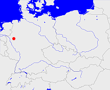
Diese Karte zeigt die Position oder den Umriss des Objekts. Haben Sie einen Fehler entdeckt? Dann würden wir uns über eine Nachricht freuen.
Übergeordnete Objekte
Legende
| | politische Verwaltung |
| | kirchliche Verwaltung |
| | gerichtliche Verwaltung |
| | Wohnplatz |
| | geographische Typen |
| | Verkehrswesen |
Übergeordnete Objekte
-
Arnsberg
(Regierungsbezirk) (1816 - 1928)
-
Nordrhein-Westfalen, Northrhine-Westphalia, North Rhine-Westphalia, Noordrijn-Westfalen
(Bundesland) (1946-08-23 -)
-
Britische Besatzungszone
(Besatzungszone) (1946-08-23 - 1949-05-23)
-
Deutschland, Bundesrepublik Deutschland, Allemagne, Duitsland, Vokietija, Niemcy, Nemecká spolková republika, Federal Republic of Germany, Tyskland, Germany, Герма́ния
(Bundesstaat) (1949-05-24 -)
-
Europäische Wirtschaftsgemeinschaft, Europäische Gemeinschaft, Europäische Union, Comhphobal Eacnamaíochta na hEorpa, Euroopan talousyhteisö, Európske hospodárske spoločenstvo, Communauté économique européenne, Comunidad Económica Europea, European Economic Community, Comunità Economica Europea, Evropské hospodářské společenství, Europese Economische Gemeenschap, Európske spoločenstvo, Europese Gemeenschap, Euroopan Yhteisö, Comunidad Europea, European Community, Comunità Europea, Evropské společenství, Communauté européenne, Comhphobal Eorpach, Europese Unie, Aontais Eorpaigh, Unione Europea, European Union, Európska únia, Unión Europea, Euroopan Unioni, Evropská unie, Union européenne
(Staatenbund) (1958 -)
-
Vereinte Nationen, Verenigde Naties, Организация Объединённых Наций, Organización de las Naciones Unidas, Organisation des Nations unies, الأمم المتحدة, 联合国, Organizácia Spojených národov, United Nations
(Staatenbund) (1973-09-18 -)
-
Westfalen, Westphalen
(Provinz) (1816-08-01 - 1946-08-23)
Übergeordnete Objekte
| Name |
Zeitraum |
Typ |
Quelle |
|
Arnsberg
|
(1816 - 1928) |
Regierungsbezirk
|
|
Untergeordnete Objekte
| Name |
Typ |
GOV-Kennung |
Zeitraum |
| Harpen |
Gemeinde
Ortsteil
|
object_1344387 |
(1816 - 1819) |
| Castrop |
Mairie
Bürgermeisterei
Amt
|
object_1143722 |
(1818 - 1902) |
| Castrop |
Gemeinde
Stadt
Ortsteil
|
object_1348568 |
(1902 - 1926) |
| Marten |
Amt
|
object_1143796 |
(1914 - 1928) |
| Annen-Wullen, Annen |
Amt
|
object_1143764 |
(1874 - 1887) |
| Rauxel |
Amt
|
object_1143779 |
(1902 - 1928-03-31) |
| Mengede |
Amt
|
object_1143777 |
(1889 - 1928-03-31) |
| Lütgendortmund |
Mairie
Bürgermeisterei
Amt
|
object_1143728 |
(1816 - 1928) |
| Wickede |
Standesamt
|
object_1155125 |
(1883) |
| Lütgen Dortmund |
Standesamt
|
object_1151997 |
(1883) |
| Dorstfeld |
Amt
|
object_1143776 |
(1886 - 1914) |
| Dorstfeld |
Standesamt
|
object_1151394 |
(1883) |
| Schwerte |
Standesamt
|
object_1151999 |
(1883) |
| Schwerte |
Stadt
|
object_1348441 |
(1844 - 1887) |
| Westhofen |
Standesamt
|
object_1149285 |
(1883) |
| Westhofen |
Amt
|
object_1143732 |
(1815 - 1886) |
| Annen-Wullen |
Standesamt
|
object_1151998 |
(1883) |
| Kirchderne, Derne |
Amt
|
object_1143792 |
(1905 - 1928-03-31) |
| Wellinghofen |
Standesamt
|
object_1153768 |
(1883) |
| Barop |
Amt
|
object_1143733 |
(1874 - 1887) |
| Barop |
Standesamt
|
object_1151395 |
(1883) |
| Courl |
Standesamt
|
object_1155127 |
(1883) |
| Eving |
Amt
|
object_1143791 |
(1905 - 1914) |
| Hörde |
Bürgermeisterei
Amt
|
object_1143726 |
(1818 - 1874) |
| Hörde |
Stadt
Ortsteil
|
HORRDEJO31SL |
(1858 - 1887) |
| Hörde |
Standesamt
|
object_1152000 |
(1883) |
| Lünen |
Mairie
Bürgermeisterei
Amt
|
object_1143727 |
(1818 - 1905) |
| Lünen |
Standesamt
|
object_1155126 |
(1883) |
| Aplerbeck |
Bürgermeisterei
Amt
|
object_1143554 |
(1818 - 1887) |
| Aplerbeck |
Standesamt
|
object_1155124 |
(1883) |
| Kastrop |
Standesamt
|
object_1153403 |
(1883) |
| Brambauer |
Amt
|
object_1143795 |
(1914 - 1928) |
| Sodingen |
Amt
|
object_1143778 |
(1902 - 1928-03-31) |
| Dortmund |
Mairie
Bürgermeisterei
|
object_1143724 |
(1818 - 1843) |
| Dortmund |
Reichsstadt
Stadt
|
object_320205 |
(1844 - 1875) |
| Lünen (Amt) |
Standesamt
|
object_1151393 |
(1883) |
| Wetter (Kerckenwetter) |
Pfarrdorf
|
WETTERJO31QJ |
(1816 - 1819) |
| Brünninghausen |
Standesamt
|
object_1153402 |
(1883) |
| Brackel |
Amt
|
object_306830 |
(1874 - 1928-03-31) |
| Brackel |
Standesamt
|
object_1152266 |
(1883) |
| Schwerte, Schwerte (Land) |
Bürgermeisterei
|
object_1143729 |
(1817 - 1843) |
| Asseln |
Standesamt
|
object_1149742 |
(1883) |
| Lünen, Lünen Mitte |
Stadtgemeinde
Stadtteil
|
object_1348099 |
(1874 - 1928) |
Bilder im GenWiki
Quicktext
adm_135913
	gehört ab 1816 bis 1928 zu adm_369059,
	hat 1816 Einwohner 33709 sagt source_390129,
	hat 1818 Einwohner 30408 sagt source_390129,
	hat 1880-12-01 Einwohner 117185 sagt source_1091743 (S. 246),
	hat 1900 Einwohner 147947 sagt source_265044,
	hat 1910 Einwohner 212819 sagt source_265044,
	hat 1995 Einwohner 598840 sagt source_284814,
	hat 2000 Einwohner 588994 sagt source_284814,
	hat 2005 Einwohner 588168 sagt source_284814,
	heißt  (auf deu) Dortmund,
	ist ab 1817 bis 1928-03-31 (auf deu) Landkreis sagt source_265044;

