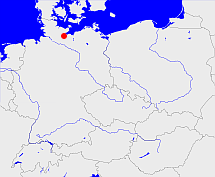
Lübeck

Diese Karte zeigt die Position oder den Umriss des Objekts. Haben Sie einen Fehler entdeckt? Dann würden wir uns über eine Nachricht freuen.
Übergeordnete Objekte
Legende
| | politische Verwaltung |
| | kirchliche Verwaltung |
| | gerichtliche Verwaltung |
| | Wohnplatz |
| | geographische Typen |
| | Verkehrswesen |
Übergeordnete Objekte
Übergeordnete Objekte
Untergeordnete Objekte
Bilder im GenWiki
Quicktext
object_1085290
	gehört ab 1867 bis 1870 zu object_264172,
	gehört ab 1871 bis 1937-03-31 zu object_190315,
	gehört bis 1866 zu object_218127,
	hat 1880 Einwohner 63571 sagt source_1343683 (Tab. I S. 5),
	hat 1880 Fläche 297.7 sagt source_1343683 (Tab. III S. 28),
	hat 1890 Einwohner 76485 sagt source_1343682 (Tab. I S. 5),
	hat 1890 Fläche 297.7 sagt source_1343682 (Tab. III S. 27),
	hat 1900 Einwohner 96775 sagt source_1343684 (Tab. I S. 4),
	hat 1900 Fläche 297.71 sagt source_1343684 (Tab. II S. 9),
	hat 1910 Einwohner 116599 sagt source_1341051 (Tab. II S. 9),
	hat 1910 Fläche 297.71 sagt source_1341051 (Tab. II S. 9),
	hat 1925 Einwohner 127971 sagt source_1341056 (S. 46),
	hat 1925 Fläche 297.71 sagt source_1341056 (S. 46),
	hat 1933 Einwohner 136413 sagt source_1267338 (S. 7),
	hat 1933-06-16 Einwohner 136159 sagt source_1084897 (S. 2),
	hat 1935 Fläche 297.71 sagt source_1267338 (S. 7),
	hat 1937 Fläche 288.5 sagt source_1084897 (S. 2),
	hat URL  https://de.wikipedia.org/wiki/Lübeck,
	heißt  (auf deu) Lübeck,
	ist bis 1937-03-31 (auf deu) Land;

