Dranse
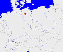
Diese Karte zeigt die Position oder den Umriss des Objekts. Haben Sie einen Fehler entdeckt? Dann würden wir uns über eine Nachricht freuen.
Übergeordnete Objekte
Legende
| | politische Verwaltung |
| | kirchliche Verwaltung |
| | gerichtliche Verwaltung |
| | Wohnplatz |
| | geographische Typen |
| | Verkehrswesen |
Übergeordnete Objekte
Übergeordnete Objekte
Untergeordnete Objekte
| Name |
Typ |
GOV-Kennung |
Zeitraum |
| Berlinchen |
Kirchengemeinde
|
object_1135704 |
|
| Berlinchen |
Dorf
Ortsteil
|
BERHENJO63GF |
(1895-12-02) |
| Sewekow |
Kirchengemeinde
|
object_1135715 |
|
| Sewekow |
Dorf
Ortsteil
|
SEWKOWJO63HF |
(1895-12-02) |
| Schweinrich |
Kirchengemeinde
|
object_1135707 |
|
| Schweinrich |
Dorf
Ortsteil
|
SCHIC1JO63HE |
(1895-12-02) |
| Dranse |
Kirchengemeinde
|
object_167152 |
|
| Dranse |
Dorf
Ortsteil
|
DRANS1JO63HE |
(1895-12-02) |
Bilder im GenWiki
Quicktext
object_1132543
	gehört zu object_164933 sagt source_1043590 (Seite 64/65) sagt source_1085418 (Seite 258 Nr. 4 a),
	hat Konfession ev,
	heißt  (auf deu) Dranse,
	ist (auf deu) Sprengel sagt source_1043590 (Seite 64/65) sagt source_1085418 (Seite 258 Nr. 4 a);

