Deventer
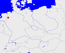
Diese Karte zeigt die Position oder den Umriss des Objekts. Haben Sie einen Fehler entdeckt? Dann würden wir uns über eine Nachricht freuen.
Übergeordnete Objekte
Legende
| | politische Verwaltung |
| | kirchliche Verwaltung |
| | gerichtliche Verwaltung |
| | Wohnplatz |
| | geographische Typen |
| | Verkehrswesen |
Übergeordnete Objekte
-
Utrecht
(Kirchenprovinz) (1559 - 1591)
Übergeordnete Objekte
| Name |
Zeitraum |
Typ |
Quelle |
|
Utrecht
|
(1559 - 1591) |
Kirchenprovinz
|
Quelle
|
Untergeordnete Objekte
Bilder im GenWiki
Quicktext
object_1157219
	gehört ab 1559 bis 1591 zu object_1135793 sagt source_1046224,
	hat Konfession rk,
	heißt  (auf dut) Deventer,
	ist ab 1559 bis 1591 (auf deu) Bistum sagt source_1046224;

