Alsfeld
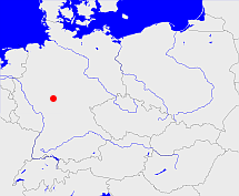
Diese Karte zeigt die Position oder den Umriss des Objekts. Haben Sie einen Fehler entdeckt? Dann würden wir uns über eine Nachricht freuen.
Übergeordnete Objekte
Legende
| | politische Verwaltung |
| | kirchliche Verwaltung |
| | gerichtliche Verwaltung |
| | Wohnplatz |
| | geographische Typen |
| | Verkehrswesen |
Übergeordnete Objekte
Übergeordnete Objekte
Untergeordnete Objekte
| Name |
Typ |
GOV-Kennung |
Zeitraum |
| Alsfeld, Adelesfelt, Adelsfelt, Alesvelt, Ailesuelt, Agilsvelt, Alsfelt, Allysfelt, Elsfeldia, Alsfeldia, Alsfeltd |
Bürgermeisterei
Stadt
|
ALSELDJO40PS |
(1848-07-31 - 1852-05-11) |
| Fischbach |
Dorf
Stadtteil
|
FISACHJO40OT |
(1848 - 1851) |
| Angenrod |
Dorf
Stadtteil
|
ANGROD_W6321 |
(1848 - 1851) |
| Elbenrod |
Dorf
Stadtteil
|
ELBROD_W6321 |
(1848 - 1851) |
| Eifa |
Dorf
Stadtteil
|
EIFIFA_W6321 |
(1848 - 1851) |
| Billertshausen |
Dorf
Stadtteil
|
BILSENJO40OS |
(1848 - 1851) |
| Elpenrod |
Gemeinde
Ortsteil
|
ELPROD_W6311 |
(1848 - 1851) |
| Altenburg |
Dorf
Stadtteil
|
ALTURG_W6321 |
(1848 - 1851) |
| Heidelbach |
Dorf
Stadtteil
|
HEIACH_W6321 |
(1848 - 1851) |
| Eudorf |
Dorf
Stadtteil
|
EUDORF_W6321 |
(1848 - 1851) |
Bilder im GenWiki
Quicktext
object_1159053
	gehört ab 1848 bis 1851 zu object_218147,
	heißt  (auf deu) Alsfeld,
	ist (auf deu) Regierungsbezirk;

