Possessern
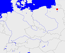
Diese Karte zeigt die Position oder den Umriss des Objekts. Haben Sie einen Fehler entdeckt? Dann würden wir uns über eine Nachricht freuen.
Übergeordnete Objekte
Legende
| | politische Verwaltung |
| | kirchliche Verwaltung |
| | gerichtliche Verwaltung |
| | Wohnplatz |
| | geographische Typen |
| | Verkehrswesen |
Übergeordnete Objekte
Übergeordnete Objekte
| Name |
Zeitraum |
Typ |
Quelle |
|
Angerburg
|
|
Kirchenkreis
|
|
Untergeordnete Objekte
| Name |
Typ |
GOV-Kennung |
Zeitraum |
| Roggen, Róg |
Dorf
Wohnplatz
Weiler
|
ROGGENKO04VE |
(1887 - 1945) |
| Sdorkowen, Dorkau, Darkau, Zdorkowo |
Wohnplatz
Wüstung
|
DORKAUKO04UD |
(1887 - 1945) |
| Possessern |
Kirche
|
object_163666 |
(- 1945) |
| Sklodowen, Kloden, Skłodowo |
Wohnplatz
|
KLODENKO04UD |
(1907) |
| Possessern, Großgarten, Pozezdrze |
Dorf
Dorf
|
GROTENKO04WD |
(1887 - 1945) |
| Numeiten, Numeyten, Numaiten, Okowizna |
Gut
Siedlung
|
NUMTENKO04VE |
(1887 - 1945) |
| Neu Haarszen, Neu Haarschen, Nowy Harsz |
Wohnplatz
|
HAAHENKO04VC |
(1907) |
| Haarszen, Haarßen, Haarschen, Harsz |
Dorf
Dorf
|
HAAHENKO04VD |
(1887 - 1945) |
| Pietzarken, Bergensee, Pieczarki |
Dorf
Dorf
|
BERSEEKO04VC |
(1887 - 1945) |
Bilder im GenWiki
Quicktext
object_163665
	gehört zu object_163593,
	hat 1912 Einwohner 2500 sagt source_214219 (2.500 Seelen),
	hat Konfession ev,
	heißt  (auf deu) Possessern sagt source_214219 (B-I.-8 S. 34),
	ist ab 1887 bis 1945 (auf deu) Kirchspiel sagt source_214219 (ab 1887);

