Sigmaringen
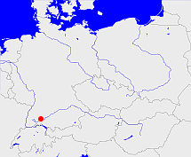
Diese Karte zeigt die Position oder den Umriss des Objekts. Haben Sie einen Fehler entdeckt? Dann würden wir uns über eine Nachricht freuen.
Bemerkungen
1849 aus den Fürstentümern Hohenzollern-Sigmaringen und Hohenzollern-Hechingen hervorgegangen
Entsprach: Hohenzollernsche Lande/Hohenzollerische Lande
1947 im Land Württemberg-Hohenzollern aufgegangen
Übergeordnete Objekte
Legende
| | politische Verwaltung |
| | kirchliche Verwaltung |
| | gerichtliche Verwaltung |
| | Wohnplatz |
| | geographische Typen |
| | Verkehrswesen |
Übergeordnete Objekte
Übergeordnete Objekte
Untergeordnete Objekte
| Name |
Typ |
GOV-Kennung |
Zeitraum |
| Trochtelfingen |
Oberamt
|
object_406229 |
(1849-12-08 - 1861-08-09) |
| Hechingen |
Oberamt
|
object_308895 |
(1849-12-08 - 1925-10-06) |
| Hechingen |
Landkreis
|
object_287939 |
(1925-10-07 - 1945-07-15) |
| Wald |
Oberamt
|
object_406230 |
(1849-12-08 - 1861-12-27) |
| Glatt |
Oberamt
|
object_406231 |
(1849-12-08 - 1854-01-18) |
| Gammertingen |
Oberamt
|
object_308894 |
(1849-12-07 - 1925-10-06) |
| Achberg |
Oberamt
|
object_406222 |
(1849-12-08 - 1854-01-18) |
| Ostrach |
Oberamt
|
object_406225 |
(1849-12-07 - 1862-03-28) |
| Sigmaringen |
Oberamt
|
object_308893 |
(1849-12-08 - 1925-10-07) |
| Sigmaringen |
Landkreis
|
adm_138437 |
(1925-10-07 - 1945-07-15) |
| Straßberg |
Oberamt
|
object_406228 |
(1849-12-08 - 1854-01-18) |
| Haigerloch |
Oberamt
|
object_308896 |
(1849-12-08 - 1925-10-06) |
Bilder im GenWiki
Quicktext
object_190338
	 TEXT: 1849 aus den Fürstentümern Hohenzollern-Sigmaringen und Hohenzollern-Hechingen hervorgegangen
Entsprach: Hohenzollernsche Lande/Hohenzollerische Lande

1947 im Land Württemberg-Hohenzollern aufgegangen :TEXT,
	gehört ab 1849 bis 1945 zu object_190337,
	gehört ab 1849 bis 1945 zu object_268785,
	hat 1880-12-01 Einwohner 67624 sagt source_1343683 (Tab. II S. 16),
	hat 1880-12-01 Fläche 1142.83 sagt source_1343683 (Tab. III S. 26),
	hat 1890-12-01 Einwohner 66085 sagt source_1343682 (Tab. II S. 18),
	hat 1890-12-01 Fläche 1142.24 sagt source_1343682 (Tab. III S. 25),
	hat 1900-12-01 Einwohner 66780 sagt source_1343684 (Tab. I S. 2),
	hat 1900-12-01 Fläche 1142.27 sagt source_1343684 ((Tab. II S. 8),
	hat 1910-12-01 Einwohner 71011 sagt source_1341051 (Tab. II S. 8),
	hat 1910-12-01 Fläche 1142.22 sagt source_1341051 (Tab. II S. 8),
	hat 1925-06-16 Einwohner 71840 sagt source_287911,
	hat 1928 Fläche 1142.254877 sagt source_287911,
	hat 1933-06-16 Einwohner 72991 sagt source_1267338 (S. 6),
	hat 1935-01-01 Fläche 1142.26 sagt source_1267338 (S. 6),
	hat 1939-05-17 Einwohner 73706 sagt source_298730 (S. 8),
	hat 1941-01-01 Fläche 1142.26 sagt source_298730 (S. 8),
	hat URL  https://de.wikipedia.org/wiki/Hohenzollernsche_Lande,
	heißt  (auf deu) Sigmaringen,
	ist ab 1849 bis 1947 (auf deu) Regierungsbezirk;

