Niederneunforn
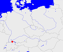
Diese Karte zeigt die Position oder den Umriss des Objekts. Haben Sie einen Fehler entdeckt? Dann würden wir uns über eine Nachricht freuen.
Übergeordnete Objekte
Legende
| | politische Verwaltung |
| | kirchliche Verwaltung |
| | gerichtliche Verwaltung |
| | Wohnplatz |
| | geographische Typen |
| | Verkehrswesen |
Übergeordnete Objekte
-
Frauenfeld
(Bezirk)
-
Thurgau
(Kanton)
-
Schweiz, Alte Eidgenossenschaft, Helvetische Republik, Schweizerische Eidgenossenschaft, Suisse, Switzerland, Zwitserland, Confoederatio Helvetica, Svizzera, Confederazione svizzera, Confederaziun svizra, Confédération suisse, Svizra
(Staat)
-
Heiliges Römisches Reich, Heiliges Römisches Reich deutscher Nation, Heiliges Römisches Reich, Sacrum Imperium, Sacrum Romanum Imperium, Sacrum Romanum Imperium Nationis Germanicæ
(KönigreichKaiserreich) (- 1648)
-
Vereinte Nationen, Verenigde Naties, Организация Объединённых Наций, Organización de las Naciones Unidas, Organisation des Nations unies, الأمم المتحدة, 联合国, Organizácia Spojených národov, United Nations
(Staatenbund) (2002-09-10 -)
Übergeordnete Objekte
Bilder im GenWiki
Quicktext
object_193127
	gehört zu CH_adm2004,
	hat 1970 Einwohner 647 sagt source_191262,
	hat 1980 Einwohner 662 sagt source_191262,
	hat 1990 Einwohner 832 sagt source_191262,
	hat 2000 Einwohner 926 sagt source_191262,
	hat Gemeindekennzahl 4601,
	hat externe Kennung  geonames:2659365,
	hat externe Kennung  nima:-2553450,
	heißt  (auf deu) Niederneunforn,
	ist (auf deu) Ort,
	liegt bei 47.5963°N 8.77975°O;

