Reichenberg

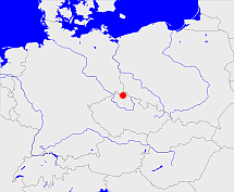
Diese Karte zeigt die Position oder den Umriss des Objekts. Haben Sie einen Fehler entdeckt? Dann würden wir uns über eine Nachricht freuen.
Übergeordnete Objekte
Legende
| | politische Verwaltung |
| | kirchliche Verwaltung |
| | gerichtliche Verwaltung |
| | Wohnplatz |
| | geographische Typen |
| | Verkehrswesen |
Übergeordnete Objekte
Übergeordnete Objekte
Untergeordnete Objekte
| Name |
Typ |
GOV-Kennung |
Zeitraum |
| Ruppersdorf, Ruprechtice |
Gemeinde
|
RUPORFJO70MS |
(1939-05-01 - 1945) |
| Rosenthal I, Rosenthal, Rŭžodol, Rosenthal I. díl, Růžodol I, Liberec XI-Růžodol I |
Ort
|
ROSAL1JO70MS |
(1939-05-01 - 1945) |
| Alt-Paulsdorf, Altpaulsdorf, Alt Paulsdorf, Staré Pavlovice, Starý Paulsdorf |
Gemeinde
|
ALTOR1JO70MS |
(1939-05-01 - 1945) |
| Niederhanichen, Nieder Hanichen, Nieder Hanichen, Dolní Hanichen, Dolní Hanychov |
Gemeinde
|
NIEHENJO70MS |
(1939-05-01 - 1945) |
| Franzendorf, Franzensdorf, Františkov |
Gemeinde
|
FRAORFJO70MS |
(1939-05-01 - 1945) |
| Reichenberg, Liberec |
Stadt
|
object_291155 |
(1938 - 1945) |
| Röchlitz bei Reichenberg, Röchlitz, Rochlice, Rochlice u Liberce |
Gemeinde
|
ROCITZJO70MS |
(1939-05-01 - 1945) |
| Oberrosenthal, Ober Rosenthal, Rosenthal II, Horní Rosenthal, Rosenthal II. díl, Horní Růžodol, Liberec VII-Horní Růžodol |
Gemeinde
|
ROSHA2JO70MS |
(1939-05-01 - 1945) |
| Alt Harzdorf, Starý Harcov, Starý Harzdorf |
Gemeinde
|
HARORFJO70MS |
(1939-05-01 - 1945) |
| Johannesthal, Janův Důl |
Gemeinde
|
JOHHALJO70MS |
(1939-05-01 - 1945) |
Bilder im GenWiki
Quicktext
object_266955
	gehört ab 1938 bis 1945 zu adm_368379 sagt source_290143,
	hat w-Nummer 62112,
	heißt  (auf deu) Reichenberg,
	ist ab 1938 bis 1945 (auf deu) Stadtkreis sagt source_290143;

