Neustadt
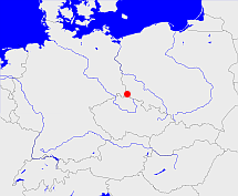
Diese Karte zeigt die Position oder den Umriss des Objekts. Haben Sie einen Fehler entdeckt? Dann würden wir uns über eine Nachricht freuen.
Übergeordnete Objekte
Legende
| | politische Verwaltung |
| | kirchliche Verwaltung |
| | gerichtliche Verwaltung |
| | Wohnplatz |
| | geographische Typen |
| | Verkehrswesen |
Übergeordnete Objekte
Übergeordnete Objekte
Untergeordnete Objekte
| Name |
Typ |
GOV-Kennung |
Zeitraum |
| Bärnsdorf an der Tafelfichte, Bärnsdorf, Horní Řasnice, Bernsdorf, Bernsdorf pod Smrkem |
Ort
|
BERKEMJO70OX |
(1930) |
| Hegewald, Hajniště |
Ort
|
HEGAL2JO70OW |
(1930) |
| Neustadt an der Tafelfichte, Neustadtl, Nové Město pod Smrkem, Neustadt u Tafelfichte |
Stadt
|
NEUADTJO70OW |
(1930) |
| Wünschendorf, Srbská |
Ort
|
WUNOR2JO70OX |
(1930) |
| Lusdorf, Lusdorf an der Tafelfichte, Ludvíkov pod Smrkem, Lusdorf u Tafelfichte |
Ort
|
LUSKEMJO70OW |
(1930) |
| Dittersbächel, Dětřichovec |
Ort
|
DITHE2JO70PW |
(1930) |
| Heinersdorf an der Tafelfichte, Jindřichovice pod Smrkem, Heinersdorf u Tafelfichte |
Ort
|
HEIHTEJO70OW |
(1930) |
Bilder im GenWiki
Quicktext
object_286727
	gehört zu object_285483,
	heißt  (auf deu) Neustadt,
	ist (auf deu) Amtsgericht;

