London Borough of Wandsworth
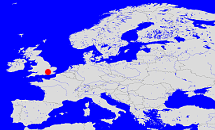
Diese Karte zeigt die Position oder den Umriss des Objekts. Haben Sie einen Fehler entdeckt? Dann würden wir uns über eine Nachricht freuen.
Übergeordnete Objekte
Legende
| | politische Verwaltung |
| | kirchliche Verwaltung |
| | gerichtliche Verwaltung |
| | Wohnplatz |
| | geographische Typen |
| | Verkehrswesen |
Übergeordnete Objekte
-
London, County of London, Greater London
(GrafschaftRegion)
-
England, England
(KönigreichLandesteil)
-
Vereinigtes Königreich von Großbritannien und Irland, Vereinigtes Königreich von Großbritannien und Nordirland, United Kingdom of Great Britain and Ireland, Verenigd Koninkrijk van Groot-Brittannië en Ierland, Royaume-Uni de Grande-Bretagne et d'Irlande, United Kingdom of Great Britain and Northern Ireland, Royaume-Uni de Grande-Bretagne et d'Irlande du Nord, Verenigd Koninkrijk van Groot-Brittannië en Noord-Ierland
(Königreich) (1801-01-01 -)
-
Europäische Wirtschaftsgemeinschaft, Europäische Gemeinschaft, Europäische Union, Comhphobal Eacnamaíochta na hEorpa, Euroopan talousyhteisö, Európske hospodárske spoločenstvo, Communauté économique européenne, Comunidad Económica Europea, European Economic Community, Comunità Economica Europea, Evropské hospodářské společenství, Europese Economische Gemeenschap, Európske spoločenstvo, Europese Gemeenschap, Euroopan Yhteisö, Comunidad Europea, European Community, Comunità Europea, Evropské společenství, Communauté européenne, Comhphobal Eorpach, Europese Unie, Aontais Eorpaigh, Unione Europea, European Union, Európska únia, Unión Europea, Euroopan Unioni, Evropská unie, Union européenne
(Staatenbund) (1973 - 2020)
-
Vereinte Nationen, Verenigde Naties, Организация Объединённых Наций, Organización de las Naciones Unidas, Organisation des Nations unies, الأمم المتحدة, 联合国, Organizácia Spojených národov, United Nations
(Staatenbund) (1945-10-24 -)
-
Königreich Großbritannien, Kingdom of Great Britain, Koninkrijk Groot-Brittannië
(Königreich) (1707-05-01 - 1800-12-31)
Übergeordnete Objekte
Untergeordnete Objekte
Bilder im GenWiki
Quicktext
object_388880
	gehört zu object_388195,
	heißt ab 1965  (auf eng) London Borough of Wandsworth,
	ist (auf deu) Borough;

