Libiąż
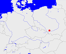
Diese Karte zeigt die Position oder den Umriss des Objekts. Haben Sie einen Fehler entdeckt? Dann würden wir uns über eine Nachricht freuen.
Übergeordnete Objekte
Legende
| | politische Verwaltung |
| | kirchliche Verwaltung |
| | gerichtliche Verwaltung |
| | Wohnplatz |
| | geographische Typen |
| | Verkehrswesen |
Übergeordnete Objekte
- Libiąż (Stadt- und Landgemeinde)
- Województwo katowickie (Wojewodschaft)
- Polen, República Popular de Polonia, Польская Народная Республика, Lenkijos Liaudies Respublika, La Pologne - République populaire, Poland - People's Republic, Polen, Rzeczpospolita Polska, Polska Rzeczpospolita Ludowa (Republik Volksrepublik)
- Polen (Dritte Republik), Polen, La Pologne - IIIe République, Polska - III Rzeczpospolita, Polaca - Tercera República, Третья Речь Посполитая, Poland (Third Republic) (Republik)
- Europäische Wirtschaftsgemeinschaft, Europäische Gemeinschaft, Europäische Union, Comhphobal Eacnamaíochta na hEorpa, Euroopan talousyhteisö, Európske hospodárske spoločenstvo, Communauté économique européenne, Comunidad Económica Europea, European Economic Community, Evropské hospodářské společenství, Europese Economische Gemeenschap, Comunità Economica Europea, Európske spoločenstvo, Europese Gemeenschap, Euroopan Yhteisö, European Community, Evropské společenství, Communauté européenne, Comhphobal Eorpach, Comunidad Europea, Comunità Europea, Európska únia, Europese Unie, Aontais Eorpaigh, European Union, Unión Europea, Euroopan Unioni, Evropská unie, Union européenne, Unione Europea (Staatenbund)
- Vereinte Nationen, Organización de las Naciones Unidas, Organisation des Nations unies, 联合国, Организация Объединённых Наций, الأمم المتحدة, United Nations, Verenigde Naties, Organizácia Spojených národov (Staatenbund)
- Powiat chrzanowski (Landkreis)
- Województwo małopolskie (Wojewodschaft)
- Polen (Dritte Republik), Polen, La Pologne - IIIe République, Polska - III Rzeczpospolita, Polaca - Tercera República, Третья Речь Посполитая, Poland (Third Republic) (Republik)
- Europäische Wirtschaftsgemeinschaft, Europäische Gemeinschaft, Europäische Union, Comhphobal Eacnamaíochta na hEorpa, Euroopan talousyhteisö, Európske hospodárske spoločenstvo, Communauté économique européenne, Comunidad Económica Europea, European Economic Community, Evropské hospodářské společenství, Europese Economische Gemeenschap, Comunità Economica Europea, Európske spoločenstvo, Europese Gemeenschap, Euroopan Yhteisö, European Community, Evropské společenství, Communauté européenne, Comhphobal Eorpach, Comunidad Europea, Comunità Europea, Európska únia, Europese Unie, Aontais Eorpaigh, European Union, Unión Europea, Euroopan Unioni, Evropská unie, Union européenne, Unione Europea (Staatenbund)
- Vereinte Nationen, Organización de las Naciones Unidas, Organisation des Nations unies, 联合国, Организация Объединённых Наций, الأمم المتحدة, United Nations, Verenigde Naties, Organizácia Spojených národov (Staatenbund)
- Krenau, Powiat chrzanowski, Powiat chrzanowski (Landkreis)
- Chrzanów (Bezirkshauptmannschaft)
Übergeordnete Objekte
| Name |
Zeitraum |
Typ |
Quelle |
|
Libiąż
|
(1969 -) |
Stadt- und Landgemeinde
|
Quelle
Libiąż - gmina
|
|
Chrzanów
|
(1907) |
Bezirkshauptmannschaft
|
Quelle
Seite 112 Wohnplatz zu Nr. 18
|
Quicktext
LIBIBIJO90PC
	gehört 1907 zu object_306258 sagt source_305701 (S. 112) (Wohnplatz zu Nr. 18),
	gehört ab 1969 zu object_1072513 sagt source_299844 (Libiąż - gmina),
	hat URL  https://en.wikipedia.org/wiki/Libiąż,
	hat URL  https://pl.wikipedia.org/wiki/Libiąż_(gmina),
	hat externe Kennung  SIMC:0940938,
	hat externe Kennung  geonames:3093457,
	heißt  (auf pol) Libiąż sagt source_299844 (Libiąż),
	ist ab 1969 (auf deu) Stadt (Siedlung) sagt source_299844 (Libiąż - gmina),
	ist bis 1969 (auf deu) Dorf sagt source_299844 (Libiąż - gmina),
	liegt bei 50.1031°N 19.3156°O;
