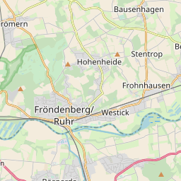
Frohnhausen

Diese Karte zeigt die Position oder den Umriss des Objekts. Haben Sie einen Fehler entdeckt? Dann würden wir uns über eine Nachricht freuen.
Übergeordnete Objekte
Legende
| | politische Verwaltung |
| | kirchliche Verwaltung |
| | gerichtliche Verwaltung |
| | Wohnplatz |
| | geographische Typen |
| | Verkehrswesen |
Übergeordnete Objekte
- Fröndenberg, Fröndenberg/Ruhr (Stadt Stadt)
- Fröndenberg (Bürgermeisterei Amt)
- Hamm, Unna (Landkreis)
- Arnsberg (Regierungsbezirk)
- Nordrhein-Westfalen, Northrhine-Westphalia, North Rhine-Westphalia, Noordrijn-Westfalen (Bundesland)
- Deutschland, Bundesrepublik Deutschland, Tyskland, Germany, Allemagne, Vokietija, Герма́ния, Duitsland, Niemcy, Nemecká spolková republika, Federal Republic of Germany (Bundesstaat)
- Europäische Wirtschaftsgemeinschaft, Europäische Gemeinschaft, Europäische Union, Comhphobal Eacnamaíochta na hEorpa, Euroopan talousyhteisö, Európske hospodárske spoločenstvo, Communauté économique européenne, Comunidad Económica Europea, European Economic Community, Evropské hospodářské společenství, Europese Economische Gemeenschap, Comunità Economica Europea, Európske spoločenstvo, Europese Gemeenschap, Euroopan Yhteisö, European Community, Evropské společenství, Communauté européenne, Comhphobal Eorpach, Comunidad Europea, Comunità Europea, Európska únia, Europese Unie, Aontais Eorpaigh, European Union, Unión Europea, Euroopan Unioni, Evropská unie, Union européenne, Unione Europea (Staatenbund)
- Vereinte Nationen, Organización de las Naciones Unidas, Organisation des Nations unies, 联合国, Организация Объединённых Наций, الأمم المتحدة, United Nations, Verenigde Naties, Organizácia Spojených národov (Staatenbund)
- Britische Besatzungszone (Besatzungszone)
- Westfalen, Westphalen (Provinz)
- Preußen, Pruisen, Pruissen (Herzogtum Königreich Freistaat)
- Deutscher Bund, German Confederation (Staatenbund)
- Norddeutscher Bund (Staatenbund Bundesstaat)
- Deutsches Reich, German Empire, Duitse Rijk (Bundesstaat)
- Völkerbund, Société des Nations, League of Nations, Sociedad de Naciones, Folkeforbundet, 國際聯盟, Liga Narodów, Volkenbond, 国際連盟, Società delle Nazioni, Milletler Cemiyeti, Sociedade das Nações (Staatenbund)
- Unna (Kreis)
- Arnsberg (Regierungsbezirk)
- Nordrhein-Westfalen, Northrhine-Westphalia, North Rhine-Westphalia, Noordrijn-Westfalen (Bundesland)
- Deutschland, Bundesrepublik Deutschland, Tyskland, Germany, Allemagne, Vokietija, Герма́ния, Duitsland, Niemcy, Nemecká spolková republika, Federal Republic of Germany (Bundesstaat)
- Europäische Wirtschaftsgemeinschaft, Europäische Gemeinschaft, Europäische Union, Comhphobal Eacnamaíochta na hEorpa, Euroopan talousyhteisö, Európske hospodárske spoločenstvo, Communauté économique européenne, Comunidad Económica Europea, European Economic Community, Evropské hospodářské společenství, Europese Economische Gemeenschap, Comunità Economica Europea, Európske spoločenstvo, Europese Gemeenschap, Euroopan Yhteisö, European Community, Evropské společenství, Communauté européenne, Comhphobal Eorpach, Comunidad Europea, Comunità Europea, Európska únia, Europese Unie, Aontais Eorpaigh, European Union, Unión Europea, Euroopan Unioni, Evropská unie, Union européenne, Unione Europea (Staatenbund)
- Vereinte Nationen, Organización de las Naciones Unidas, Organisation des Nations unies, 联合国, Организация Объединённых Наций, الأمم المتحدة, United Nations, Verenigde Naties, Organizácia Spojených národov (Staatenbund)
- Britische Besatzungszone (Besatzungszone)
- Westfalen, Westphalen (Provinz)
- Preußen, Pruisen, Pruissen (Herzogtum Königreich Freistaat)
- Deutscher Bund, German Confederation (Staatenbund)
- Norddeutscher Bund (Staatenbund Bundesstaat)
- Deutsches Reich, German Empire, Duitse Rijk (Bundesstaat)
- Völkerbund, Société des Nations, League of Nations, Sociedad de Naciones, Folkeforbundet, 國際聯盟, Liga Narodów, Volkenbond, 国際連盟, Società delle Nazioni, Milletler Cemiyeti, Sociedade das Nações (Staatenbund)
- Alt-katholische Gemeinde Dortmund (Kirchengemeinde)
- Fröndenberg (Bürgermeisterei Amt)
- Hamm, Unna (Landkreis)
- Arnsberg (Regierungsbezirk)
- Nordrhein-Westfalen, Northrhine-Westphalia, North Rhine-Westphalia, Noordrijn-Westfalen (Bundesland)
- Deutschland, Bundesrepublik Deutschland, Tyskland, Germany, Allemagne, Vokietija, Герма́ния, Duitsland, Niemcy, Nemecká spolková republika, Federal Republic of Germany (Bundesstaat)
- Europäische Wirtschaftsgemeinschaft, Europäische Gemeinschaft, Europäische Union, Comhphobal Eacnamaíochta na hEorpa, Euroopan talousyhteisö, Európske hospodárske spoločenstvo, Communauté économique européenne, Comunidad Económica Europea, European Economic Community, Evropské hospodářské společenství, Europese Economische Gemeenschap, Comunità Economica Europea, Európske spoločenstvo, Europese Gemeenschap, Euroopan Yhteisö, European Community, Evropské společenství, Communauté européenne, Comhphobal Eorpach, Comunidad Europea, Comunità Europea, Európska únia, Europese Unie, Aontais Eorpaigh, European Union, Unión Europea, Euroopan Unioni, Evropská unie, Union européenne, Unione Europea (Staatenbund)
- Vereinte Nationen, Organización de las Naciones Unidas, Organisation des Nations unies, 联合国, Организация Объединённых Наций, الأمم المتحدة, United Nations, Verenigde Naties, Organizácia Spojených národov (Staatenbund)
- Britische Besatzungszone (Besatzungszone)
- Westfalen, Westphalen (Provinz)
- Preußen, Pruisen, Pruissen (Herzogtum Königreich Freistaat)
- Deutscher Bund, German Confederation (Staatenbund)
- Norddeutscher Bund (Staatenbund Bundesstaat)
- Deutsches Reich, German Empire, Duitse Rijk (Bundesstaat)
- Völkerbund, Société des Nations, League of Nations, Sociedad de Naciones, Folkeforbundet, 國際聯盟, Liga Narodów, Volkenbond, 国際連盟, Società delle Nazioni, Milletler Cemiyeti, Sociedade das Nações (Staatenbund)
Übergeordnete Objekte
Quicktext
FROSENJO31VL
	gehört ab 1817 bis 1967 zu object_1143852,
	gehört ab 1968-01-01 zu FROERGJO31VL sagt source_1052377 (§7),
	heißt  (auf deu) Frohnhausen,
	ist ab 1968-01-01 (auf deu) Ortsteil,
	ist bis 1967-12-31 (auf deu) Gemeinde sagt source_1052376 (§7),
	liegt bei 51.483463°N 7.804912°O;