Hohensalza, Hohensalza, Inowracaw, Inowrocław, Inowrocław
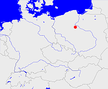
Diese Karte zeigt die Position oder den Umriss des Objekts. Haben Sie einen Fehler entdeckt? Dann würden wir uns über eine Nachricht freuen.
Übergeordnete Objekte
Legende
| | politische Verwaltung |
| | kirchliche Verwaltung |
| | gerichtliche Verwaltung |
| | Wohnplatz |
| | geographische Typen |
| | Verkehrswesen |
Übergeordnete Objekte
Untergeordnete Objekte
Quicktext
HOHLZAJO92DT
	gehört ab 1815 bis 1920 zu object_262356,
	gehört ab 1940 bis 1945 zu object_1049771,
	hat 1875-12-01 Einwohner 9147 sagt source_1343683 (Tab. IV S. 34),
	hat 1880-12-01 Einwohner 11558 sagt source_1343683 (Tab. IV S. 34),
	hat 1895-12-02 Einwohner 20689 sagt source_1343685 (S. 743),
	hat 1900-12-01 Einwohner 26141 sagt source_1343685 (S. 743),
	hat 1900-12-01 Fläche 23.2 sagt source_1343684 (Tab. III S. 12),
	hat 1905-12-01 Einwohner 24471 sagt source_1341051 (Anh. S. 8),
	hat 1910 Fläche 22.61 sagt source_276668 (Bd. 1 S. 821),
	hat 1910-12-01 Einwohner 25604 sagt source_1341051 (Anh. S. 8),
	hat URL  https://de.wikipedia.org/wiki/Inowroc%C5%82aw,
	heißt ab 1815 bis 1904  (auf pol) Inowracaw,
	heißt ab 1904 bis 1920  (auf deu) Hohensalza,
	heißt ab 1920 bis 1939  (auf pol) Inowrocław,
	heißt ab 1939 bis 1945  (auf deu) Hohensalza,
	heißt ab 1945  (auf pol) Inowrocław sagt source_354167,
	ist (auf deu) Stadt (Gebietskörperschaft);


