Voigtshof, Wójtówko
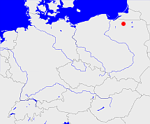
Diese Karte zeigt die Position oder den Umriss des Objekts. Haben Sie einen Fehler entdeckt? Dann würden wir uns über eine Nachricht freuen.
Übergeordnete Objekte
Legende
| | politische Verwaltung |
| | kirchliche Verwaltung |
| | gerichtliche Verwaltung |
| | Wohnplatz |
| | geographische Typen |
| | Verkehrswesen |
Übergeordnete Objekte
- Seeburg, Jeziorany (Stadt- und Landgemeinde)
- Powiat olsztyński (Landkreis)
- Województwo warmińsko-mazurskie (Wojewodschaft)
- Polen (Dritte Republik), Polen, La Pologne - IIIe République, Polska - III Rzeczpospolita, Polaca - Tercera República, Третья Речь Посполитая, Poland (Third Republic) (Republik)
- Europäische Wirtschaftsgemeinschaft, Europäische Gemeinschaft, Europäische Union, Comhphobal Eacnamaíochta na hEorpa, Euroopan talousyhteisö, Európske hospodárske spoločenstvo, Communauté économique européenne, Comunidad Económica Europea, European Economic Community, Evropské hospodářské společenství, Europese Economische Gemeenschap, Comunità Economica Europea, Európske spoločenstvo, Europese Gemeenschap, Euroopan Yhteisö, European Community, Evropské společenství, Communauté européenne, Comhphobal Eorpach, Comunidad Europea, Comunità Europea, Európska únia, Europese Unie, Aontais Eorpaigh, European Union, Unión Europea, Euroopan Unioni, Evropská unie, Union européenne, Unione Europea (Staatenbund)
- Vereinte Nationen, Organización de las Naciones Unidas, Organisation des Nations unies, 联合国, Организация Объединённых Наций, الأمم المتحدة, United Nations, Verenigde Naties, Organizácia Spojených národov (Staatenbund)
- Województwo olsztyńskie (Wojewodschaft)
- Polen, República Popular de Polonia, Польская Народная Республика, Lenkijos Liaudies Respublika, La Pologne - République populaire, Poland - People's Republic, Polen, Rzeczpospolita Polska, Polska Rzeczpospolita Ludowa (Republik Volksrepublik)
- Polen (Dritte Republik), Polen, La Pologne - IIIe République, Polska - III Rzeczpospolita, Polaca - Tercera República, Третья Речь Посполитая, Poland (Third Republic) (Republik)
- Europäische Wirtschaftsgemeinschaft, Europäische Gemeinschaft, Europäische Union, Comhphobal Eacnamaíochta na hEorpa, Euroopan talousyhteisö, Európske hospodárske spoločenstvo, Communauté économique européenne, Comunidad Económica Europea, European Economic Community, Evropské hospodářské společenství, Europese Economische Gemeenschap, Comunità Economica Europea, Európske spoločenstvo, Europese Gemeenschap, Euroopan Yhteisö, European Community, Evropské společenství, Communauté européenne, Comhphobal Eorpach, Comunidad Europea, Comunità Europea, Európska únia, Europese Unie, Aontais Eorpaigh, European Union, Unión Europea, Euroopan Unioni, Evropská unie, Union européenne, Unione Europea (Staatenbund)
- Vereinte Nationen, Organización de las Naciones Unidas, Organisation des Nations unies, 联合国, Организация Объединённых Наций, الأمم المتحدة, United Nations, Verenigde Naties, Organizácia Spojených národov (Staatenbund)
- Voigtshof (Gutsbezirk)
- Rößel, Rössel (Landkreis)
- Allenstein (Regierungsbezirk)
- Königsberg (Regierungsbezirk)
- Preußen, Ostpreußen, Prusse orientale, East Prussia, Rytu Prusija, Восточная Пруссия, Prusy Zachodnie (Provinz)
- Preußen, Ostpreußen, Prusse orientale, East Prussia, Rytu Prusija, Восточная Пруссия, Prusy Zachodnie (Provinz)
- Preußen (Provinz)
- Lokau (Landgemeinde Gemeinde)
- Rößel, Rössel (Landkreis)
- Allenstein (Regierungsbezirk)
- Königsberg (Regierungsbezirk)
- Preußen, Ostpreußen, Prusse orientale, East Prussia, Rytu Prusija, Восточная Пруссия, Prusy Zachodnie (Provinz)
- Preußen, Ostpreußen, Prusse orientale, East Prussia, Rytu Prusija, Восточная Пруссия, Prusy Zachodnie (Provinz)
- Preußen (Provinz)
- Jeziorany (Stadt- und Landgemeinde)
- Powiat olsztyński (Landkreis)
- Województwo warmińsko-mazurskie (Wojewodschaft)
- Polen (Dritte Republik), Polen, La Pologne - IIIe République, Polska - III Rzeczpospolita, Polaca - Tercera República, Третья Речь Посполитая, Poland (Third Republic) (Republik)
- Europäische Wirtschaftsgemeinschaft, Europäische Gemeinschaft, Europäische Union, Comhphobal Eacnamaíochta na hEorpa, Euroopan talousyhteisö, Európske hospodárske spoločenstvo, Communauté économique européenne, Comunidad Económica Europea, European Economic Community, Evropské hospodářské společenství, Europese Economische Gemeenschap, Comunità Economica Europea, Európske spoločenstvo, Europese Gemeenschap, Euroopan Yhteisö, European Community, Evropské společenství, Communauté européenne, Comhphobal Eorpach, Comunidad Europea, Comunità Europea, Európska únia, Europese Unie, Aontais Eorpaigh, European Union, Unión Europea, Euroopan Unioni, Evropská unie, Union européenne, Unione Europea (Staatenbund)
- Vereinte Nationen, Organización de las Naciones Unidas, Organisation des Nations unies, 联合国, Организация Объединённых Наций, الأمم المتحدة, United Nations, Verenigde Naties, Organizácia Spojených národov (Staatenbund)
- Województwo olsztyńskie (Wojewodschaft)
- Polen, República Popular de Polonia, Польская Народная Республика, Lenkijos Liaudies Respublika, La Pologne - République populaire, Poland - People's Republic, Polen, Rzeczpospolita Polska, Polska Rzeczpospolita Ludowa (Republik Volksrepublik)
- Polen (Dritte Republik), Polen, La Pologne - IIIe République, Polska - III Rzeczpospolita, Polaca - Tercera República, Третья Речь Посполитая, Poland (Third Republic) (Republik)
- Europäische Wirtschaftsgemeinschaft, Europäische Gemeinschaft, Europäische Union, Comhphobal Eacnamaíochta na hEorpa, Euroopan talousyhteisö, Európske hospodárske spoločenstvo, Communauté économique européenne, Comunidad Económica Europea, European Economic Community, Evropské hospodářské společenství, Europese Economische Gemeenschap, Comunità Economica Europea, Európske spoločenstvo, Europese Gemeenschap, Euroopan Yhteisö, European Community, Evropské společenství, Communauté européenne, Comhphobal Eorpach, Comunidad Europea, Comunità Europea, Európska únia, Europese Unie, Aontais Eorpaigh, European Union, Unión Europea, Euroopan Unioni, Evropská unie, Union européenne, Unione Europea (Staatenbund)
- Vereinte Nationen, Organización de las Naciones Unidas, Organisation des Nations unies, 联合国, Организация Объединённых Наций, الأمم المتحدة, United Nations, Verenigde Naties, Organizácia Spojených národov (Staatenbund)
Quicktext
VOIHOFKO03IX
	gehört ab 1928-09-30 bis 1945 zu object_1041798 sagt source_290143,
	gehört ab 1999 zu object_1023863,
	gehört bis 1928-09-29 zu object_328665 sagt source_190237,
	gehört zu object_1074041,
	hat 2004 PLZ PL-11-320,
	hat 2007 Einwohner 170,
	hat externe Kennung  SIMC:0476984,
	hat w-Nummer 50338,
	heißt  (auf deu) Voigtshof sagt source_190237 (Wohnplatz 33.116),
	heißt  (auf pol) Wójtówko sagt source_190269,
	ist ab 1945 (auf deu) Dorf,
	ist bis 1945 (auf deu) Gut (Gebäude),
	liegt bei 53.9839°N 20.7209°O;
