Waldenburg
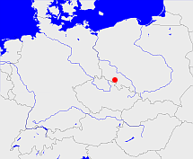
Diese Karte zeigt die Position oder den Umriss des Objekts. Haben Sie einen Fehler entdeckt? Dann würden wir uns über eine Nachricht freuen.
Übergeordnete Objekte
Legende
| | politische Verwaltung |
| | kirchliche Verwaltung |
| | gerichtliche Verwaltung |
| | Wohnplatz |
| | geographische Typen |
| | Verkehrswesen |
Übergeordnete Objekte
-
Breslau
(Regierungsbezirk) (1820 - 1945)
-
Reichenbach
(Regierungsbezirk) (1816 - 1820)
-
Schlesien
(ProvinzProvinz) (1815-04-30 - 1820-05-01)
Übergeordnete Objekte
| Name |
Zeitraum |
Typ |
Quelle |
|
Breslau
|
(1820 - 1945) |
Regierungsbezirk
|
|
|
Reichenbach
|
(1816 - 1820) |
Regierungsbezirk
|
|
Untergeordnete Objekte
| Name |
Typ |
GOV-Kennung |
Zeitraum |
| Hartau |
Gemeinde
|
object_1136866 |
|
| Schönhut, Smiłów |
Ort
|
object_188106 |
|
| Ober Salzbrunn, Bad Salzbrunn |
Stadt
|
object_188092 |
(- 1945) |
| Ober Salzbrunn, Bad Salzbrunn |
Amtsbezirk
|
object_1262654 |
(1874-05-09 - 1945) |
| Ober Salzbrunn, Bad Salzbrunn |
Amtsbezirk
|
object_1262654 |
(1874-05-09 - 1945) |
| Rudolfswaldau |
Landgemeinde
Gemeinde
|
RUDDAUJO80FQ |
(1885) |
| Polsnitz, Pełcznica |
Stadtteil
|
object_188098 |
(1885) |
| Nieder |
Ort
|
object_188093 |
|
| Neu Lässig |
Gemeinde
|
object_389277 |
|
| Neu Lässig |
Gutsbezirk
|
object_322491 |
(- 1928) |
| Weißstein |
Amtsbezirk
|
object_1262663 |
(1885) |
| Adelsbach, Struga |
Dorf
|
ADEACHJO80CT |
(- 1945) |
| Nieder Hermsdorf, Hermsdorf, Sobięcin |
Dorf
Stadtteil
|
object_188080 |
(- 1945) |
| Alt Lässig, Altlässig |
Gemeinde
|
object_1136851 |
|
| Friedland in Schlesien |
Amtsbezirk
|
object_1197953 |
(- 1945) |
| Kynau, Zagórze Śląskie |
Gemeinde
|
KYNNAUJO80ES |
|
| Dittmannsdorf |
Amtsbezirk
|
object_1197816 |
(1874-05-09 - 1945) |
| Dittmannsdorf |
Landgemeinde
Gemeinde
|
object_1136857 |
(- 1945) |
| Dittmannsdorf |
Amtsbezirk
|
object_1262645 |
(1874-05-09 - 1945) |
| Dittersbach |
Standesamt
|
object_1155016 |
(1883) |
| Dittersbach |
Gemeinde
|
object_1136856 |
(- 1934) |
| Alt Reichenau |
Amtsbezirk
|
object_263717 |
(1933 - 1934) |
| Weissstein |
Standesamt
|
object_1155021 |
(1883) |
| Bärsdorf |
Landgemeinde
Gemeinde
|
object_1136853 |
(- 1945) |
| Charlottenbrunn |
Standesamt
|
object_1152621 |
(1883) |
| Charlottenbrunn |
Amtsbezirk
|
object_1262644 |
(1885) |
| Reimswaldau |
Gutsbezirk
|
object_322494 |
(- 1928) |
| Reimswaldau |
Landgemeinde
Gemeinde
|
object_1197831 |
(- 1945) |
| Waldenburg, Waldenburg in Schlesien |
Standesamt
|
object_1151495 |
(1883) |
| Gottesberg (Schles.), Gottesberg |
Stadt
|
object_363350 |
(- 1945) |
| Ober Waldenburg |
Standesamt
|
object_1149561 |
(1883) |
| Ober Waldenburg |
Amtsbezirk
|
object_1262655 |
(1885) |
| Ober Waldenburg |
Gutsbezirk
|
object_322493 |
(- 1928) |
| Dörnhau |
Gemeinde
|
object_1136858 |
|
| Reußendorf, Rusinowa, Wałbrzych-Rusinowa |
Gemeinde
Stadtteil
|
REUORFJO80DS |
(- 1945) |
| Waldenburg in Schlesien, Waldenburg |
Stadt
|
object_1136855 |
(1818 - 1924) |
| Nieder Hermsdorf |
Standesamt
|
object_1153871 |
(1883) |
| Nieder Hermsdorf |
Gutsbezirk
|
object_324062 |
(1885) |
| Wüstewaltersdorf |
Standesamt
|
object_1153948 |
(1885) |
| Wildberg |
Amtsbezirk
|
object_1262664 |
(1885) |
| Nieder Rudolfswaldau |
Landgemeinde
|
object_1197928 |
(1874) |
| Fürstenstein |
Gutsbezirk
|
object_322484 |
(- 1928) |
| Fürstenstein |
Standesamt
|
object_1152740 |
(1883) |
| Fürstenstein |
Amtsbezirk
|
object_1262647 |
(1885) |
| Wüstegiersdorf |
Landgemeinde
Gemeinde
|
object_1197918 |
(1929-01-01 - 1945) |
| Hornschloß |
Amtsbezirk
|
object_1262653 |
(1885) |
| Gottesberg |
Amtsbezirk
|
object_1197835 |
(- 1945) |
| Lehmwasser, Glinica |
Gemeinde
|
LEHSERJO80DR |
|
| Langwaltersdorf, Lang Waltersdorf |
Amtsbezirk
|
object_1192786 |
(1874-05-09 - 1945) |
| Langwaltersdorf, Lang Waltersdorf |
Landgemeinde
Gemeinde
|
object_363352 |
(- 1945) |
| Hartebusch-Siedlung |
Ort
|
object_188075 |
|
| Kynsburg, Zamek Grodno |
Ort
|
object_188105 |
|
| Sorgau, Nieder Salzbrunn |
Amtsbezirk
|
object_1197853 |
(1874-05-09 - 1945) |
| Steingrund, Kamieńsk |
Gemeinde
|
object_188096 |
|
| Alt Lässig |
Amtsbezirk
|
object_389271 |
|
| Alt Lässig |
Gutsbezirk
|
object_322480 |
(- 1928) |
| Neuhaus |
Standesamt
|
object_1149791 |
(1883) |
| Neuhaus |
Gutsbezirk
|
object_322492 |
(- 1928) |
| Hochwald |
Amtsbezirk
|
object_1262651 |
(1885) |
| Adelsbach |
Amtsbezirk
|
object_1262642 |
(1885) |
| Adelsbach |
Gutsbezirk
|
object_322479 |
(- 1928) |
| Jauernig |
Gemeinde
|
JAUNIGJO80ER |
(- 1938-03-31) |
| Ober Hermsdorf |
Gemeinde
|
object_389278 |
(- 1937) |
| Neu Salzbrunn |
Gemeinde
|
object_1346251 |
(1818 - 1927-03-31) |
| Neuhain, Glinik Nowy |
Gemeinde
Stadtteil
|
NEUAI1JO80DR |
(- 1945) |
| Langwaltersdorf |
Gutsbezirk
|
object_322488 |
(- 1928) |
| Bad Charlottenbrunn |
Gemeinde
|
object_1136854 |
|
| Hohe Eule |
Amtsbezirk
|
object_1262652 |
(1885) |
| Bärengrund |
Gemeinde
|
object_1136852 |
|
| Rothenbach, Gorce |
Gemeinde
Stadt
|
object_363349 |
(- 1945) |
| Reussendorf |
Standesamt
|
object_1152624 |
(1883) |
| Zedlitzheide, Siedlików |
Ortsteil
|
ZEDIDEJO80FQ |
|
| Schmidtsdorf, Kowalowa |
Gemeinde
|
object_363354 |
(- 1945) |
| Seitendorf |
Standesamt
|
object_1153874 |
(1883) |
| Seitendorf |
Amtsbezirk
|
object_1197798 |
(1874-05-09 - 1945) |
| Seitendorf |
Gutsbezirk
|
object_322496 |
(- 1928) |
| Seitendorf |
Landgemeinde
Gemeinde
|
object_1197800 |
(- 1945) |
| Ober Wüstegiersdorf |
Landgemeinde
Gemeinde
|
object_1197917 |
(- 1945) |
| Ober Wüstegiersdorf |
Amtsbezirk
|
object_1197916 |
(1874-05-09 - 1945) |
| Reimsbach, Rybnica Mała |
Gemeinde
|
REIACHJO80DQ |
|
| Friedland, Friedland in Schlesien |
Stadt
|
object_188094 |
(- 1945) |
| Friedland, Friedland in Schlesien |
Standesamt
|
object_1149789 |
(1883) |
| Reußendorf |
Amtsbezirk
|
object_1262658 |
(1885) |
| Reußendorf |
Gutsbezirk
|
object_322495 |
(- 1928) |
| Alt Friedland |
Amtsbezirk
|
object_1192783 |
|
| Kynau |
Standesamt
|
object_1154656 |
(1883) |
| Kynau |
Amtsbezirk
|
object_1197818 |
(1874-05-09 - 1945) |
| Kynau |
Gutsbezirk
|
object_322487 |
(- 1928) |
| Nieder Wüstegiersdorf |
Standesamt
|
object_1163964 |
(1885) |
| Olbersdorf, eingegangen |
Ort
|
object_188081 |
|
| Liebichau, Lubiechów |
Dorf
Stadtteil
|
LIEHAUJO80DT |
(- 1945) |
| Hausdorf |
Standesamt
|
object_1152625 |
(1883) |
| Hausdorf |
Amtsbezirk
|
object_1262650 |
(1885) |
| Hausdorf |
Gemeinde
|
object_1136867 |
|
| Quolsdorf |
Gemeinde
|
object_1137505 |
(1932-10-01 -) |
| Nieder Wüstegiersdorf, Nieder-Wüstegiersdorf, Wüstegiersdorf |
Landgemeinde
Gemeinde
|
WUSORFJO80EQ |
(- 1945) |
| Neu Weißstein, Kamionek |
Gemeinde
Stadtteil
|
NEUEINJO80DS |
(- 1923) |
| Raspenau, Łączna |
Gemeinde
|
object_363353 |
(- 1945) |
| Erlenbusch, Nieder Tannhausen |
Landgemeinde
Gemeinde
|
object_1136861 |
(- 1945) |
| Nieder Wüste-Giersdorf |
Standesamt
|
object_1155015 |
(1883) |
| Michelsdorf |
Amtsbezirk
|
object_1192787 |
|
| Michelsdorf |
Gemeinde
|
object_188102 |
(- 1945) |
| Michelsdorf |
Gutsbezirk
|
object_322490 |
(- 1928) |
| Polsnitz |
Standesamt
|
object_1197302 |
(1883) |
| Polsnitz |
Landgemeinde
Gemeinde
|
object_1197303 |
(1885) |
| Polsnitz |
Amtsbezirk
|
object_1197301 |
(1885) |
| Polsnotz |
Standesamt
|
object_1153876 |
(1883) |
| Fellhammer |
Gutsbezirk
|
object_322482 |
(- 1928) |
| Fellhammer |
Amtsbezirk
|
object_389272 |
|
| Fellhammer |
Standesamt
|
object_1152622 |
(1883) |
| Fellhammer |
Gemeinde
|
object_1136862 |
(- 1945) |
| Liebichau |
Gutsbezirk
|
object_322489 |
(- 1928) |
| Althain |
Gemeinde
|
object_1136850 |
(- 1945) |
| Lomnitz, Łomnica |
Gemeinde
|
object_188109 |
|
| Neudorf, Nowe Siodło |
Gemeinde
|
object_188074 |
|
| Neu Hohendorf |
Gemeinde
|
object_389276 |
|
| Konradsthal |
Gemeinde
|
object_1136869 |
(- 1945) |
| Altwasser |
Gemeinde
|
object_1136849 |
(- 1919-03-31) |
| Altwasser |
Amtsbezirk
|
object_1197795 |
(1874-05-09 - 1919-03-31) |
| Altwasser |
Gutsbezirk
|
object_322481 |
(- 1928) |
| Schenkendorf |
Landgemeinde
Gemeinde
|
object_1197822 |
(- 1937-03-31) |
| Nieder Wüstegiersdorf, Wüstegiersdorf |
Amtsbezirk
|
object_1163963 |
(1874-05-09 - 1945) |
| Donnerau |
Amtsbezirk
|
object_1192784 |
(1874-05-09 - 1945) |
| Donnerau |
Landgemeinde
Gemeinde
|
object_1136859 |
(- 1945) |
| Fröhlichsdorf |
Gemeinde
|
object_1136863 |
|
| Fröhlichsdorf |
Gutsbezirk
|
object_322483 |
(- 1928) |
| Ober Rudolfswaldau |
Landgemeinde
|
object_1197933 |
(1874) |
| Kaltvorwerk (= Polsnitz) |
Gutsbezirk
|
object_322486 |
(- 1928) |
| Dorfbach |
Gemeinde
|
object_1136860 |
|
| Liebersdorf |
Landgemeinde
Gemeinde
|
object_1197852 |
(1934-04-01 - 1945) |
| Heinrichau |
Landgemeinde
Gemeinde
|
object_1136868 |
(1885) |
| Nieder Salzbrunn |
Standesamt
|
object_1154653 |
(1883) |
| Nieder Salzbrunn |
Landgemeinde
Gemeinde
|
object_1197857 |
(- 1945) |
| Friedersdorf |
Gemeinde
|
FRIORFJO30DV |
(- 1938-03-31) |
| Gaablau |
Landgemeinde
Gemeinde
|
object_1197844 |
(1934-04-01 - 1945) |
| Kaltwasser |
Landgemeinde
|
object_188086 |
(- 1928-12-31) |
| Göhlenau |
Gemeinde
|
object_1136864 |
(- 1945) |
| Göhlenau |
Gutsbezirk
|
object_322485 |
(- 1928) |
| Fürstenstein, Książ |
Dorf
Stadtteil
|
object_189827 |
(- 1945) |
| Sophienau, Suliszów |
Gemeinde
|
SOPNAUJO80ER |
|
| Neugericht |
Gemeinde
|
NEUCH1JO80FR |
(- 1938-03-31) |
| Rudolfswaldau, Ober Rudolphswaldau |
Amtsbezirk
|
object_1197929 |
(1874-05-09 - 1945) |
| Waldenburg in Schlesien |
Amtsbezirk
|
object_1197827 |
(- 1945) |
| Wüste Waltersdorf, Wüstewaltersdorf |
Amtsbezirk
|
object_1197948 |
(1874-05-09 - 1945) |
| Wüste Waltersdorf, Wüstewaltersdorf |
Landgemeinde
Gemeinde
|
object_1197949 |
(- 1945) |
| Tannhausen |
Gutsbezirk
|
object_322497 |
(- 1928) |
| Tannhausen |
Standesamt
|
object_1153873 |
(1883) |
| Tannhausen |
Amtsbezirk
|
object_1197946 |
(1874-05-09 -) |
| Tannhausen |
Amtsbezirk
|
object_1262661 |
(1874-05-09 -) |
| Lang Waltersdorf |
Standesamt
|
object_1149560 |
(1883) |
| Wolfsberg |
Amtsbezirk
|
object_1262665 |
(1885) |
| Weißstein, Biały Kamień, Wałbrzych-Biały Kamień |
Gemeinde
Stadtteil
|
WEIEINJO80DS |
(- 1945) |
| Liebersdorf, Rothenbach i. Schlesien |
Amtsbezirk
|
object_1193460 |
(1934-04-01 - 1945) |
| Ober Salzbrunn |
Standesamt
|
object_1154654 |
(1883) |
| Görbersdorf |
Standesamt
|
object_1149788 |
(1883) |
| Görbersdorf |
Amtsbezirk
|
object_1262648 |
(1885) |
| Görbersdorf |
Gemeinde
|
object_1136865 |
|
Bilder im GenWiki
Quicktext
adm_169853
	gehört ab 1816 bis 1820 zu object_257589,
	gehört ab 1820 bis 1945 zu adm_368469,
	hat 1818 Einwohner 35290 sagt source_355986 (Seite 866),
	hat 1880-12-01 Einwohner 112358 sagt source_1091743 (S. 121),
	hat 1900 Einwohner 143361 sagt source_265044,
	hat 1910 Einwohner 168714 sagt source_265044,
	hat w-Nummer 53147,
	heißt  (auf deu) Waldenburg,
	ist bis 1945 (auf deu) Landkreis;

