Frankenstein
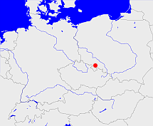
Diese Karte zeigt die Position oder den Umriss des Objekts. Haben Sie einen Fehler entdeckt? Dann würden wir uns über eine Nachricht freuen.
Übergeordnete Objekte
Legende
| | politische Verwaltung |
| | kirchliche Verwaltung |
| | gerichtliche Verwaltung |
| | Wohnplatz |
| | geographische Typen |
| | Verkehrswesen |
Übergeordnete Objekte
-
Reichenbach
(Regierungsbezirk) (1816 - 1820)
-
Schlesien
(ProvinzProvinz) (1815-04-30 - 1820-05-01)
-
Breslau
(Regierungsbezirk) (1820 - 1945)
Übergeordnete Objekte
| Name |
Zeitraum |
Typ |
Quelle |
|
Reichenbach
|
(1816 - 1820) |
Regierungsbezirk
|
|
|
Breslau
|
(1820 - 1945) |
Regierungsbezirk
|
|
Untergeordnete Objekte
| Name |
Typ |
GOV-Kennung |
Zeitraum |
| Nieder-Pritschen, Przyczina Dolna |
Ort
|
object_363308 |
|
| Zesselwitz |
Gemeinde
|
object_1137264 |
(1932 -) |
| Kamenz |
Gutsbezirk
|
object_324671 |
(- 1928) |
| Kamenz |
Standesamt
|
object_1153445 |
(1883) |
| Kamenz |
Gemeinde
|
object_308203 |
(- 1945) |
| Bernsdorf |
Gemeinde
|
object_1137252 |
(1932 -) |
| Bernsdorf |
Amtsbezirk
|
object_1193029 |
|
| Nieder Kunzendorf, Kalinowice Dolne |
Dorf
|
NIEORFJO80NP |
(1932 -) |
| Neuhof |
Gemeinde
|
object_1137245 |
(1932 -) |
| Quickendorf |
Standesamt
|
object_1154358 |
(1883) |
| Quickendorf |
Amtsbezirk
|
object_1262395 |
(1885) |
| Quickendorf |
Gemeinde
|
object_1137285 |
|
| Quickendorf |
Gutsbezirk
|
object_321335 |
(- 1929-09-30) |
| Haunold |
Gemeinde
|
object_1137201 |
|
| Haunold |
Gutsbezirk
|
object_321325 |
(- 1929-09-30) |
| Korschwitz |
Amtsbezirk
|
object_1193035 |
|
| Zülzendorf |
Gemeinde
|
object_1137210 |
|
| Reumen |
Gemeinde
|
object_1137280 |
(1932 -) |
| Reichenstein |
Standesamt
|
object_1149093 |
(1883) |
| Reichenstein |
Stadt
|
object_1137290 |
(- 1945) |
| Reichenstein |
Amtsbezirk
|
object_1195402 |
(1885) |
| Schrom |
Gemeinde
|
object_1137234 |
|
| Tarnau |
Gemeinde
|
object_1137236 |
|
| Tarnau |
Gutsbezirk
|
object_321345 |
(- 1928) |
| Tarnau |
Amtsbezirk
|
object_1276803 |
(1939) |
| Rätsch |
Gemeinde
|
object_1137283 |
|
| Gallenau |
Gemeinde
|
object_1137198 |
|
| Gallenau |
Amtsbezirk
|
object_1273058 |
(1939) |
| Wartha |
Standesamt
|
object_1155183 |
(1883) |
| Wartha |
Amtsbezirk
|
object_1262797 |
(1885) |
| Wartha |
Stadt
|
object_1137292 |
|
| Heinzendorf |
Gemeinde
|
object_1137242 |
(1932 -) |
| Schönheide A |
Gutsbezirk
|
object_321338 |
(- 1928) |
| Schönheide B |
Gutsbezirk
|
object_321339 |
(- 1928) |
| Dittmannsdorf |
Gemeinde
|
object_1137258 |
|
| Dittmannsdorf |
Gutsbezirk
|
object_321322 |
(- 1929-09-30) |
| Dittmannsdorf |
Standesamt
|
object_1151327 |
(1939) |
| Niklasdorf |
Gemeinde
|
object_1137254 |
|
| Niklasdorf |
Gutsbezirk
|
object_321332 |
(- 1929-09-30) |
| Viehhöfe, Krowniki |
Ort
|
VIEOFEJO80MN |
|
| Neu Altmannsdorf |
Standesamt
|
object_1252984 |
(1939) |
| Tepliwoda, Lauenbrunn |
Gemeinde
|
object_1137270 |
(1932 -) |
| Tepliwoda, Lauenbrunn |
Amtsbezirk
|
object_1193044 |
(1939) |
| Tepliwoda, Lauenbrunn |
Standesamt
|
object_1252965 |
(1939) |
| Bölmsdorf, Belmsdorf |
Gemeinde
|
object_1137244 |
(1932 -) |
| Bärwalde |
Gemeinde
|
object_1137217 |
(1932 -) |
| Bärwalde |
Amtsbezirk
|
object_1273048 |
(1939) |
| Hertwigswalde |
Gemeinde
|
object_1137205 |
(1932 -) |
| Hertwigswalde |
Standesamt
|
object_1151134 |
(1939) |
| Frankenstein |
Standesamt
|
object_1154360 |
(1883) |
| Frankenstein |
Stadt
|
object_1137289 |
|
| Frankenstein |
Amtsbezirk
|
object_1262789 |
(1885) |
| Willwitz |
Gemeinde
|
object_1137266 |
(1932 -) |
| Willwitz |
Standesamt
|
object_1273604 |
(1939) |
| Maifritzdorf |
Standesamt
|
object_1152285 |
(1883) |
| Maifritzdorf |
Gemeinde
|
object_1137208 |
|
| Maifritzdorf |
Amtsbezirk
|
object_1262435 |
|
| Ober Pomsdorf |
Gemeinde
|
object_1137209 |
(1932 -) |
| Alt Altmannsdorf |
Standesamt
|
object_1149289 |
(1883) |
| Alt Altmannsdorf |
Amtsbezirk
|
object_1262391 |
(1887) |
| Alt Altmannsdorf |
Gemeinde
|
object_1137191 |
|
| Silberberg |
Standesamt
|
object_1155178 |
(1883) |
| Silberberg |
Gemeinde
|
object_1137291 |
|
| Silberberg |
Amtsbezirk
|
object_1262796 |
(1885) |
| Nieder Kunzendorf |
Gemeinde
|
object_1137227 |
(1932 -) |
| Glambach |
Gemeinde
|
object_1137240 |
(1932 -) |
| Reindörfel |
Gemeinde
|
object_1137281 |
(1932 -) |
| Lauenbrunn |
Amtsbezirk
|
object_1273087 |
(1939) |
| Heinrichswalde |
Standesamt
|
object_1149290 |
(1883) |
| Heinrichswalde |
Amtsbezirk
|
object_1262791 |
(1885) |
| Heinrichswalde |
Gemeinde
|
object_1137203 |
|
| Reisezagel |
Landgemeinde
|
object_1267570 |
(1885) |
| Neuhaus |
Gemeinde
|
object_1137247 |
(1932 -) |
| Neuhaus |
Amtsbezirk
|
object_1193038 |
|
| Neuhaus |
Standesamt
|
object_1153045 |
(1939) |
| Riegersdorf |
Gemeinde
|
object_1137248 |
|
| Schlause |
Gemeinde
|
object_1137275 |
(1932 -) |
| Schlause |
Standesamt
|
object_1273047 |
(1939) |
| Reichenau |
Standesamt
|
object_1155182 |
(1883) |
| Reichenau |
Gemeinde
|
object_1137212 |
|
| Reichenau |
Amtsbezirk
|
object_1273490 |
(1939) |
| Baumgarten |
Standesamt
|
object_1151274 |
(1883) |
| Baumgarten |
Gemeinde
|
object_1137257 |
|
| Baumgarten |
Amtsbezirk
|
object_1267265 |
|
| Kunzendorf |
Amtsbezirk
|
object_1193036 |
|
| Kunzendorf |
Gemeinde
|
object_1137213 |
|
| Schlottendorf |
Gemeinde
|
object_1137277 |
|
| Schlottendorf |
Standesamt
|
object_1273491 |
(1939) |
| Olbersdorf, Groß Olbersdorf |
Gemeinde
|
object_1137259 |
|
| Briesnitz |
Standesamt
|
object_1154359 |
(1883) |
| Briesnitz |
Amtsbezirk
|
object_1193031 |
|
| Briesnitz |
Gemeinde
|
object_1137194 |
|
| Briesnitz |
Gutsbezirk
|
object_321321 |
(- 1929-09-30) |
| Plottnitz |
Gemeinde
|
object_1137261 |
|
| Plottnitz |
Gutsbezirk
|
object_321334 |
(- 1929-09-30) |
| Löwenstein |
Gemeinde
|
object_1137207 |
|
| Löwenstein |
Gutsbezirk
|
object_321331 |
(- 1929-09-30) |
| Hartha, Dürr Hartha |
Gemeinde
|
object_1137196 |
|
| Nieder Pomsdorf-Liebenau |
Standesamt
|
object_1149754 |
(1939) |
| Kühnheide |
Gutsbezirk
|
object_321329 |
(- 1929-09-30) |
| Wiltsch, Wilcza |
Gemeinde
|
object_356325 |
(1885) |
| Alt-Heinrichau |
Standesamt
|
object_1273603 |
(1939) |
| Altaltmannsdorf, Alt Altmannsdorf |
Gutsbezirk
|
object_321319 |
(- 1929-09-30) |
| Seitendorf |
Standesamt
|
object_1153510 |
(1883) |
| Seitendorf |
Gemeinde
|
object_1137228 |
|
| Seitendorf |
Gutsbezirk
|
object_321342 |
(- 1928) |
| Seitendorf |
Amtsbezirk
|
object_1267314 |
|
| Zinkwitz |
Gemeinde
|
object_1137263 |
(1932 -) |
| Peterwitz |
Standesamt
|
object_1151275 |
(1883) |
| Peterwitz |
Gemeinde
|
object_1137250 |
(- 1945) |
| Peterwitz |
Gutsbezirk
|
object_321333 |
(- 1929-09-30) |
| Kamenz-Hemmersdorf |
Gutsbezirk
|
object_324672 |
(- 1928) |
| Rosenbach |
Gemeinde
|
object_1137279 |
|
| Rosenbach |
Gutsbezirk
|
object_321337 |
(- 1929-09-30) |
| Lampersdorf |
Standesamt
|
object_1154356 |
(1883) |
| Lampersdorf |
Gemeinde
|
object_1137253 |
|
| Lampersdorf |
Gutsbezirk
|
object_321330 |
(- 1929-09-30) |
| Neu Altmannsdorf, Neu Altmannsdorf |
Landgemeinde
Gemeinde
|
object_1137225 |
(1932 -) |
| Grochwitz |
Gemeinde
|
object_1137214 |
|
| Pilz |
Gemeinde
|
object_1137235 |
|
| Sand |
Gemeinde
|
object_1137278 |
|
| Brucksteine |
Gemeinde
|
object_1137195 |
(1932 -) |
| Groß Nossen |
Gemeinde
|
object_1137220 |
(1932 -) |
| Groß Nossen |
Amtsbezirk
|
object_1193032 |
|
| Groß Nossen |
Standesamt
|
object_1149756 |
(1939) |
| Banau |
Standesamt
|
object_1151276 |
(1883) |
| Banau |
Gemeinde
|
object_1137193 |
|
| Banau |
Gutsbezirk
|
object_321320 |
(- 1929-09-30) |
| Banau |
Amtsbezirk
|
object_1262434 |
(1885) |
| Leipe |
Gemeinde
|
object_1137223 |
(1932 -) |
| Stolz |
Standesamt
|
object_1150691 |
(1883) |
| Stolz |
Amtsbezirk
|
object_1252913 |
(1885) |
| Stolz |
Gemeinde
|
object_1137274 |
|
| Stolz |
Gutsbezirk
|
object_321343 |
(- 1928) |
| Kamenz A. |
Amtsbezirk
|
object_1262792 |
(1885) |
| Zadel |
Standesamt
|
object_1153506 |
(1883) |
| Zadel |
Gemeinde
|
object_1137265 |
|
| Zadel |
Amtsbezirk
|
object_1262433 |
(1885) |
| Algersdorf |
Amtsbezirk
|
object_1193028 |
|
| Schräbsdorf |
Standesamt
|
object_1152344 |
(1883) |
| Schräbsdorf |
Amtsbezirk
|
object_1193043 |
|
| Schräbsdorf |
Gemeinde
|
object_1137276 |
|
| Schräbsdorf |
Gutsbezirk
|
object_321341 |
(- 1928) |
| Ober Johnsdorf |
Gemeinde
|
object_1137229 |
(1932 -) |
| Münchhof |
Amtsbezirk
|
object_1193037 |
|
| Zülzendorf, Sulisławice (powiat ząbkowicki) |
Standesamt
|
object_1152078 |
(1939) |
| Moschwitz |
Gemeinde
|
object_1137224 |
(1932 -) |
| Moschwitz |
Standesamt
|
object_1151772 |
(- 1945) |
| Wenig Nossen |
Gemeinde
|
object_1137268 |
(1932 -) |
| Karlsberg |
Gutsbezirk
|
object_321326 |
(- 1929-09-30) |
| Gierichswalde |
Gemeinde
|
object_1137199 |
|
| Raudnitz |
Standesamt
|
object_1153513 |
(1883) |
| Raudnitz |
Amtsbezirk
|
object_1262793 |
(1885) |
| Raudnitz |
Gemeinde
|
object_1137282 |
|
| Frankenberg |
Standesamt
|
object_1152572 |
(1883) |
| Frankenberg |
Amtsbezirk
|
object_1262394 |
(1885) |
| Frankenberg |
Gemeinde
|
object_1137246 |
|
| Tomnitz |
Standesamt
|
object_1153514 |
(1883) |
| Tomnitz |
Amtsbezirk
|
object_1194637 |
|
| Tomnitz |
Gemeinde
|
object_1137269 |
|
| Tomnitz |
Gutsbezirk
|
object_321346 |
(- 1928) |
| Johnsbach |
Gemeinde
|
object_1137206 |
|
| Follmersdorf |
Forstgutsbezirk
|
object_1262443 |
(1885) |
| Follmersdorf |
Gemeinde
|
object_1137197 |
|
| Kosemitz |
Gemeinde
|
object_1137221 |
(1932 -) |
| Bärdorf |
Gemeinde
|
object_1137218 |
(1932 - 1945) |
| Bärdorf |
Standesamt
|
object_1147477 |
(1939) |
| Bärdorf |
Amtsbezirk
|
object_1262817 |
(1939) |
| Weigelsdorf |
Landgemeinde
Gemeinde
|
object_1137241 |
(1932 -) |
| Ober Kunzendorf |
Gemeinde
|
object_1137231 |
(1932 -) |
| Dörndorf |
Gemeinde
|
object_1137215 |
|
| Sehersgrund |
Gemeinde
|
object_1262396 |
(1885) |
| Kamenz B |
Amtsbezirk
|
object_1262393 |
|
| Liebenau |
Gemeinde
|
object_1137249 |
(1932 -) |
| Liebenau |
Amtsbezirk
|
object_1262823 |
(1939) |
| Polnisch Peterwitz, Petershagen |
Gemeinde
|
object_1137262 |
|
| Tarchwitz |
Gemeinde
|
object_1137272 |
(1932 -) |
| Karlsberg, Oberförsterei-Anteil |
Gutsbezirk
|
object_324673 |
(- 1928) |
| Kobelau |
Gemeinde
|
object_1137190 |
(1875-07-21 -) |
| Kobelau |
Gutsbezirk
|
object_321328 |
(- 1929-09-30) |
| Raschgrund |
Landgemeinde
|
object_1267544 |
(1898) |
| Hemmersdorf |
Gutsbezirk
|
object_324670 |
(- 1928) |
| Hemmersdorf |
Gemeinde
|
object_1137204 |
|
| Wiesenthal |
Landgemeinde
Gemeinde
|
object_1137267 |
(1932 -) |
| Wiesenthal |
Amtsbezirk
|
object_1193045 |
|
| Krelkau |
Gemeinde
|
object_1137222 |
(1932 -) |
| Krelkau |
Standesamt
|
object_1155277 |
(1939) |
| Krelkau |
Amtsbezirk
|
object_1262821 |
(1939) |
| Gläsendorf |
Gemeinde
|
object_1137211 |
|
| Raudnitz-Raschdorf |
Gutsbezirk
|
object_321336 |
(- 1929-09-30) |
| Weigelsdorf, Weigelsdorf-Kunzendorf |
Amtsbezirk
|
object_1262825 |
(1939) |
| Raschdorf |
Gemeinde
|
object_1137284 |
|
| Baitzen |
Gemeinde
|
object_1137192 |
|
| Paulwitz |
Gemeinde
|
object_1137260 |
|
| Protzan |
Gemeinde
|
object_1137286 |
|
| Protzan |
Standesamt
|
object_1273067 |
(1939) |
| Schönjohnsdorf |
Amtsbezirk
|
object_1193041 |
|
| Heinrichau |
Gemeinde
|
object_1137243 |
(1932 -) |
| Heinrichau |
Standesamt
|
object_1155276 |
(1939) |
| Schönheide |
Standesamt
|
object_1149094 |
(1883) |
| Schönheide |
Amtsbezirk
|
object_1194636 |
|
| Schönheide |
Gemeinde
|
object_1137230 |
|
| Schönwalde |
Standesamt
|
object_1150688 |
(1883) |
| Schönwalde |
Amtsbezirk
|
object_1262795 |
(1885) |
| Schönwalde |
Gemeinde
|
object_1137239 |
|
| Schönwalde |
Gutsbezirk
|
object_321340 |
(- 1928) |
| Münsterberg in Schlesien, Münsterberg |
Stadt
|
object_1193536 |
(1932 - 1945) |
| Nieder Pomsdorf |
Gemeinde
|
object_1137226 |
(1932 -) |
| Nieder Pomsdorf |
Amtsbezirk
|
object_1193039 |
|
| Olbersdorf |
Gemeinde
|
object_1137256 |
(1932 -) |
| Olbersdorf |
Standesamt
|
object_1151273 |
(1883) |
| Olbersdorf |
Standesamt
|
object_1151771 |
(1939) |
| Heinersdorf |
Gemeinde
|
object_1137202 |
|
| Tadelwitz |
Gemeinde
|
object_1137273 |
|
| Tadelwitz |
Gutsbezirk
|
object_321344 |
(- 1928) |
| Schodelwitz |
Gemeinde
|
object_1262398 |
(1885) |
| Taschenberg |
Gemeinde
|
object_1137271 |
(1932 -) |
| Giersdorf |
Standesamt
|
object_1153444 |
(1883) |
| Giersdorf |
Amtsbezirk
|
object_1262790 |
(1885) |
| Giersdorf |
Gemeinde
|
object_1137237 |
|
| Giersdorf |
Gutsbezirk
|
object_321323 |
(- 1929-09-30) |
| Weigelsdorf-Kunzendorf, Weigelsdorf |
Standesamt
|
object_1151770 |
(1939) |
| Frömsdorf |
Gemeinde
|
object_1137219 |
(1932 -) |
| Frömsdorf |
Standesamt
|
object_1149288 |
(1939) |
| Alt Heinrichau |
Gemeinde
|
object_1137216 |
(1932 -) |
| Heinrichau, Alt-Heinrichau |
Amtsbezirk
|
object_1193033 |
|
| Olbersdorf, Groß-Olbersdorf |
Amtsbezirk
|
object_1193040 |
|
| Berzdorf |
Amtsbezirk
|
object_1193030 |
|
| Kleutsch |
Standesamt
|
object_1149291 |
(1883) |
| Kleutsch |
Amtsbezirk
|
object_1193034 |
|
| Kleutsch |
Gemeinde
|
object_1137255 |
|
| Kleutsch |
Gutsbezirk
|
object_321327 |
(- 1929-09-30) |
| Grochau |
Gemeinde
|
object_1137200 |
|
| Grochau |
Gutsbezirk
|
object_321324 |
(- 1929-09-30) |
| Bernsdorf, Bernsdorf-Reindörfel |
Standesamt
|
object_1147479 |
(1939) |
| Herzogswalde |
Gemeinde
|
object_1137251 |
|
| Eichau |
Landgemeinde
Gemeinde
|
object_1137238 |
(1932 -) |
| Eichau |
Gemeinde
|
object_1137232 |
|
| Eichau |
Gutsbezirk
Gemeinde
|
object_275231 |
(1939) |
| Wolmsdorf |
Gemeinde
|
object_1137233 |
|
| Ober-Pritschen, Przyczina Gorna |
Ort
|
object_186596 |
|
| Grunau |
Gemeinde
|
object_1262392 |
(1885) |
Bilder im GenWiki
Quicktext
adm_169867
	gehört ab 1816 bis 1820 zu object_257589,
	gehört ab 1820 bis 1945 zu adm_368469,
	hat 1818 Einwohner 34722 sagt source_355986 (Seite 866),
	hat 1880-12-01 Einwohner 50723 sagt source_1091743 (S. 118),
	hat 1900 Einwohner 45632 sagt source_265044,
	hat 1910 Einwohner 45312 sagt source_265044,
	hat w-Nummer 53132,
	heißt  (auf deu) Frankenstein,
	ist (auf deu) Landkreis;

