Lichtenberg
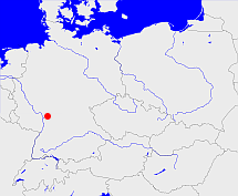
Diese Karte zeigt die Position oder den Umriss des Objekts. Haben Sie einen Fehler entdeckt? Dann würden wir uns über eine Nachricht freuen.
Übergeordnete Objekte
Legende
| | politische Verwaltung |
| | kirchliche Verwaltung |
| | gerichtliche Verwaltung |
| | Wohnplatz |
| | geographische Typen |
| | Verkehrswesen |
Übergeordnete Objekte
Übergeordnete Objekte
Untergeordnete Objekte
| Name |
Typ |
GOV-Kennung |
Zeitraum |
| Brandau, Branda, Branda, Brandau, Brandaw, Brandauwe, Brandauwe, Brandau |
Gemeinde
Ortsteil
|
BRADAUJN49IR |
(1783 - 1821) |
| Nonrod |
Gemeinde
Ortsteil
|
NONRODJN49JS |
(1783 -) |
| Nieder-Modau |
Gemeinde
Ortsteil
|
NIEDAUJN49IS |
(1783 -) |
| Webern |
Gemeinde
Ortsteil
|
object_1139534 |
(1783 -) |
| Wersau |
Gemeinde
|
WERSAUJN49KS |
(1783 -) |
| Lichtenberg |
Gemeinde
Ortsteil
|
LICERGJN49JS |
(1783 -) |
| Meßbach |
Gemeinde
Ortsteil
|
MESACHJN49JR |
(1783 -) |
| Herchenrode |
Gemeinde
Ortsteil
|
HERODEJN49IS |
(1783 -) |
| Obernhausen |
Ort
|
OBESENJN49JS |
(1783 -) |
| Wembach |
Gemeinde
Gemeindeteil
|
WEMACH_W6101 |
(1783 -) |
| Roßdorf |
Gemeinde
|
ROSORFJN49JU |
(1783 -) |
| Niedernhausen, Waldhausen |
Gemeinde
Ortsteil
|
NIESENJN49JS |
(1783 -) |
| Allertshofen, Allerczhoffen, Allertzhoffen, Allerzhoffen, Allertshofen |
Gemeinde
Ortsteil
|
ALLFENJN49IR |
(- 1821) |
| Ernsthofen, Ernsthofen, Ernsthofen, Ernsthoffen, Ernsthoven, Ernsthoiffen, Ernshoven |
Gemeinde
Ortsteil
|
ERNFENJN49IS |
(- 1821) |
| Reinheim |
Stadt
|
REIEIMJN49KU |
(1783 -) |
| Bierbach, Burbach, Burlebach |
Ortsteil
|
BIEACHJN49KS |
(1783 -) |
| Rohrbach |
Gemeinde
Gemeindeteil
|
ROHACHJN49JS |
(1783 -) |
| Asbach, Aspach das lit undir Lichtenberg, Aßpach, Aspach |
Gemeinde
Ortsteil
|
ASBACHJN49JS |
(- 1821) |
| Steinau |
Gemeinde
Ortsteil
|
STENAUJN49JR |
(1783 -) |
| Neunkirchen |
Gemeinde
Ortsteil
|
NEUHENJN49JR |
(1783 -) |
| Hahn |
Ort
|
object_281344 |
|
| Ober-Modau |
Gemeinde
Ortsteil
|
OBEDAUJN49IS |
(1783 -) |
| Groß-Zimmern |
Gemeinde
|
ZIMERNJN49JV |
(1783 -) |
| Dilshofen |
Wohnplatz
|
DILFEN_W6101 |
(1783 -) |
| Brensbach |
Gemeinde
|
BREACHJN49KS |
(1783 -) |
| Groß-Bieberau |
Stadt
|
BIERAUJN49KT |
(1783 -) |
| Ober-Ramstadt |
Gemeinde
Stadt
|
RAMADTJN49IU |
(1783 -) |
| Billings |
Gemeinde
Ortsteil
|
BILNGSJN49JS |
(1783 -) |
| Ueberau |
Gemeinde
Ortsteil
|
UEBRAU_W6101 |
(1783 -) |
| Gundernhausen |
Gemeinde
Ortsteil
|
GUNSENJN49JU |
(1783 -) |
| Nieder-Kainsbach |
Ortsteil
|
NIEACHJN49KR |
(1783 -) |
| Frankenhausen |
Gemeinde
Ortsteil
|
FRASENJN49IS |
(1783 -) |
| Lützelbach |
Gemeinde
Ortsteil
|
LUTACHJN49JR |
(1783 -) |
Bilder im GenWiki
Quicktext
object_1086555
	gehört ab 1806 bis 1821 zu object_280026,
	gehört bis 1806 zu object_1086554,
	heißt  (auf deu) Lichtenberg,
	ist bis 1821 (auf deu) Amt (Verwaltung);

