Ritschezka, Річецька с.-р., Richetska

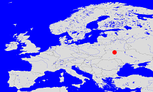
Diese Karte zeigt die Position oder den Umriss des Objekts. Haben Sie einen Fehler entdeckt? Dann würden wir uns über eine Nachricht freuen.
Übergeordnete Objekte
Legende
| | politische Verwaltung |
| | kirchliche Verwaltung |
| | gerichtliche Verwaltung |
| | Wohnplatz |
| | geographische Typen |
| | Verkehrswesen |
Untergeordnete Objekte
| Name |
Typ |
GOV-Kennung |
Zeitraum |
| Retschki, Речки, Rzeczki, Рiчки |
Dorf
|
RETHKIKO30NQ |
|
| Annowka, Анновка, Annówka, Ганнівка |
Dorf
|
ANNWKAKO30MP |
|
| Kasak, Казак, Kozak, Козак |
Dorf
|
KASSAKKO30NQ |
|
| Kopytow, Копытов, Kopytów, Копитів |
Dorf
|
KOPTOWKO30MP |
|
| Retschetschina, Речечина, Rzeczyzna, Річечина, Rzeczeczyzna |
KolonieDorf
|
RETINAKO30MQ |
|
Quicktext
object_1143083
	hat ab 1991 PLZ UA-34745 sagt source_390584,
	heißt  (auf deu) Ritschezka,
	heißt  (auf eng) Richetska,
	heißt  (auf ukr) Річецька с.-р.,
	ist (auf deu) Dorfrat;
