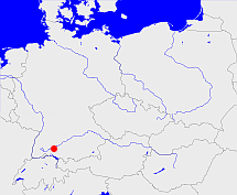
Mengen

map

This map shows the position or outline of the object. Have you found an error? Then we would be happy about a message.

GOV id http://gov.genealogy.net/object_1264038
name
  • Mengen (deu)
type
  • Kirchengemeinde (1956 -)
denomination
  • ev
web page
Article about this place in the genealogy.net wiki
Geographic Position
  • 48.0497°N 9.3317°E calculated center position of the place
  • Number of the German 1:25,000 map sheet: 7921

Superordinate objects

Caption

 political administration
 ecclesiastical
 judical
 settlement
 geographic
 transportation

Superordinate objects

Superordinate objects

name Timespan type Source
Biberach (1956-04-12 -) deanery

Subordinate objects

name type GOV-Id Timespan
Mengen town part of town MENGENJN48QB (1956-04-12 -)
Blochingen Pfarrdorf part of place BLOGENJN48QB (1956-04-12 -)
Rulfingen Pfarrdorf part of place RULGENJN48PA (1956-04-12 -)
Rosna village part of place ROSSNAJN48PA (1956-04-12 -)
Beuren village part of place BEURENJN48QB (1951-05-31 -)
Ennetach Pfarrdorf part of place ENNACHJN48PB (1956-04-12 -)

Images in the GenWiki


Quicktext

object_1264038
	has URL  http://www.mengen-evangelisch.de/,
	has denomination ev,
	has name (in deu) Mengen,
	is from 1956 (in deu) Kirchengemeinde,
	is from 1956-04-12 part of object_179490;
RDF
Quick Search