Rajon Mazejew, Мацеевский р-н, Маціївський р-н, Луківський р-н

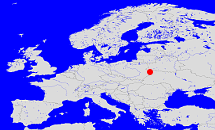
Diese Karte zeigt die Position oder den Umriss des Objekts. Haben Sie einen Fehler entdeckt? Dann würden wir uns über eine Nachricht freuen.
Übergeordnete Objekte
Legende
| | politische Verwaltung |
| | kirchliche Verwaltung |
| | gerichtliche Verwaltung |
| | Wohnplatz |
| | geographische Typen |
| | Verkehrswesen |
Übergeordnete Objekte
- Kreisgebiet Kowel (Kreisgebiet)
- Oblast Wolhynien (Luzk), Obwód wołyński (Łuck), Волинська область (Луцьк), Волынская область (Луцк) (Oblast)
- Ukraine, Ukraina, Україна, Украина, Ukraine, Ukrajina, Oekraïne (Republik)
- Ukrainische Sozialistische Sowjetrepublik (USSR), Українська Радянська Соціалістична Республіка (УРСР), Украинская Советская Социалистическая Республика (УССР) (Republik Unionsrepublik)
- UdSSR, Union der Sozialistischen Sowjetrepubliken, Sowjetunion, Union of Soviet Socialist Republics, USSR, Союз Советских Социалистических Республик, СССР, Soviet Union, Советский Союз, USSR, Unie van Socialistische Sovjetrepublieken (Bundesstaat)
- Vereinte Nationen, Organización de las Naciones Unidas, Organisation des Nations unies, 联合国, Организация Объединённых Наций, الأمم المتحدة, United Nations, Verenigde Naties, Organizácia Spojených národov (Staatenbund)
Untergeordnete Objekte
| Name |
Typ |
GOV-Kennung |
Zeitraum |
| Belitschi, Біличі, Bilicze, Беличи, Биличи |
Dorf
|
BELCHIKO21EF |
(1940 - 1959) |
| Tschornoplesy, Черноплесы, Czarnoplesy, Чорноплеси |
Dorf
|
TSCESYKO21DH |
(1940 - 1959) |
| Wilka-Podhorodnenska, Вілька-Подгородненська, Wólka-Podhorodenska, Вилька-Подгородненская |
Dorf
|
WILAJAKO21CF |
(1940 - 1959) |
| Satschernetschje, Зачернеччя, Зачернечье, Zaczernecze |
Dorf
|
SATHJEKO21EG |
(1940 - 1959) |
| Wygnanka, Вигнанка, Выгнанка, Wygnanka |
Dorf
|
WYGNKAKO21DH |
(1940 - 1959) |
| Wysoke, Wyżówka, Високе, Высокое |
ChutorDorf
|
WYSOJEKO21DG |
(1940 - 1959) |
Quicktext
object_1266371
	gehört ab 1940 bis 1959 zu object_290447 sagt source_301432,
	gehört ab 1941 bis 1944 zu object_306993 sagt source_1046581,
	heißt ab 1946  (auf ukr) Луківський р-н,
	heißt bis 1946  (auf deu) Rajon Mazejew,
	heißt bis 1946  (auf rus) Мацеевский р-н,
	heißt bis 1946  (auf ukr) Маціївський р-н,
	ist ab 1940 bis 1959 (auf deu) Rayon;
