Potsdam
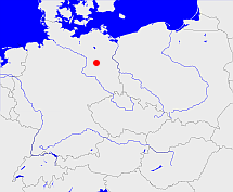
Diese Karte zeigt die Position oder den Umriss des Objekts. Haben Sie einen Fehler entdeckt? Dann würden wir uns über eine Nachricht freuen.
Übergeordnete Objekte
Legende
| | politische Verwaltung |
| | kirchliche Verwaltung |
| | gerichtliche Verwaltung |
| | Wohnplatz |
| | geographische Typen |
| | Verkehrswesen |
Übergeordnete Objekte
Übergeordnete Objekte
Untergeordnete Objekte
| Name |
Typ |
GOV-Kennung |
Zeitraum |
| Kyritz |
Kreis
|
adm_142030 |
(1952-07-25 - 1990-10-02) |
| Brandenburg a./H. |
Stadtkreis
|
object_263140 |
(1952-07-25 - 1990-10-02) |
| Königs Wusterhausen |
Landkreis
|
adm_142029 |
(1952-07-25 - 1990-10-02) |
| Potsdam-Land |
Landkreis
|
adm_142038 |
(1952-07-24 - 1990-10-02) |
| Zossen |
Landkreis
|
adm_142048 |
(1952-07-25 - 1990-10-02) |
| Wittstock |
Kreis
|
adm_142047 |
(1952-07-25 - 1990-10-02) |
| Jüterbog |
Landkreis
|
adm_142028 |
(1952-07-25 - 1990-10-02) |
| Oranienburg |
Landkreis
|
adm_142036 |
(1952-07-25 - 1990-10-02) |
| Nauen |
Kreis
|
adm_142034 |
(1952-07-25 - 1990-10-02) |
| Pritzwalk |
Kreis
|
adm_142040 |
(1952-07-25 - 1990-10-02) |
| Rathenow |
Landkreis
|
adm_142041 |
(1952-07-25 - 1990-10-02) |
| Neuruppin |
Kreis
|
adm_142035 |
(1952-07-25 - 1990-10-02) |
| Luckenwalde |
Landkreis
|
adm_142033 |
(1952-07-25 - 1990-10-02) |
| Potsdam |
Stadtkreis
|
adm_142054 |
(1952-07-25 - 1990-10-02) |
| Brandenburg |
Landkreis
|
adm_142017 |
(1952-07-25 - 1990-10-02) |
| Gransee |
Kreis
|
adm_142025 |
(1952-07-25 - 1990-10-02) |
| Belzig |
Landkreis
|
adm_142015 |
(1952-07-25 - 1990-10-02) |
Bilder im GenWiki
Quicktext
object_218123
	gehört ab 1952-07-25 bis 1990-10-02 zu object_218112 sagt source_257541,
	hat 1981-12-31 Einwohner 1118413 sagt source_1087078 (S. 6),
	hat 1983-12-31 Einwohner 1121900 sagt source_1087078 (S. 6),
	hat 1983-12-31 Fläche 12568.0 sagt source_1087078 (S. 6),
	hat externe Kennung  Bezirksnummer:04 sagt source_257541,
	heißt ab 1952-07-25 bis 1990-10-02  (auf deu) Potsdam,
	ist ab 1952-07-25 bis 1990-10-02 (auf deu) Bezirk;

