Zwiefaltendorf (St. Michael)
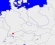
Diese Karte zeigt die Position oder den Umriss des Objekts. Haben Sie einen Fehler entdeckt? Dann würden wir uns über eine Nachricht freuen.
Übergeordnete Objekte
Legende
| | politische Verwaltung |
| | kirchliche Verwaltung |
| | gerichtliche Verwaltung |
| | Wohnplatz |
| | geographische Typen |
| | Verkehrswesen |
Übergeordnete Objekte
Untergeordnete Objekte
Quicktext
object_266749
	gehört zu object_1253161,
	gehört zu object_190392,
	hat Konfession rk,
	heißt  (auf deu) Zwiefaltendorf (St. Michael),
	ist ab 1217 (auf deu) Pfarrei;


