II. Landvogtei am mittlern Neckar

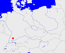
Diese Karte zeigt die Position oder den Umriss des Objekts. Haben Sie einen Fehler entdeckt? Dann würden wir uns über eine Nachricht freuen.
Übergeordnete Objekte
Legende
| | politische Verwaltung |
| | kirchliche Verwaltung |
| | gerichtliche Verwaltung |
| | Wohnplatz |
| | geographische Typen |
| | Verkehrswesen |
Übergeordnete Objekte
- Württemberg (Königreich)
- Rheinbund, Confédération du Rhin (Staatenbund)
- Deutscher Bund, German Confederation (Staatenbund)
- Deutsches Reich, German Empire, Duitse Rijk (Bundesstaat)
- Völkerbund, Société des Nations, League of Nations, Sociedad de Naciones, Folkeforbundet, 國際聯盟, Liga Narodów, Volkenbond, 国際連盟, Società delle Nazioni, Milletler Cemiyeti, Sociedade das Nações (Staatenbund)
Übergeordnete Objekte
Untergeordnete Objekte
Quicktext
object_306557
	gehört ab 1810-12-10 bis 1818-01-01 zu object_190729,
	heißt  (auf deu) II. Landvogtei am mittlern Neckar sagt source_1191821 (S. 213),
	ist ab 1810-12-10 bis 1818-01-01 (auf deu) Kreis (mittlere Verwaltungsebene) sagt source_1188899 sagt source_1191823;


