Unterrheinkreis (Mannheim)
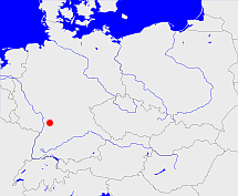
Diese Karte zeigt die Position oder den Umriss des Objekts. Haben Sie einen Fehler entdeckt? Dann würden wir uns über eine Nachricht freuen.
Übergeordnete Objekte
Legende
| | politische Verwaltung |
| | kirchliche Verwaltung |
| | gerichtliche Verwaltung |
| | Wohnplatz |
| | geographische Typen |
| | Verkehrswesen |
Übergeordnete Objekte
-
Baden
(KurfürstentumGroßherzogtumFreistaat) (1832-02-18 - 1864-09-30)
Übergeordnete Objekte
| Name |
Zeitraum |
Typ |
Quelle |
|
Baden
|
(1832-02-18 - 1864-09-30) |
Kurfürstentum
Großherzogtum
Freistaat
|
|
Untergeordnete Objekte
| Name |
Typ |
GOV-Kennung |
Zeitraum |
| Krautheim |
Bezirksamt
|
object_1049784 |
(1832 - 1864) |
| Udenheim, Philippsburg |
Amt
|
object_381419 |
(1832 - 1864) |
| Mosbach |
Amt
Amt
Bezirksamt
Landkreis
|
object_320498 |
(1832 - 1864) |
| Wiesloch |
Amt
Bezirksamt
|
object_320492 |
(1832 - 1864) |
| Ladenburg |
Oberamt
Amt
|
object_306783 |
(1832 - 1864) |
| Tauberbischofsheim |
Amt
Bezirksamt
Landkreis
|
object_320495 |
(1832 - 1864) |
| Adelsheim |
Amt
Bezirksamt
|
object_320493 |
(1832 - 1864) |
| Weinheim |
Amt
Amt
Bezirksamt
|
object_320488 |
(1832 - 1864) |
| Eberbach |
Amt
Bezirksamt
|
object_320497 |
(1832 - 1864) |
| Wertheim |
Amt
Bezirksamt
|
object_320499 |
(1832 - 1864) |
| Schwetzingen |
Amt
Bezirksamt
|
object_320487 |
(1832 - 1864) |
| Mannheim |
Amt
Stadtkreis
|
MANEIMJN49FL |
(1832 - 1864) |
| Walldürn |
Amt
Bezirksamt
|
object_391265 |
(1832 - 1864) |
| Sinsheim |
Amt
Bezirksamt
Landkreis
|
object_320491 |
(1832 - 1864) |
| Neckargemünd |
Amt
|
object_406838 |
(1832 - 1857) |
| Heidelberg |
Oberamt
|
object_306780 |
(1832 - 1864) |
| Buchen |
Amt
|
object_884510 |
(1832 - 1864) |
Bilder im GenWiki
Quicktext
object_320436
	gehört ab 1832-02-18 bis 1864-09-30 zu object_217952,
	heißt ab 1832 bis 1864  (auf deu) Unterrheinkreis (Mannheim),
	ist ab 1832 bis 1864 (auf deu) Kreis (mittlere Verwaltungsebene);

