Homburg
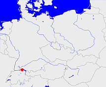
Diese Karte zeigt die Position oder den Umriss des Objekts. Haben Sie einen Fehler entdeckt? Dann würden wir uns über eine Nachricht freuen.
Übergeordnete Objekte
Legende
| | politische Verwaltung |
| | kirchliche Verwaltung |
| | gerichtliche Verwaltung |
| | Wohnplatz |
| | geographische Typen |
| | Verkehrswesen |
Übergeordnete Objekte
- Steckborn (Bezirk)
- Thurgau (Kanton)
- Schweiz, Alte Eidgenossenschaft, Helvetische Republik, Schweizerische Eidgenossenschaft, Suisse, Switzerland, Zwitserland, Svizzera, Svizra, Confédération suisse, Confederazione svizzera, Confoederatio Helvetica, Confederaziun svizra (Staat)
- Heiliges Römisches Reich, Heiliges Römisches Reich deutscher Nation, Heiliges Römisches Reich, Sacrum Imperium, Sacrum Romanum Imperium, Sacrum Romanum Imperium Nationis Germanicæ (Königreich Kaiserreich)
- Vereinte Nationen, Organización de las Naciones Unidas, Organisation des Nations unies, 联合国, Организация Объединённых Наций, الأمم المتحدة, United Nations, Verenigde Naties, Organizácia Spojených národov (Staatenbund)
Untergeordnete Objekte
| Name |
Typ |
GOV-Kennung |
Zeitraum |
| Hörhausen |
Ort
|
HORSENJN47LP |
|
Quicktext
HOMURGJN47MP
	gehört zu CH_adm2007,
	hat 1970 Einwohner 1114 sagt source_191262,
	hat 1980 Einwohner 1071 sagt source_191262,
	hat 1990 Einwohner 1248 sagt source_191262,
	hat 2000 Einwohner 1432 sagt source_191262,
	hat Gemeindekennzahl 4816,
	hat PLZ 8508,
	hat externe Kennung  geonames:2660308,
	hat externe Kennung  opengeodb:31626,
	heißt  (auf deu) Homburg,
	ist (auf deu) Ort,
	liegt bei 47.63°N 9.0°O;
