Altenkrempe


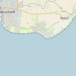
Diese Karte zeigt die Position oder den Umriss des Objekts. Haben Sie einen Fehler entdeckt? Dann würden wir uns über eine Nachricht freuen.
| GOV-Kennung | http://gov.genealogy.net/ALTMPEJO54KD |
| Name |
|
| Typ | |
| Einwohner | |
| Postleitzahl |
|
| Haushalte |
|
| externe Kennung | |
| Artikel zu diesem Objekt im GenWiki | |
| Geographische Position |
|
| Kontaktmöglichkeiten |
Wenn Sie mit anderen Personen, die sich für Schleswig-Holstein interessieren, in Kontakt treten wollen, empfehlen wir unser Diskussionsystem. |
Übergeordnete Objekte
Legende
| politische Verwaltung | |
| kirchliche Verwaltung | |
| gerichtliche Verwaltung | |
| Wohnplatz | |
| geographische Typen | |
| Verkehrswesen |
Übergeordnete Objekte
Übergeordnete Objekte
Untergeordnete Objekte
Quicktext
ALTMPEJO54KD
	gehört 1890 zu object_321049 sagt source_387809 (S. 3),
	gehört zu object_185181 sagt source_387809 (S. 3),
	gehört zu object_293248 sagt source_1081178 (S. 87) sagt source_1082104 (S. 66),
	hat 1961-06-06 Einwohner 235 sagt source_1081178 (S. 87),
	hat 1964 PLZ W2431 sagt source_1081178 (S. 87),
	hat 1970-05-27 Einwohner 195 sagt source_1082104 (S. 66),
	hat 1987-05-25 Einwohner 267 sagt source_387814 (S. 49),
	hat 1987-05-25 Haushalte 97 sagt source_387814 (S. 49),
	hat ab 1993-07-01 PLZ 23730,
	hat bis 1993-06-30 PLZ W2430,
	hat externe Kennung  geonames:2957557,
	heißt  (auf deu) Altenkrempe,
	ist (auf deu) Kirchdorf sagt source_1081178 (S. 87) sagt source_1082104 (S. 66),
	liegt bei 54.13°N 10.83°O;