Giesmannsdorf, Gostków
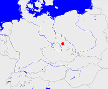
Diese Karte zeigt die Position oder den Umriss des Objekts. Haben Sie einen Fehler entdeckt? Dann würden wir uns über eine Nachricht freuen.
Übergeordnete Objekte
Legende
| | politische Verwaltung |
| | kirchliche Verwaltung |
| | gerichtliche Verwaltung |
| | Wohnplatz |
| | geographische Typen |
| | Verkehrswesen |
Übergeordnete Objekte
- Stare Bogaczowice (Landgemeinde)
- Powiat wałbrzyski (Landkreis)
- Województwo dolnośląskie (Wojewodschaft)
- Polen (Dritte Republik), Polen, La Pologne - IIIe République, Polska - III Rzeczpospolita, Polaca - Tercera República, Третья Речь Посполитая, Poland (Third Republic) (Republik)
- Europäische Wirtschaftsgemeinschaft, Europäische Gemeinschaft, Europäische Union, Comhphobal Eacnamaíochta na hEorpa, Euroopan talousyhteisö, Európske hospodárske spoločenstvo, Communauté économique européenne, Comunidad Económica Europea, European Economic Community, Evropské hospodářské společenství, Europese Economische Gemeenschap, Comunità Economica Europea, Európske spoločenstvo, Europese Gemeenschap, Euroopan Yhteisö, European Community, Evropské společenství, Communauté européenne, Comhphobal Eorpach, Comunidad Europea, Comunità Europea, Európska únia, Europese Unie, Aontais Eorpaigh, European Union, Unión Europea, Euroopan Unioni, Evropská unie, Union européenne, Unione Europea (Staatenbund)
- Vereinte Nationen, Organización de las Naciones Unidas, Organisation des Nations unies, 联合国, Организация Объединённых Наций, الأمم المتحدة, United Nations, Verenigde Naties, Organizácia Spojených národov (Staatenbund)
- Giesmannsdorf (Gemeinde)
- Gießmannsdorf, Giesmannsdorf (Standesamt)
- Jauer (Landkreis)
- Liegnitz (Regierungsbezirk)
- Niederschlesien (Provinz Provinz)
- Preußen, Pruisen, Pruissen (Herzogtum Königreich Freistaat)
- Deutscher Bund, German Confederation (Staatenbund)
- Norddeutscher Bund (Staatenbund Bundesstaat)
- Deutsches Reich, German Empire, Duitse Rijk (Bundesstaat)
- Völkerbund, Société des Nations, League of Nations, Sociedad de Naciones, Folkeforbundet, 國際聯盟, Liga Narodów, Volkenbond, 国際連盟, Società delle Nazioni, Milletler Cemiyeti, Sociedade das Nações (Staatenbund)
- Schlesien (Provinz Provinz)
- Preußen, Pruisen, Pruissen (Herzogtum Königreich Freistaat)
- Deutscher Bund, German Confederation (Staatenbund)
- Norddeutscher Bund (Staatenbund Bundesstaat)
- Deutsches Reich, German Empire, Duitse Rijk (Bundesstaat)
- Völkerbund, Société des Nations, League of Nations, Sociedad de Naciones, Folkeforbundet, 國際聯盟, Liga Narodów, Volkenbond, 国際連盟, Società delle Nazioni, Milletler Cemiyeti, Sociedade das Nações (Staatenbund)
- Reichenbach (Regierungsbezirk)
- Schlesien (Provinz Provinz)
- Preußen, Pruisen, Pruissen (Herzogtum Königreich Freistaat)
- Deutscher Bund, German Confederation (Staatenbund)
- Norddeutscher Bund (Staatenbund Bundesstaat)
- Deutsches Reich, German Empire, Duitse Rijk (Bundesstaat)
- Völkerbund, Société des Nations, League of Nations, Sociedad de Naciones, Folkeforbundet, 國際聯盟, Liga Narodów, Volkenbond, 国際連盟, Società delle Nazioni, Milletler Cemiyeti, Sociedade das Nações (Staatenbund)
- Preußen, Pruisen, Pruissen (Herzogtum Königreich Freistaat)
- Deutscher Bund, German Confederation (Staatenbund)
- Norddeutscher Bund (Staatenbund Bundesstaat)
- Deutsches Reich, German Empire, Duitse Rijk (Bundesstaat)
- Völkerbund, Société des Nations, League of Nations, Sociedad de Naciones, Folkeforbundet, 國際聯盟, Liga Narodów, Volkenbond, 国際連盟, Società delle Nazioni, Milletler Cemiyeti, Sociedade das Nações (Staatenbund)
- Bolkenhayn, Bolkenhain (Landkreis)
- Liegnitz (Regierungsbezirk)
- Niederschlesien (Provinz Provinz)
- Preußen, Pruisen, Pruissen (Herzogtum Königreich Freistaat)
- Deutscher Bund, German Confederation (Staatenbund)
- Norddeutscher Bund (Staatenbund Bundesstaat)
- Deutsches Reich, German Empire, Duitse Rijk (Bundesstaat)
- Völkerbund, Société des Nations, League of Nations, Sociedad de Naciones, Folkeforbundet, 國際聯盟, Liga Narodów, Volkenbond, 国際連盟, Società delle Nazioni, Milletler Cemiyeti, Sociedade das Nações (Staatenbund)
- Niederschlesien (Provinz Provinz)
- Preußen, Pruisen, Pruissen (Herzogtum Königreich Freistaat)
- Deutscher Bund, German Confederation (Staatenbund)
- Norddeutscher Bund (Staatenbund Bundesstaat)
- Deutsches Reich, German Empire, Duitse Rijk (Bundesstaat)
- Völkerbund, Société des Nations, League of Nations, Sociedad de Naciones, Folkeforbundet, 國際聯盟, Liga Narodów, Volkenbond, 国際連盟, Società delle Nazioni, Milletler Cemiyeti, Sociedade das Nações (Staatenbund)
- Schlesien (Provinz Provinz)
- Preußen, Pruisen, Pruissen (Herzogtum Königreich Freistaat)
- Deutscher Bund, German Confederation (Staatenbund)
- Norddeutscher Bund (Staatenbund Bundesstaat)
- Deutsches Reich, German Empire, Duitse Rijk (Bundesstaat)
- Völkerbund, Société des Nations, League of Nations, Sociedad de Naciones, Folkeforbundet, 國際聯盟, Liga Narodów, Volkenbond, 国際連盟, Società delle Nazioni, Milletler Cemiyeti, Sociedade das Nações (Staatenbund)
- Preußen, Pruisen, Pruissen (Herzogtum Königreich Freistaat)
- Deutscher Bund, German Confederation (Staatenbund)
- Norddeutscher Bund (Staatenbund Bundesstaat)
- Deutsches Reich, German Empire, Duitse Rijk (Bundesstaat)
- Völkerbund, Société des Nations, League of Nations, Sociedad de Naciones, Folkeforbundet, 國際聯盟, Liga Narodów, Volkenbond, 国際連盟, Società delle Nazioni, Milletler Cemiyeti, Sociedade das Nações (Staatenbund)
- Schlesien (Provinz Provinz)
- Preußen, Pruisen, Pruissen (Herzogtum Königreich Freistaat)
- Deutscher Bund, German Confederation (Staatenbund)
- Norddeutscher Bund (Staatenbund Bundesstaat)
- Deutsches Reich, German Empire, Duitse Rijk (Bundesstaat)
- Völkerbund, Société des Nations, League of Nations, Sociedad de Naciones, Folkeforbundet, 國際聯盟, Liga Narodów, Volkenbond, 国際連盟, Società delle Nazioni, Milletler Cemiyeti, Sociedade das Nações (Staatenbund)
- Preußen, Pruisen, Pruissen (Herzogtum Königreich Freistaat)
- Deutscher Bund, German Confederation (Staatenbund)
- Norddeutscher Bund (Staatenbund Bundesstaat)
- Deutsches Reich, German Empire, Duitse Rijk (Bundesstaat)
- Völkerbund, Société des Nations, League of Nations, Sociedad de Naciones, Folkeforbundet, 國際聯盟, Liga Narodów, Volkenbond, 国際連盟, Società delle Nazioni, Milletler Cemiyeti, Sociedade das Nações (Staatenbund)
- Reichenbach (Regierungsbezirk)
- Schlesien (Provinz Provinz)
- Preußen, Pruisen, Pruissen (Herzogtum Königreich Freistaat)
- Deutscher Bund, German Confederation (Staatenbund)
- Norddeutscher Bund (Staatenbund Bundesstaat)
- Deutsches Reich, German Empire, Duitse Rijk (Bundesstaat)
- Völkerbund, Société des Nations, League of Nations, Sociedad de Naciones, Folkeforbundet, 國際聯盟, Liga Narodów, Volkenbond, 国際連盟, Società delle Nazioni, Milletler Cemiyeti, Sociedade das Nações (Staatenbund)
- Preußen, Pruisen, Pruissen (Herzogtum Königreich Freistaat)
- Deutscher Bund, German Confederation (Staatenbund)
- Norddeutscher Bund (Staatenbund Bundesstaat)
- Deutsches Reich, German Empire, Duitse Rijk (Bundesstaat)
- Völkerbund, Société des Nations, League of Nations, Sociedad de Naciones, Folkeforbundet, 國際聯盟, Liga Narodów, Volkenbond, 国際連盟, Società delle Nazioni, Milletler Cemiyeti, Sociedade das Nações (Staatenbund)
- Jauer (Landkreis)
- Liegnitz (Regierungsbezirk)
- Niederschlesien (Provinz Provinz)
- Preußen, Pruisen, Pruissen (Herzogtum Königreich Freistaat)
- Deutscher Bund, German Confederation (Staatenbund)
- Norddeutscher Bund (Staatenbund Bundesstaat)
- Deutsches Reich, German Empire, Duitse Rijk (Bundesstaat)
- Völkerbund, Société des Nations, League of Nations, Sociedad de Naciones, Folkeforbundet, 國際聯盟, Liga Narodów, Volkenbond, 国際連盟, Società delle Nazioni, Milletler Cemiyeti, Sociedade das Nações (Staatenbund)
- Niederschlesien (Provinz Provinz)
- Preußen, Pruisen, Pruissen (Herzogtum Königreich Freistaat)
- Deutscher Bund, German Confederation (Staatenbund)
- Norddeutscher Bund (Staatenbund Bundesstaat)
- Deutsches Reich, German Empire, Duitse Rijk (Bundesstaat)
- Völkerbund, Société des Nations, League of Nations, Sociedad de Naciones, Folkeforbundet, 國際聯盟, Liga Narodów, Volkenbond, 国際連盟, Società delle Nazioni, Milletler Cemiyeti, Sociedade das Nações (Staatenbund)
- Schlesien (Provinz Provinz)
- Preußen, Pruisen, Pruissen (Herzogtum Königreich Freistaat)
- Deutscher Bund, German Confederation (Staatenbund)
- Norddeutscher Bund (Staatenbund Bundesstaat)
- Deutsches Reich, German Empire, Duitse Rijk (Bundesstaat)
- Völkerbund, Société des Nations, League of Nations, Sociedad de Naciones, Folkeforbundet, 國際聯盟, Liga Narodów, Volkenbond, 国際連盟, Società delle Nazioni, Milletler Cemiyeti, Sociedade das Nações (Staatenbund)
- Preußen, Pruisen, Pruissen (Herzogtum Königreich Freistaat)
- Deutscher Bund, German Confederation (Staatenbund)
- Norddeutscher Bund (Staatenbund Bundesstaat)
- Deutsches Reich, German Empire, Duitse Rijk (Bundesstaat)
- Völkerbund, Société des Nations, League of Nations, Sociedad de Naciones, Folkeforbundet, 國際聯盟, Liga Narodów, Volkenbond, 国際連盟, Società delle Nazioni, Milletler Cemiyeti, Sociedade das Nações (Staatenbund)
- Schlesien (Provinz Provinz)
- Preußen, Pruisen, Pruissen (Herzogtum Königreich Freistaat)
- Deutscher Bund, German Confederation (Staatenbund)
- Norddeutscher Bund (Staatenbund Bundesstaat)
- Deutsches Reich, German Empire, Duitse Rijk (Bundesstaat)
- Völkerbund, Société des Nations, League of Nations, Sociedad de Naciones, Folkeforbundet, 國際聯盟, Liga Narodów, Volkenbond, 国際連盟, Società delle Nazioni, Milletler Cemiyeti, Sociedade das Nações (Staatenbund)
- Preußen, Pruisen, Pruissen (Herzogtum Königreich Freistaat)
- Deutscher Bund, German Confederation (Staatenbund)
- Norddeutscher Bund (Staatenbund Bundesstaat)
- Deutsches Reich, German Empire, Duitse Rijk (Bundesstaat)
- Völkerbund, Société des Nations, League of Nations, Sociedad de Naciones, Folkeforbundet, 國際聯盟, Liga Narodów, Volkenbond, 国際連盟, Società delle Nazioni, Milletler Cemiyeti, Sociedade das Nações (Staatenbund)
- Reichenbach (Regierungsbezirk)
- Schlesien (Provinz Provinz)
- Preußen, Pruisen, Pruissen (Herzogtum Königreich Freistaat)
- Deutscher Bund, German Confederation (Staatenbund)
- Norddeutscher Bund (Staatenbund Bundesstaat)
- Deutsches Reich, German Empire, Duitse Rijk (Bundesstaat)
- Völkerbund, Société des Nations, League of Nations, Sociedad de Naciones, Folkeforbundet, 國際聯盟, Liga Narodów, Volkenbond, 国際連盟, Società delle Nazioni, Milletler Cemiyeti, Sociedade das Nações (Staatenbund)
- Preußen, Pruisen, Pruissen (Herzogtum Königreich Freistaat)
- Deutscher Bund, German Confederation (Staatenbund)
- Norddeutscher Bund (Staatenbund Bundesstaat)
- Deutsches Reich, German Empire, Duitse Rijk (Bundesstaat)
- Völkerbund, Société des Nations, League of Nations, Sociedad de Naciones, Folkeforbundet, 國際聯盟, Liga Narodów, Volkenbond, 国際連盟, Società delle Nazioni, Milletler Cemiyeti, Sociedade das Nações (Staatenbund)
- Bolckenhayn und Landeshuth (Weichbild)
- Schweidnitz (Fürstentum)
- Schweidnitz-Jauer (Herzogtum)
- Preußen, Pruisen, Pruissen (Herzogtum Königreich Freistaat)
- Deutscher Bund, German Confederation (Staatenbund)
- Norddeutscher Bund (Staatenbund Bundesstaat)
- Deutsches Reich, German Empire, Duitse Rijk (Bundesstaat)
- Völkerbund, Société des Nations, League of Nations, Sociedad de Naciones, Folkeforbundet, 國際聯盟, Liga Narodów, Volkenbond, 国際連盟, Società delle Nazioni, Milletler Cemiyeti, Sociedade das Nações (Staatenbund)
- Böhmen, Země Česká, Bohemia, Království české (Herzogtum Königreich Land)
- Heiliges Römisches Reich, Heiliges Römisches Reich deutscher Nation, Heiliges Römisches Reich, Sacrum Imperium, Sacrum Romanum Imperium, Sacrum Romanum Imperium Nationis Germanicæ (Königreich Kaiserreich)
- Reichsprotektorat Böhmen und Mähren, Protektorát Čechy a Morava (Protektorat)
- Deutsches Reich, German Empire, Duitse Rijk (Bundesstaat)
- Völkerbund, Société des Nations, League of Nations, Sociedad de Naciones, Folkeforbundet, 國際聯盟, Liga Narodów, Volkenbond, 国際連盟, Società delle Nazioni, Milletler Cemiyeti, Sociedade das Nações (Staatenbund)
- Kaiserthum Österreich, Cisleithanien, Österreichische Länder, Impero Austriaco, Předlitavsko (Kaiserreich Reichshälfte)
- Tschechoslowakei, Tschecho-Slowakische Republik, Tschechoslowakei, Tschechoslowakische Republik, Tschechoslowakische Sozialistische Republik, Tschechische und Slowakische Föderative Republik, Tschechoslowakei, Československo, Československo, Česko-Slovenská Republika (ČSR), Česko-Slovenská Republika (ČSR), Československo, Československá republika, Czechoslovak Republic, Československá Republika (ČSR), Československá socialistická republika (ČSSR), Česká a Slovenská Federativní Republika (ČSFR), Tsjecho-Slowakije, Tsjechoslowakije, Česká a Slovenská Federatívna Republika (ČSFR) (Republik Republik)
- Tschechoslowakei, Tschecho-Slowakische Republik, Tschechoslowakei, Tschechoslowakische Republik, Tschechoslowakische Sozialistische Republik, Tschechische und Slowakische Föderative Republik, Tschechoslowakei, Československo, Československo, Česko-Slovenská Republika (ČSR), Česko-Slovenská Republika (ČSR), Československo, Československá republika, Czechoslovak Republic, Československá Republika (ČSR), Československá socialistická republika (ČSSR), Česká a Slovenská Federativní Republika (ČSFR), Tsjecho-Slowakije, Tsjechoslowakije, Česká a Slovenská Federatívna Republika (ČSFR) (Republik Republik)
- Bolkenhain (Amtsgericht)
- Hirschberg (Landgericht)
- Schlesien zu Breslau, Breslau, Appellationsgericht Breslau (Oberlandesgericht)
- Reichsgericht (Oberstes Gericht)
- Deutsches Reich, German Empire, Duitse Rijk (Bundesstaat)
- Völkerbund, Société des Nations, League of Nations, Sociedad de Naciones, Folkeforbundet, 國際聯盟, Liga Narodów, Volkenbond, 国際連盟, Società delle Nazioni, Milletler Cemiyeti, Sociedade das Nações (Staatenbund)
- Preußisches Obertribunal (Oberstes Gericht)
- Preußen, Pruisen, Pruissen (Herzogtum Königreich Freistaat)
- Deutscher Bund, German Confederation (Staatenbund)
- Norddeutscher Bund (Staatenbund Bundesstaat)
- Deutsches Reich, German Empire, Duitse Rijk (Bundesstaat)
- Völkerbund, Société des Nations, League of Nations, Sociedad de Naciones, Folkeforbundet, 國際聯盟, Liga Narodów, Volkenbond, 国際連盟, Società delle Nazioni, Milletler Cemiyeti, Sociedade das Nações (Staatenbund)
- Gießmannsdorf, Giesmannsdorf (Standesamt)
- Jauer (Landkreis)
- Liegnitz (Regierungsbezirk)
- Niederschlesien (Provinz Provinz)
- Preußen, Pruisen, Pruissen (Herzogtum Königreich Freistaat)
- Deutscher Bund, German Confederation (Staatenbund)
- Norddeutscher Bund (Staatenbund Bundesstaat)
- Deutsches Reich, German Empire, Duitse Rijk (Bundesstaat)
- Völkerbund, Société des Nations, League of Nations, Sociedad de Naciones, Folkeforbundet, 國際聯盟, Liga Narodów, Volkenbond, 国際連盟, Società delle Nazioni, Milletler Cemiyeti, Sociedade das Nações (Staatenbund)
- Niederschlesien (Provinz Provinz)
- Preußen, Pruisen, Pruissen (Herzogtum Königreich Freistaat)
- Deutscher Bund, German Confederation (Staatenbund)
- Norddeutscher Bund (Staatenbund Bundesstaat)
- Deutsches Reich, German Empire, Duitse Rijk (Bundesstaat)
- Völkerbund, Société des Nations, League of Nations, Sociedad de Naciones, Folkeforbundet, 國際聯盟, Liga Narodów, Volkenbond, 国際連盟, Società delle Nazioni, Milletler Cemiyeti, Sociedade das Nações (Staatenbund)
- Schlesien (Provinz Provinz)
- Preußen, Pruisen, Pruissen (Herzogtum Königreich Freistaat)
- Deutscher Bund, German Confederation (Staatenbund)
- Norddeutscher Bund (Staatenbund Bundesstaat)
- Deutsches Reich, German Empire, Duitse Rijk (Bundesstaat)
- Völkerbund, Société des Nations, League of Nations, Sociedad de Naciones, Folkeforbundet, 國際聯盟, Liga Narodów, Volkenbond, 国際連盟, Società delle Nazioni, Milletler Cemiyeti, Sociedade das Nações (Staatenbund)
- Preußen, Pruisen, Pruissen (Herzogtum Königreich Freistaat)
- Deutscher Bund, German Confederation (Staatenbund)
- Norddeutscher Bund (Staatenbund Bundesstaat)
- Deutsches Reich, German Empire, Duitse Rijk (Bundesstaat)
- Völkerbund, Société des Nations, League of Nations, Sociedad de Naciones, Folkeforbundet, 國際聯盟, Liga Narodów, Volkenbond, 国際連盟, Società delle Nazioni, Milletler Cemiyeti, Sociedade das Nações (Staatenbund)
- Schlesien (Provinz Provinz)
- Preußen, Pruisen, Pruissen (Herzogtum Königreich Freistaat)
- Deutscher Bund, German Confederation (Staatenbund)
- Norddeutscher Bund (Staatenbund Bundesstaat)
- Deutsches Reich, German Empire, Duitse Rijk (Bundesstaat)
- Völkerbund, Société des Nations, League of Nations, Sociedad de Naciones, Folkeforbundet, 國際聯盟, Liga Narodów, Volkenbond, 国際連盟, Società delle Nazioni, Milletler Cemiyeti, Sociedade das Nações (Staatenbund)
- Preußen, Pruisen, Pruissen (Herzogtum Königreich Freistaat)
- Deutscher Bund, German Confederation (Staatenbund)
- Norddeutscher Bund (Staatenbund Bundesstaat)
- Deutsches Reich, German Empire, Duitse Rijk (Bundesstaat)
- Völkerbund, Société des Nations, League of Nations, Sociedad de Naciones, Folkeforbundet, 國際聯盟, Liga Narodów, Volkenbond, 国際連盟, Società delle Nazioni, Milletler Cemiyeti, Sociedade das Nações (Staatenbund)
- Reichenbach (Regierungsbezirk)
- Schlesien (Provinz Provinz)
- Preußen, Pruisen, Pruissen (Herzogtum Königreich Freistaat)
- Deutscher Bund, German Confederation (Staatenbund)
- Norddeutscher Bund (Staatenbund Bundesstaat)
- Deutsches Reich, German Empire, Duitse Rijk (Bundesstaat)
- Völkerbund, Société des Nations, League of Nations, Sociedad de Naciones, Folkeforbundet, 國際聯盟, Liga Narodów, Volkenbond, 国際連盟, Società delle Nazioni, Milletler Cemiyeti, Sociedade das Nações (Staatenbund)
- Preußen, Pruisen, Pruissen (Herzogtum Königreich Freistaat)
- Deutscher Bund, German Confederation (Staatenbund)
- Norddeutscher Bund (Staatenbund Bundesstaat)
- Deutsches Reich, German Empire, Duitse Rijk (Bundesstaat)
- Völkerbund, Société des Nations, League of Nations, Sociedad de Naciones, Folkeforbundet, 國際聯盟, Liga Narodów, Volkenbond, 国際連盟, Società delle Nazioni, Milletler Cemiyeti, Sociedade das Nações (Staatenbund)
- Bolkenhayn, Bolkenhain (Landkreis)
- Liegnitz (Regierungsbezirk)
- Niederschlesien (Provinz Provinz)
- Preußen, Pruisen, Pruissen (Herzogtum Königreich Freistaat)
- Deutscher Bund, German Confederation (Staatenbund)
- Norddeutscher Bund (Staatenbund Bundesstaat)
- Deutsches Reich, German Empire, Duitse Rijk (Bundesstaat)
- Völkerbund, Société des Nations, League of Nations, Sociedad de Naciones, Folkeforbundet, 國際聯盟, Liga Narodów, Volkenbond, 国際連盟, Società delle Nazioni, Milletler Cemiyeti, Sociedade das Nações (Staatenbund)
- Niederschlesien (Provinz Provinz)
- Preußen, Pruisen, Pruissen (Herzogtum Königreich Freistaat)
- Deutscher Bund, German Confederation (Staatenbund)
- Norddeutscher Bund (Staatenbund Bundesstaat)
- Deutsches Reich, German Empire, Duitse Rijk (Bundesstaat)
- Völkerbund, Société des Nations, League of Nations, Sociedad de Naciones, Folkeforbundet, 國際聯盟, Liga Narodów, Volkenbond, 国際連盟, Società delle Nazioni, Milletler Cemiyeti, Sociedade das Nações (Staatenbund)
- Schlesien (Provinz Provinz)
- Preußen, Pruisen, Pruissen (Herzogtum Königreich Freistaat)
- Deutscher Bund, German Confederation (Staatenbund)
- Norddeutscher Bund (Staatenbund Bundesstaat)
- Deutsches Reich, German Empire, Duitse Rijk (Bundesstaat)
- Völkerbund, Société des Nations, League of Nations, Sociedad de Naciones, Folkeforbundet, 國際聯盟, Liga Narodów, Volkenbond, 国際連盟, Società delle Nazioni, Milletler Cemiyeti, Sociedade das Nações (Staatenbund)
- Preußen, Pruisen, Pruissen (Herzogtum Königreich Freistaat)
- Deutscher Bund, German Confederation (Staatenbund)
- Norddeutscher Bund (Staatenbund Bundesstaat)
- Deutsches Reich, German Empire, Duitse Rijk (Bundesstaat)
- Völkerbund, Société des Nations, League of Nations, Sociedad de Naciones, Folkeforbundet, 國際聯盟, Liga Narodów, Volkenbond, 国際連盟, Società delle Nazioni, Milletler Cemiyeti, Sociedade das Nações (Staatenbund)
- Schlesien (Provinz Provinz)
- Preußen, Pruisen, Pruissen (Herzogtum Königreich Freistaat)
- Deutscher Bund, German Confederation (Staatenbund)
- Norddeutscher Bund (Staatenbund Bundesstaat)
- Deutsches Reich, German Empire, Duitse Rijk (Bundesstaat)
- Völkerbund, Société des Nations, League of Nations, Sociedad de Naciones, Folkeforbundet, 國際聯盟, Liga Narodów, Volkenbond, 国際連盟, Società delle Nazioni, Milletler Cemiyeti, Sociedade das Nações (Staatenbund)
- Preußen, Pruisen, Pruissen (Herzogtum Königreich Freistaat)
- Deutscher Bund, German Confederation (Staatenbund)
- Norddeutscher Bund (Staatenbund Bundesstaat)
- Deutsches Reich, German Empire, Duitse Rijk (Bundesstaat)
- Völkerbund, Société des Nations, League of Nations, Sociedad de Naciones, Folkeforbundet, 國際聯盟, Liga Narodów, Volkenbond, 国際連盟, Società delle Nazioni, Milletler Cemiyeti, Sociedade das Nações (Staatenbund)
- Reichenbach (Regierungsbezirk)
- Schlesien (Provinz Provinz)
- Preußen, Pruisen, Pruissen (Herzogtum Königreich Freistaat)
- Deutscher Bund, German Confederation (Staatenbund)
- Norddeutscher Bund (Staatenbund Bundesstaat)
- Deutsches Reich, German Empire, Duitse Rijk (Bundesstaat)
- Völkerbund, Société des Nations, League of Nations, Sociedad de Naciones, Folkeforbundet, 國際聯盟, Liga Narodów, Volkenbond, 国際連盟, Società delle Nazioni, Milletler Cemiyeti, Sociedade das Nações (Staatenbund)
- Preußen, Pruisen, Pruissen (Herzogtum Königreich Freistaat)
- Deutscher Bund, German Confederation (Staatenbund)
- Norddeutscher Bund (Staatenbund Bundesstaat)
- Deutsches Reich, German Empire, Duitse Rijk (Bundesstaat)
- Völkerbund, Société des Nations, League of Nations, Sociedad de Naciones, Folkeforbundet, 國際聯盟, Liga Narodów, Volkenbond, 国際連盟, Società delle Nazioni, Milletler Cemiyeti, Sociedade das Nações (Staatenbund)
- Giesmannsdorf (Amtsbezirk)
- Jauer (Landkreis)
- Liegnitz (Regierungsbezirk)
- Niederschlesien (Provinz Provinz)
- Preußen, Pruisen, Pruissen (Herzogtum Königreich Freistaat)
- Deutscher Bund, German Confederation (Staatenbund)
- Norddeutscher Bund (Staatenbund Bundesstaat)
- Deutsches Reich, German Empire, Duitse Rijk (Bundesstaat)
- Völkerbund, Société des Nations, League of Nations, Sociedad de Naciones, Folkeforbundet, 國際聯盟, Liga Narodów, Volkenbond, 国際連盟, Società delle Nazioni, Milletler Cemiyeti, Sociedade das Nações (Staatenbund)
- Niederschlesien (Provinz Provinz)
- Preußen, Pruisen, Pruissen (Herzogtum Königreich Freistaat)
- Deutscher Bund, German Confederation (Staatenbund)
- Norddeutscher Bund (Staatenbund Bundesstaat)
- Deutsches Reich, German Empire, Duitse Rijk (Bundesstaat)
- Völkerbund, Société des Nations, League of Nations, Sociedad de Naciones, Folkeforbundet, 國際聯盟, Liga Narodów, Volkenbond, 国際連盟, Società delle Nazioni, Milletler Cemiyeti, Sociedade das Nações (Staatenbund)
- Schlesien (Provinz Provinz)
- Preußen, Pruisen, Pruissen (Herzogtum Königreich Freistaat)
- Deutscher Bund, German Confederation (Staatenbund)
- Norddeutscher Bund (Staatenbund Bundesstaat)
- Deutsches Reich, German Empire, Duitse Rijk (Bundesstaat)
- Völkerbund, Société des Nations, League of Nations, Sociedad de Naciones, Folkeforbundet, 國際聯盟, Liga Narodów, Volkenbond, 国際連盟, Società delle Nazioni, Milletler Cemiyeti, Sociedade das Nações (Staatenbund)
- Preußen, Pruisen, Pruissen (Herzogtum Königreich Freistaat)
- Deutscher Bund, German Confederation (Staatenbund)
- Norddeutscher Bund (Staatenbund Bundesstaat)
- Deutsches Reich, German Empire, Duitse Rijk (Bundesstaat)
- Völkerbund, Société des Nations, League of Nations, Sociedad de Naciones, Folkeforbundet, 國際聯盟, Liga Narodów, Volkenbond, 国際連盟, Società delle Nazioni, Milletler Cemiyeti, Sociedade das Nações (Staatenbund)
- Schlesien (Provinz Provinz)
- Preußen, Pruisen, Pruissen (Herzogtum Königreich Freistaat)
- Deutscher Bund, German Confederation (Staatenbund)
- Norddeutscher Bund (Staatenbund Bundesstaat)
- Deutsches Reich, German Empire, Duitse Rijk (Bundesstaat)
- Völkerbund, Société des Nations, League of Nations, Sociedad de Naciones, Folkeforbundet, 國際聯盟, Liga Narodów, Volkenbond, 国際連盟, Società delle Nazioni, Milletler Cemiyeti, Sociedade das Nações (Staatenbund)
- Preußen, Pruisen, Pruissen (Herzogtum Königreich Freistaat)
- Deutscher Bund, German Confederation (Staatenbund)
- Norddeutscher Bund (Staatenbund Bundesstaat)
- Deutsches Reich, German Empire, Duitse Rijk (Bundesstaat)
- Völkerbund, Société des Nations, League of Nations, Sociedad de Naciones, Folkeforbundet, 國際聯盟, Liga Narodów, Volkenbond, 国際連盟, Società delle Nazioni, Milletler Cemiyeti, Sociedade das Nações (Staatenbund)
- Reichenbach (Regierungsbezirk)
- Schlesien (Provinz Provinz)
- Preußen, Pruisen, Pruissen (Herzogtum Königreich Freistaat)
- Deutscher Bund, German Confederation (Staatenbund)
- Norddeutscher Bund (Staatenbund Bundesstaat)
- Deutsches Reich, German Empire, Duitse Rijk (Bundesstaat)
- Völkerbund, Société des Nations, League of Nations, Sociedad de Naciones, Folkeforbundet, 國際聯盟, Liga Narodów, Volkenbond, 国際連盟, Società delle Nazioni, Milletler Cemiyeti, Sociedade das Nações (Staatenbund)
- Preußen, Pruisen, Pruissen (Herzogtum Königreich Freistaat)
- Deutscher Bund, German Confederation (Staatenbund)
- Norddeutscher Bund (Staatenbund Bundesstaat)
- Deutsches Reich, German Empire, Duitse Rijk (Bundesstaat)
- Völkerbund, Société des Nations, League of Nations, Sociedad de Naciones, Folkeforbundet, 國際聯盟, Liga Narodów, Volkenbond, 国際連盟, Società delle Nazioni, Milletler Cemiyeti, Sociedade das Nações (Staatenbund)
- Landeshut (Landkreis)
- Liegnitz (Regierungsbezirk)
- Niederschlesien (Provinz Provinz)
- Preußen, Pruisen, Pruissen (Herzogtum Königreich Freistaat)
- Deutscher Bund, German Confederation (Staatenbund)
- Norddeutscher Bund (Staatenbund Bundesstaat)
- Deutsches Reich, German Empire, Duitse Rijk (Bundesstaat)
- Völkerbund, Société des Nations, League of Nations, Sociedad de Naciones, Folkeforbundet, 國際聯盟, Liga Narodów, Volkenbond, 国際連盟, Società delle Nazioni, Milletler Cemiyeti, Sociedade das Nações (Staatenbund)
- Niederschlesien (Provinz Provinz)
- Preußen, Pruisen, Pruissen (Herzogtum Königreich Freistaat)
- Deutscher Bund, German Confederation (Staatenbund)
- Norddeutscher Bund (Staatenbund Bundesstaat)
- Deutsches Reich, German Empire, Duitse Rijk (Bundesstaat)
- Völkerbund, Société des Nations, League of Nations, Sociedad de Naciones, Folkeforbundet, 國際聯盟, Liga Narodów, Volkenbond, 国際連盟, Società delle Nazioni, Milletler Cemiyeti, Sociedade das Nações (Staatenbund)
- Schlesien (Provinz Provinz)
- Preußen, Pruisen, Pruissen (Herzogtum Königreich Freistaat)
- Deutscher Bund, German Confederation (Staatenbund)
- Norddeutscher Bund (Staatenbund Bundesstaat)
- Deutsches Reich, German Empire, Duitse Rijk (Bundesstaat)
- Völkerbund, Société des Nations, League of Nations, Sociedad de Naciones, Folkeforbundet, 國際聯盟, Liga Narodów, Volkenbond, 国際連盟, Società delle Nazioni, Milletler Cemiyeti, Sociedade das Nações (Staatenbund)
- Preußen, Pruisen, Pruissen (Herzogtum Königreich Freistaat)
- Deutscher Bund, German Confederation (Staatenbund)
- Norddeutscher Bund (Staatenbund Bundesstaat)
- Deutsches Reich, German Empire, Duitse Rijk (Bundesstaat)
- Völkerbund, Société des Nations, League of Nations, Sociedad de Naciones, Folkeforbundet, 國際聯盟, Liga Narodów, Volkenbond, 国際連盟, Società delle Nazioni, Milletler Cemiyeti, Sociedade das Nações (Staatenbund)
- Schlesien (Provinz Provinz)
- Preußen, Pruisen, Pruissen (Herzogtum Königreich Freistaat)
- Deutscher Bund, German Confederation (Staatenbund)
- Norddeutscher Bund (Staatenbund Bundesstaat)
- Deutsches Reich, German Empire, Duitse Rijk (Bundesstaat)
- Völkerbund, Société des Nations, League of Nations, Sociedad de Naciones, Folkeforbundet, 國際聯盟, Liga Narodów, Volkenbond, 国際連盟, Società delle Nazioni, Milletler Cemiyeti, Sociedade das Nações (Staatenbund)
- Preußen, Pruisen, Pruissen (Herzogtum Königreich Freistaat)
- Deutscher Bund, German Confederation (Staatenbund)
- Norddeutscher Bund (Staatenbund Bundesstaat)
- Deutsches Reich, German Empire, Duitse Rijk (Bundesstaat)
- Völkerbund, Société des Nations, League of Nations, Sociedad de Naciones, Folkeforbundet, 國際聯盟, Liga Narodów, Volkenbond, 国際連盟, Società delle Nazioni, Milletler Cemiyeti, Sociedade das Nações (Staatenbund)
- Reichenbach (Regierungsbezirk)
- Schlesien (Provinz Provinz)
- Preußen, Pruisen, Pruissen (Herzogtum Königreich Freistaat)
- Deutscher Bund, German Confederation (Staatenbund)
- Norddeutscher Bund (Staatenbund Bundesstaat)
- Deutsches Reich, German Empire, Duitse Rijk (Bundesstaat)
- Völkerbund, Société des Nations, League of Nations, Sociedad de Naciones, Folkeforbundet, 國際聯盟, Liga Narodów, Volkenbond, 国際連盟, Società delle Nazioni, Milletler Cemiyeti, Sociedade das Nações (Staatenbund)
- Preußen, Pruisen, Pruissen (Herzogtum Königreich Freistaat)
- Deutscher Bund, German Confederation (Staatenbund)
- Norddeutscher Bund (Staatenbund Bundesstaat)
- Deutsches Reich, German Empire, Duitse Rijk (Bundesstaat)
- Völkerbund, Société des Nations, League of Nations, Sociedad de Naciones, Folkeforbundet, 國際聯盟, Liga Narodów, Volkenbond, 国際連盟, Società delle Nazioni, Milletler Cemiyeti, Sociedade das Nações (Staatenbund)
- Bolkenhayn, Bolkenhain (Landkreis)
- Liegnitz (Regierungsbezirk)
- Niederschlesien (Provinz Provinz)
- Preußen, Pruisen, Pruissen (Herzogtum Königreich Freistaat)
- Deutscher Bund, German Confederation (Staatenbund)
- Norddeutscher Bund (Staatenbund Bundesstaat)
- Deutsches Reich, German Empire, Duitse Rijk (Bundesstaat)
- Völkerbund, Société des Nations, League of Nations, Sociedad de Naciones, Folkeforbundet, 國際聯盟, Liga Narodów, Volkenbond, 国際連盟, Società delle Nazioni, Milletler Cemiyeti, Sociedade das Nações (Staatenbund)
- Niederschlesien (Provinz Provinz)
- Preußen, Pruisen, Pruissen (Herzogtum Königreich Freistaat)
- Deutscher Bund, German Confederation (Staatenbund)
- Norddeutscher Bund (Staatenbund Bundesstaat)
- Deutsches Reich, German Empire, Duitse Rijk (Bundesstaat)
- Völkerbund, Société des Nations, League of Nations, Sociedad de Naciones, Folkeforbundet, 國際聯盟, Liga Narodów, Volkenbond, 国際連盟, Società delle Nazioni, Milletler Cemiyeti, Sociedade das Nações (Staatenbund)
- Schlesien (Provinz Provinz)
- Preußen, Pruisen, Pruissen (Herzogtum Königreich Freistaat)
- Deutscher Bund, German Confederation (Staatenbund)
- Norddeutscher Bund (Staatenbund Bundesstaat)
- Deutsches Reich, German Empire, Duitse Rijk (Bundesstaat)
- Völkerbund, Société des Nations, League of Nations, Sociedad de Naciones, Folkeforbundet, 國際聯盟, Liga Narodów, Volkenbond, 国際連盟, Società delle Nazioni, Milletler Cemiyeti, Sociedade das Nações (Staatenbund)
- Preußen, Pruisen, Pruissen (Herzogtum Königreich Freistaat)
- Deutscher Bund, German Confederation (Staatenbund)
- Norddeutscher Bund (Staatenbund Bundesstaat)
- Deutsches Reich, German Empire, Duitse Rijk (Bundesstaat)
- Völkerbund, Société des Nations, League of Nations, Sociedad de Naciones, Folkeforbundet, 國際聯盟, Liga Narodów, Volkenbond, 国際連盟, Società delle Nazioni, Milletler Cemiyeti, Sociedade das Nações (Staatenbund)
- Schlesien (Provinz Provinz)
- Preußen, Pruisen, Pruissen (Herzogtum Königreich Freistaat)
- Deutscher Bund, German Confederation (Staatenbund)
- Norddeutscher Bund (Staatenbund Bundesstaat)
- Deutsches Reich, German Empire, Duitse Rijk (Bundesstaat)
- Völkerbund, Société des Nations, League of Nations, Sociedad de Naciones, Folkeforbundet, 國際聯盟, Liga Narodów, Volkenbond, 国際連盟, Società delle Nazioni, Milletler Cemiyeti, Sociedade das Nações (Staatenbund)
- Preußen, Pruisen, Pruissen (Herzogtum Königreich Freistaat)
- Deutscher Bund, German Confederation (Staatenbund)
- Norddeutscher Bund (Staatenbund Bundesstaat)
- Deutsches Reich, German Empire, Duitse Rijk (Bundesstaat)
- Völkerbund, Société des Nations, League of Nations, Sociedad de Naciones, Folkeforbundet, 國際聯盟, Liga Narodów, Volkenbond, 国際連盟, Società delle Nazioni, Milletler Cemiyeti, Sociedade das Nações (Staatenbund)
- Reichenbach (Regierungsbezirk)
- Schlesien (Provinz Provinz)
- Preußen, Pruisen, Pruissen (Herzogtum Königreich Freistaat)
- Deutscher Bund, German Confederation (Staatenbund)
- Norddeutscher Bund (Staatenbund Bundesstaat)
- Deutsches Reich, German Empire, Duitse Rijk (Bundesstaat)
- Völkerbund, Société des Nations, League of Nations, Sociedad de Naciones, Folkeforbundet, 國際聯盟, Liga Narodów, Volkenbond, 国際連盟, Società delle Nazioni, Milletler Cemiyeti, Sociedade das Nações (Staatenbund)
- Preußen, Pruisen, Pruissen (Herzogtum Königreich Freistaat)
- Deutscher Bund, German Confederation (Staatenbund)
- Norddeutscher Bund (Staatenbund Bundesstaat)
- Deutsches Reich, German Empire, Duitse Rijk (Bundesstaat)
- Völkerbund, Société des Nations, League of Nations, Sociedad de Naciones, Folkeforbundet, 國際聯盟, Liga Narodów, Volkenbond, 国際連盟, Società delle Nazioni, Milletler Cemiyeti, Sociedade das Nações (Staatenbund)
Übergeordnete Objekte
Untergeordnete Objekte
Quicktext
GIEORFJO80BT
	gehört ab 1999 zu object_308193 sagt source_1079298,
	gehört bis 1945 zu object_363309,
	hat externe Kennung  SIMC:0855256,
	heißt ab 1945  (auf pol) Gostków,
	heißt bis 1945  (auf deu) Giesmannsdorf,
	ist (auf deu) Dorf,
	liegt bei 50.8439°N 16.1014°O;


