Kratzeburg
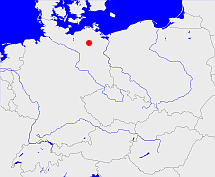
Diese Karte zeigt die Position oder den Umriss des Objekts. Haben Sie einen Fehler entdeckt? Dann würden wir uns über eine Nachricht freuen.
Übergeordnete Objekte
Legende
| | politische Verwaltung |
| | kirchliche Verwaltung |
| | gerichtliche Verwaltung |
| | Wohnplatz |
| | geographische Typen |
| | Verkehrswesen |
Übergeordnete Objekte
- Neustrelitz-Land (Amt)
- Neustrelitz (Landkreis)
- Mecklenburg, Mecklenburg-Vorpommern, Mecklenburg, Mecklenburg-Vorpommern, Mecklenburg-Voor-Pommeren, Mecklenburg-Vorpommern (Land Bundesland)
- Deutschland, Bundesrepublik Deutschland, Tyskland, Germany, Allemagne, Vokietija, Герма́ния, Duitsland, Niemcy, Nemecká spolková republika, Federal Republic of Germany (Bundesstaat)
- Europäische Wirtschaftsgemeinschaft, Europäische Gemeinschaft, Europäische Union, Comhphobal Eacnamaíochta na hEorpa, Euroopan talousyhteisö, Európske hospodárske spoločenstvo, Communauté économique européenne, Comunidad Económica Europea, European Economic Community, Evropské hospodářské společenství, Europese Economische Gemeenschap, Comunità Economica Europea, Európske spoločenstvo, Europese Gemeenschap, Euroopan Yhteisö, European Community, Evropské společenství, Communauté européenne, Comhphobal Eorpach, Comunidad Europea, Comunità Europea, Európska únia, Europese Unie, Aontais Eorpaigh, European Union, Unión Europea, Euroopan Unioni, Evropská unie, Union européenne, Unione Europea (Staatenbund)
- Vereinte Nationen, Organización de las Naciones Unidas, Organisation des Nations unies, 联合国, Организация Объединённых Наций, الأمم المتحدة, United Nations, Verenigde Naties, Organizácia Spojených národov (Staatenbund)
- Deutsches Reich, German Empire, Duitse Rijk (Bundesstaat)
- DDR, Deutsche Demokratische Republik, German Democratic Republic, République démocratique allemande, Duitse Democratische Republiek (Staat)
- SBZ, Sowjetische Besatzungszone (Besatzungszone)
- Neubrandenburg (Bezirk)
- Mecklenburg, Mecklenburg-Vorpommern, Mecklenburg, Mecklenburg-Vorpommern, Mecklenburg-Voor-Pommeren, Mecklenburg-Vorpommern (Land Bundesland)
- Deutschland, Bundesrepublik Deutschland, Tyskland, Germany, Allemagne, Vokietija, Герма́ния, Duitsland, Niemcy, Nemecká spolková republika, Federal Republic of Germany (Bundesstaat)
- Europäische Wirtschaftsgemeinschaft, Europäische Gemeinschaft, Europäische Union, Comhphobal Eacnamaíochta na hEorpa, Euroopan talousyhteisö, Európske hospodárske spoločenstvo, Communauté économique européenne, Comunidad Económica Europea, European Economic Community, Evropské hospodářské společenství, Europese Economische Gemeenschap, Comunità Economica Europea, Európske spoločenstvo, Europese Gemeenschap, Euroopan Yhteisö, European Community, Evropské společenství, Communauté européenne, Comhphobal Eorpach, Comunidad Europea, Comunità Europea, Európska únia, Europese Unie, Aontais Eorpaigh, European Union, Unión Europea, Euroopan Unioni, Evropská unie, Union européenne, Unione Europea (Staatenbund)
- Vereinte Nationen, Organización de las Naciones Unidas, Organisation des Nations unies, 联合国, Организация Объединённых Наций, الأمم المتحدة, United Nations, Verenigde Naties, Organizácia Spojených národov (Staatenbund)
- Deutsches Reich, German Empire, Duitse Rijk (Bundesstaat)
- DDR, Deutsche Demokratische Republik, German Democratic Republic, République démocratique allemande, Duitse Democratische Republiek (Staat)
- SBZ, Sowjetische Besatzungszone (Besatzungszone)
- Mecklenburg-Strelitz (Landkreis)
- Mecklenburg, Mecklenburg-Vorpommern, Mecklenburg, Mecklenburg-Vorpommern, Mecklenburg-Voor-Pommeren, Mecklenburg-Vorpommern (Land Bundesland)
- Deutschland, Bundesrepublik Deutschland, Tyskland, Germany, Allemagne, Vokietija, Герма́ния, Duitsland, Niemcy, Nemecká spolková republika, Federal Republic of Germany (Bundesstaat)
- Europäische Wirtschaftsgemeinschaft, Europäische Gemeinschaft, Europäische Union, Comhphobal Eacnamaíochta na hEorpa, Euroopan talousyhteisö, Európske hospodárske spoločenstvo, Communauté économique européenne, Comunidad Económica Europea, European Economic Community, Evropské hospodářské společenství, Europese Economische Gemeenschap, Comunità Economica Europea, Európske spoločenstvo, Europese Gemeenschap, Euroopan Yhteisö, European Community, Evropské společenství, Communauté européenne, Comhphobal Eorpach, Comunidad Europea, Comunità Europea, Európska únia, Europese Unie, Aontais Eorpaigh, European Union, Unión Europea, Euroopan Unioni, Evropská unie, Union européenne, Unione Europea (Staatenbund)
- Vereinte Nationen, Organización de las Naciones Unidas, Organisation des Nations unies, 联合国, Организация Объединённых Наций, الأمم المتحدة, United Nations, Verenigde Naties, Organizácia Spojených národov (Staatenbund)
- Deutsches Reich, German Empire, Duitse Rijk (Bundesstaat)
- DDR, Deutsche Demokratische Republik, German Democratic Republic, République démocratique allemande, Duitse Democratische Republiek (Staat)
- SBZ, Sowjetische Besatzungszone (Besatzungszone)
- Mecklenburgische Seenplatte (Landkreis)
- Mecklenburg, Mecklenburg-Vorpommern, Mecklenburg, Mecklenburg-Vorpommern, Mecklenburg-Voor-Pommeren, Mecklenburg-Vorpommern (Land Bundesland)
- Deutschland, Bundesrepublik Deutschland, Tyskland, Germany, Allemagne, Vokietija, Герма́ния, Duitsland, Niemcy, Nemecká spolková republika, Federal Republic of Germany (Bundesstaat)
- Europäische Wirtschaftsgemeinschaft, Europäische Gemeinschaft, Europäische Union, Comhphobal Eacnamaíochta na hEorpa, Euroopan talousyhteisö, Európske hospodárske spoločenstvo, Communauté économique européenne, Comunidad Económica Europea, European Economic Community, Evropské hospodářské společenství, Europese Economische Gemeenschap, Comunità Economica Europea, Európske spoločenstvo, Europese Gemeenschap, Euroopan Yhteisö, European Community, Evropské společenství, Communauté européenne, Comhphobal Eorpach, Comunidad Europea, Comunità Europea, Európska únia, Europese Unie, Aontais Eorpaigh, European Union, Unión Europea, Euroopan Unioni, Evropská unie, Union européenne, Unione Europea (Staatenbund)
- Vereinte Nationen, Organización de las Naciones Unidas, Organisation des Nations unies, 联合国, Организация Объединённых Наций, الأمم المتحدة, United Nations, Verenigde Naties, Organizácia Spojených národov (Staatenbund)
- Deutsches Reich, German Empire, Duitse Rijk (Bundesstaat)
- DDR, Deutsche Demokratische Republik, German Democratic Republic, République démocratique allemande, Duitse Democratische Republiek (Staat)
- SBZ, Sowjetische Besatzungszone (Besatzungszone)
- Neustrelitz (Landkreis)
- Mecklenburg, Mecklenburg-Vorpommern, Mecklenburg, Mecklenburg-Vorpommern, Mecklenburg-Voor-Pommeren, Mecklenburg-Vorpommern (Land Bundesland)
- Deutschland, Bundesrepublik Deutschland, Tyskland, Germany, Allemagne, Vokietija, Герма́ния, Duitsland, Niemcy, Nemecká spolková republika, Federal Republic of Germany (Bundesstaat)
- Europäische Wirtschaftsgemeinschaft, Europäische Gemeinschaft, Europäische Union, Comhphobal Eacnamaíochta na hEorpa, Euroopan talousyhteisö, Európske hospodárske spoločenstvo, Communauté économique européenne, Comunidad Económica Europea, European Economic Community, Evropské hospodářské společenství, Europese Economische Gemeenschap, Comunità Economica Europea, Európske spoločenstvo, Europese Gemeenschap, Euroopan Yhteisö, European Community, Evropské společenství, Communauté européenne, Comhphobal Eorpach, Comunidad Europea, Comunità Europea, Európska únia, Europese Unie, Aontais Eorpaigh, European Union, Unión Europea, Euroopan Unioni, Evropská unie, Union européenne, Unione Europea (Staatenbund)
- Vereinte Nationen, Organización de las Naciones Unidas, Organisation des Nations unies, 联合国, Организация Объединённых Наций, الأمم المتحدة, United Nations, Verenigde Naties, Organizácia Spojených národov (Staatenbund)
- Deutsches Reich, German Empire, Duitse Rijk (Bundesstaat)
- DDR, Deutsche Demokratische Republik, German Democratic Republic, République démocratique allemande, Duitse Democratische Republiek (Staat)
- SBZ, Sowjetische Besatzungszone (Besatzungszone)
- Neubrandenburg (Bezirk)
- Mecklenburg, Mecklenburg-Vorpommern, Mecklenburg, Mecklenburg-Vorpommern, Mecklenburg-Voor-Pommeren, Mecklenburg-Vorpommern (Land Bundesland)
- Deutschland, Bundesrepublik Deutschland, Tyskland, Germany, Allemagne, Vokietija, Герма́ния, Duitsland, Niemcy, Nemecká spolková republika, Federal Republic of Germany (Bundesstaat)
- Europäische Wirtschaftsgemeinschaft, Europäische Gemeinschaft, Europäische Union, Comhphobal Eacnamaíochta na hEorpa, Euroopan talousyhteisö, Európske hospodárske spoločenstvo, Communauté économique européenne, Comunidad Económica Europea, European Economic Community, Evropské hospodářské společenství, Europese Economische Gemeenschap, Comunità Economica Europea, Európske spoločenstvo, Europese Gemeenschap, Euroopan Yhteisö, European Community, Evropské společenství, Communauté européenne, Comhphobal Eorpach, Comunidad Europea, Comunità Europea, Európska únia, Europese Unie, Aontais Eorpaigh, European Union, Unión Europea, Euroopan Unioni, Evropská unie, Union européenne, Unione Europea (Staatenbund)
- Vereinte Nationen, Organización de las Naciones Unidas, Organisation des Nations unies, 联合国, Организация Объединённых Наций, الأمم المتحدة, United Nations, Verenigde Naties, Organizácia Spojených národov (Staatenbund)
- Deutsches Reich, German Empire, Duitse Rijk (Bundesstaat)
- DDR, Deutsche Demokratische Republik, German Democratic Republic, République démocratique allemande, Duitse Democratische Republiek (Staat)
- SBZ, Sowjetische Besatzungszone (Besatzungszone)
- Strelitz, Stargard (Landkreis)
- Mecklenburg, Mecklenburg-Vorpommern, Mecklenburg, Mecklenburg-Vorpommern, Mecklenburg-Voor-Pommeren, Mecklenburg-Vorpommern (Land Bundesland)
- Deutschland, Bundesrepublik Deutschland, Tyskland, Germany, Allemagne, Vokietija, Герма́ния, Duitsland, Niemcy, Nemecká spolková republika, Federal Republic of Germany (Bundesstaat)
- Europäische Wirtschaftsgemeinschaft, Europäische Gemeinschaft, Europäische Union, Comhphobal Eacnamaíochta na hEorpa, Euroopan talousyhteisö, Európske hospodárske spoločenstvo, Communauté économique européenne, Comunidad Económica Europea, European Economic Community, Evropské hospodářské společenství, Europese Economische Gemeenschap, Comunità Economica Europea, Európske spoločenstvo, Europese Gemeenschap, Euroopan Yhteisö, European Community, Evropské společenství, Communauté européenne, Comhphobal Eorpach, Comunidad Europea, Comunità Europea, Európska únia, Europese Unie, Aontais Eorpaigh, European Union, Unión Europea, Euroopan Unioni, Evropská unie, Union européenne, Unione Europea (Staatenbund)
- Vereinte Nationen, Organización de las Naciones Unidas, Organisation des Nations unies, 联合国, Организация Объединённых Наций, الأمم المتحدة, United Nations, Verenigde Naties, Organizácia Spojených národov (Staatenbund)
- Deutsches Reich, German Empire, Duitse Rijk (Bundesstaat)
- DDR, Deutsche Demokratische Republik, German Democratic Republic, République démocratique allemande, Duitse Democratische Republiek (Staat)
- SBZ, Sowjetische Besatzungszone (Besatzungszone)
- Mirow (Amt Amt)
- Strelitz (Amt)
- Mecklenburgische Seenplatte (Landkreis)
- Mecklenburg, Mecklenburg-Vorpommern, Mecklenburg, Mecklenburg-Vorpommern, Mecklenburg-Voor-Pommeren, Mecklenburg-Vorpommern (Land Bundesland)
- Deutschland, Bundesrepublik Deutschland, Tyskland, Germany, Allemagne, Vokietija, Герма́ния, Duitsland, Niemcy, Nemecká spolková republika, Federal Republic of Germany (Bundesstaat)
- Europäische Wirtschaftsgemeinschaft, Europäische Gemeinschaft, Europäische Union, Comhphobal Eacnamaíochta na hEorpa, Euroopan talousyhteisö, Európske hospodárske spoločenstvo, Communauté économique européenne, Comunidad Económica Europea, European Economic Community, Evropské hospodářské společenství, Europese Economische Gemeenschap, Comunità Economica Europea, Európske spoločenstvo, Europese Gemeenschap, Euroopan Yhteisö, European Community, Evropské společenství, Communauté européenne, Comhphobal Eorpach, Comunidad Europea, Comunità Europea, Európska únia, Europese Unie, Aontais Eorpaigh, European Union, Unión Europea, Euroopan Unioni, Evropská unie, Union européenne, Unione Europea (Staatenbund)
- Vereinte Nationen, Organización de las Naciones Unidas, Organisation des Nations unies, 联合国, Организация Объединённых Наций, الأمم المتحدة, United Nations, Verenigde Naties, Organizácia Spojených národov (Staatenbund)
- Deutsches Reich, German Empire, Duitse Rijk (Bundesstaat)
- DDR, Deutsche Demokratische Republik, German Democratic Republic, République démocratique allemande, Duitse Democratische Republiek (Staat)
- SBZ, Sowjetische Besatzungszone (Besatzungszone)
- Mecklenburg-Strelitz (Landkreis)
- Mecklenburg, Mecklenburg-Vorpommern, Mecklenburg, Mecklenburg-Vorpommern, Mecklenburg-Voor-Pommeren, Mecklenburg-Vorpommern (Land Bundesland)
- Deutschland, Bundesrepublik Deutschland, Tyskland, Germany, Allemagne, Vokietija, Герма́ния, Duitsland, Niemcy, Nemecká spolková republika, Federal Republic of Germany (Bundesstaat)
- Europäische Wirtschaftsgemeinschaft, Europäische Gemeinschaft, Europäische Union, Comhphobal Eacnamaíochta na hEorpa, Euroopan talousyhteisö, Európske hospodárske spoločenstvo, Communauté économique européenne, Comunidad Económica Europea, European Economic Community, Evropské hospodářské společenství, Europese Economische Gemeenschap, Comunità Economica Europea, Európske spoločenstvo, Europese Gemeenschap, Euroopan Yhteisö, European Community, Evropské společenství, Communauté européenne, Comhphobal Eorpach, Comunidad Europea, Comunità Europea, Európska únia, Europese Unie, Aontais Eorpaigh, European Union, Unión Europea, Euroopan Unioni, Evropská unie, Union européenne, Unione Europea (Staatenbund)
- Vereinte Nationen, Organización de las Naciones Unidas, Organisation des Nations unies, 联合国, Организация Объединённых Наций, الأمم المتحدة, United Nations, Verenigde Naties, Organizácia Spojených národov (Staatenbund)
- Deutsches Reich, German Empire, Duitse Rijk (Bundesstaat)
- DDR, Deutsche Demokratische Republik, German Democratic Republic, République démocratique allemande, Duitse Democratische Republiek (Staat)
- SBZ, Sowjetische Besatzungszone (Besatzungszone)
- Neustrelitz (Maria-Hilfe der Christen) (Pfarrkuratie Pfarrei)
Untergeordnete Objekte
| Name |
Typ |
GOV-Kennung |
Zeitraum |
| Käbelick |
Ort
|
KABICKJO63LK |
|
| Dalmsdorf |
GemeindeOrtsteil
|
DALORF_O2081 |
(1937-04-01 -) |
| Dambeck |
GemeindeOrtsteil
|
DAMECKJO63LK |
(1951-01-01 -) |
| Krienke |
GemeindeOrtsteil
|
KRINKEJO63KJ |
(1969-01-01 -) |
| Pieverstorf |
GemeindeOrtsteil
|
PIEORFJO63LK |
(1957-01-01 -) |
| Granziner Mühle |
Wohnplatz
|
GRAHLEJO63KJ |
|
| Henningsfelde |
Wohnplatz
|
HENLDEJO63KJ |
|
| Granzin |
GemeindeOrtsteil
|
GRAZINJO63KJ |
(1969-01-01 -) |
| Kratzeburg |
GemeindeOrtsteil
|
KRAUR1JO63LK |
(1919-02-01 -) |
Quicktext
KRAURGJO63LK
	gehört ab 1919-02-01 bis 1920-02-15 zu object_285206,
	gehört ab 1920-02-16 bis 1934-01-14 zu object_285209,
	gehört ab 1934-01-15 bis 1946-03-31 zu object_314943 sagt source_190312 sagt source_317505 sagt source_317506 (Seite 305),
	gehört ab 1946-04-01 bis 1994-06-11 zu adm_143026 sagt source_149277 (Seite 133) sagt source_284918 sagt source_317505,
	gehört ab 1992-03-31 zu object_152552 sagt source_312221,
	gehört ab 1994-06-12 bis 2011-09-03 zu adm_143055 sagt source_149277 (Seite 133),
	gehört ab 2011-09-04 zu object_387264 sagt source_387259 (§ 7 Absatz 2 Ziff. 1) sagt source_387948,
	gehört zu object_1187220,
	hat 1933 Einwohner 285 sagt source_190312,
	hat 1939 Einwohner 267 sagt source_190312,
	hat 1946 Einwohner 588 sagt source_284918,
	hat ab 1993-07-01 PLZ 17237,
	hat ab 2011-09-04 Gemeindekennzahl 13071080,
	hat bis 1993-06-30 PLZ O2081,
	hat bis 2011-09-03 Gemeindekennzahl 13055037,
	hat externe Kennung  geonames:2884680,
	hat externe Kennung  opengeodb:19646,
	heißt  (auf deu) Kratzeburg,
	ist ab 1919-02-01 (auf deu) Gemeinde sagt source_284918;
