Alt Schönau
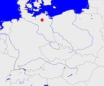
Diese Karte zeigt die Position oder den Umriss des Objekts. Haben Sie einen Fehler entdeckt? Dann würden wir uns über eine Nachricht freuen.
Übergeordnete Objekte
Legende
| | politische Verwaltung |
| | kirchliche Verwaltung |
| | gerichtliche Verwaltung |
| | Wohnplatz |
| | geographische Typen |
| | Verkehrswesen |
Übergeordnete Objekte
- Groß-Gievitz (Kirchspiel)
- Müritz (Landkreis)
- Mecklenburg, Mecklenburg-Vorpommern, Mecklenburg, Mecklenburg-Vorpommern, Mecklenburg-Voor-Pommeren, Mecklenburg-Vorpommern (Land Bundesland)
- Deutschland, Bundesrepublik Deutschland, Tyskland, Germany, Allemagne, Vokietija, Герма́ния, Duitsland, Niemcy, Nemecká spolková republika, Federal Republic of Germany (Bundesstaat)
- Europäische Wirtschaftsgemeinschaft, Europäische Gemeinschaft, Europäische Union, Comhphobal Eacnamaíochta na hEorpa, Euroopan talousyhteisö, Európske hospodárske spoločenstvo, Communauté économique européenne, Comunidad Económica Europea, European Economic Community, Evropské hospodářské společenství, Europese Economische Gemeenschap, Comunità Economica Europea, Európske spoločenstvo, Europese Gemeenschap, Euroopan Yhteisö, European Community, Evropské společenství, Communauté européenne, Comhphobal Eorpach, Comunidad Europea, Comunità Europea, Európska únia, Europese Unie, Aontais Eorpaigh, European Union, Unión Europea, Euroopan Unioni, Evropská unie, Union européenne, Unione Europea (Staatenbund)
- Vereinte Nationen, Organización de las Naciones Unidas, Organisation des Nations unies, 联合国, Организация Объединённых Наций, الأمم المتحدة, United Nations, Verenigde Naties, Organizácia Spojených národov (Staatenbund)
- Deutsches Reich, German Empire, Duitse Rijk (Bundesstaat)
- DDR, Deutsche Demokratische Republik, German Democratic Republic, République démocratique allemande, Duitse Democratische Republiek (Staat)
- SBZ, Sowjetische Besatzungszone (Besatzungszone)
- Lansen-Schönau (Gemeinde Ortsteil)
- Müritz (Landkreis)
- Mecklenburg, Mecklenburg-Vorpommern, Mecklenburg, Mecklenburg-Vorpommern, Mecklenburg-Voor-Pommeren, Mecklenburg-Vorpommern (Land Bundesland)
- Deutschland, Bundesrepublik Deutschland, Tyskland, Germany, Allemagne, Vokietija, Герма́ния, Duitsland, Niemcy, Nemecká spolková republika, Federal Republic of Germany (Bundesstaat)
- Europäische Wirtschaftsgemeinschaft, Europäische Gemeinschaft, Europäische Union, Comhphobal Eacnamaíochta na hEorpa, Euroopan talousyhteisö, Európske hospodárske spoločenstvo, Communauté économique européenne, Comunidad Económica Europea, European Economic Community, Evropské hospodářské společenství, Europese Economische Gemeenschap, Comunità Economica Europea, Európske spoločenstvo, Europese Gemeenschap, Euroopan Yhteisö, European Community, Evropské společenství, Communauté européenne, Comhphobal Eorpach, Comunidad Europea, Comunità Europea, Európska únia, Europese Unie, Aontais Eorpaigh, European Union, Unión Europea, Euroopan Unioni, Evropská unie, Union européenne, Unione Europea (Staatenbund)
- Vereinte Nationen, Organización de las Naciones Unidas, Organisation des Nations unies, 联合国, Организация Объединённых Наций, الأمم المتحدة, United Nations, Verenigde Naties, Organizácia Spojených národov (Staatenbund)
- Deutsches Reich, German Empire, Duitse Rijk (Bundesstaat)
- DDR, Deutsche Demokratische Republik, German Democratic Republic, République démocratique allemande, Duitse Democratische Republiek (Staat)
- SBZ, Sowjetische Besatzungszone (Besatzungszone)
- Peenehagen (Gemeinde)
- Mecklenburgische Seenplatte (Landkreis)
- Mecklenburg, Mecklenburg-Vorpommern, Mecklenburg, Mecklenburg-Vorpommern, Mecklenburg-Voor-Pommeren, Mecklenburg-Vorpommern (Land Bundesland)
- Deutschland, Bundesrepublik Deutschland, Tyskland, Germany, Allemagne, Vokietija, Герма́ния, Duitsland, Niemcy, Nemecká spolková republika, Federal Republic of Germany (Bundesstaat)
- Europäische Wirtschaftsgemeinschaft, Europäische Gemeinschaft, Europäische Union, Comhphobal Eacnamaíochta na hEorpa, Euroopan talousyhteisö, Európske hospodárske spoločenstvo, Communauté économique européenne, Comunidad Económica Europea, European Economic Community, Evropské hospodářské společenství, Europese Economische Gemeenschap, Comunità Economica Europea, Európske spoločenstvo, Europese Gemeenschap, Euroopan Yhteisö, European Community, Evropské společenství, Communauté européenne, Comhphobal Eorpach, Comunidad Europea, Comunità Europea, Európska únia, Europese Unie, Aontais Eorpaigh, European Union, Unión Europea, Euroopan Unioni, Evropská unie, Union européenne, Unione Europea (Staatenbund)
- Vereinte Nationen, Organización de las Naciones Unidas, Organisation des Nations unies, 联合国, Организация Объединённых Наций, الأمم المتحدة, United Nations, Verenigde Naties, Organizácia Spojených národov (Staatenbund)
- Deutsches Reich, German Empire, Duitse Rijk (Bundesstaat)
- DDR, Deutsche Demokratische Republik, German Democratic Republic, République démocratique allemande, Duitse Democratische Republiek (Staat)
- SBZ, Sowjetische Besatzungszone (Besatzungszone)
- Seenlandschaft Waren (Amt)
- Müritz (Landkreis)
- Mecklenburg, Mecklenburg-Vorpommern, Mecklenburg, Mecklenburg-Vorpommern, Mecklenburg-Voor-Pommeren, Mecklenburg-Vorpommern (Land Bundesland)
- Deutschland, Bundesrepublik Deutschland, Tyskland, Germany, Allemagne, Vokietija, Герма́ния, Duitsland, Niemcy, Nemecká spolková republika, Federal Republic of Germany (Bundesstaat)
- Europäische Wirtschaftsgemeinschaft, Europäische Gemeinschaft, Europäische Union, Comhphobal Eacnamaíochta na hEorpa, Euroopan talousyhteisö, Európske hospodárske spoločenstvo, Communauté économique européenne, Comunidad Económica Europea, European Economic Community, Evropské hospodářské společenství, Europese Economische Gemeenschap, Comunità Economica Europea, Európske spoločenstvo, Europese Gemeenschap, Euroopan Yhteisö, European Community, Evropské společenství, Communauté européenne, Comhphobal Eorpach, Comunidad Europea, Comunità Europea, Európska únia, Europese Unie, Aontais Eorpaigh, European Union, Unión Europea, Euroopan Unioni, Evropská unie, Union européenne, Unione Europea (Staatenbund)
- Vereinte Nationen, Organización de las Naciones Unidas, Organisation des Nations unies, 联合国, Организация Объединённых Наций, الأمم المتحدة, United Nations, Verenigde Naties, Organizácia Spojených národov (Staatenbund)
- Deutsches Reich, German Empire, Duitse Rijk (Bundesstaat)
- DDR, Deutsche Demokratische Republik, German Democratic Republic, République démocratique allemande, Duitse Democratische Republiek (Staat)
- SBZ, Sowjetische Besatzungszone (Besatzungszone)
- Mecklenburgische Seenplatte (Landkreis)
- Mecklenburg, Mecklenburg-Vorpommern, Mecklenburg, Mecklenburg-Vorpommern, Mecklenburg-Voor-Pommeren, Mecklenburg-Vorpommern (Land Bundesland)
- Deutschland, Bundesrepublik Deutschland, Tyskland, Germany, Allemagne, Vokietija, Герма́ния, Duitsland, Niemcy, Nemecká spolková republika, Federal Republic of Germany (Bundesstaat)
- Europäische Wirtschaftsgemeinschaft, Europäische Gemeinschaft, Europäische Union, Comhphobal Eacnamaíochta na hEorpa, Euroopan talousyhteisö, Európske hospodárske spoločenstvo, Communauté économique européenne, Comunidad Económica Europea, European Economic Community, Evropské hospodářské společenství, Europese Economische Gemeenschap, Comunità Economica Europea, Európske spoločenstvo, Europese Gemeenschap, Euroopan Yhteisö, European Community, Evropské společenství, Communauté européenne, Comhphobal Eorpach, Comunidad Europea, Comunità Europea, Európska únia, Europese Unie, Aontais Eorpaigh, European Union, Unión Europea, Euroopan Unioni, Evropská unie, Union européenne, Unione Europea (Staatenbund)
- Vereinte Nationen, Organización de las Naciones Unidas, Organisation des Nations unies, 联合国, Организация Объединённых Наций, الأمم المتحدة, United Nations, Verenigde Naties, Organizácia Spojených národov (Staatenbund)
- Deutsches Reich, German Empire, Duitse Rijk (Bundesstaat)
- DDR, Deutsche Demokratische Republik, German Democratic Republic, République démocratique allemande, Duitse Democratische Republiek (Staat)
- SBZ, Sowjetische Besatzungszone (Besatzungszone)
- Waren-Land (Amt)
- Müritz (Landkreis)
- Mecklenburg, Mecklenburg-Vorpommern, Mecklenburg, Mecklenburg-Vorpommern, Mecklenburg-Voor-Pommeren, Mecklenburg-Vorpommern (Land Bundesland)
- Deutschland, Bundesrepublik Deutschland, Tyskland, Germany, Allemagne, Vokietija, Герма́ния, Duitsland, Niemcy, Nemecká spolková republika, Federal Republic of Germany (Bundesstaat)
- Europäische Wirtschaftsgemeinschaft, Europäische Gemeinschaft, Europäische Union, Comhphobal Eacnamaíochta na hEorpa, Euroopan talousyhteisö, Európske hospodárske spoločenstvo, Communauté économique européenne, Comunidad Económica Europea, European Economic Community, Evropské hospodářské společenství, Europese Economische Gemeenschap, Comunità Economica Europea, Európske spoločenstvo, Europese Gemeenschap, Euroopan Yhteisö, European Community, Evropské společenství, Communauté européenne, Comhphobal Eorpach, Comunidad Europea, Comunità Europea, Európska únia, Europese Unie, Aontais Eorpaigh, European Union, Unión Europea, Euroopan Unioni, Evropská unie, Union européenne, Unione Europea (Staatenbund)
- Vereinte Nationen, Organización de las Naciones Unidas, Organisation des Nations unies, 联合国, Организация Объединённых Наций, الأمم المتحدة, United Nations, Verenigde Naties, Organizácia Spojených národov (Staatenbund)
- Deutsches Reich, German Empire, Duitse Rijk (Bundesstaat)
- DDR, Deutsche Demokratische Republik, German Democratic Republic, République démocratique allemande, Duitse Democratische Republiek (Staat)
- SBZ, Sowjetische Besatzungszone (Besatzungszone)
- Waren (Amt Landkreis)
- Neubrandenburg (Bezirk)
- Mecklenburg, Mecklenburg-Vorpommern, Mecklenburg, Mecklenburg-Vorpommern, Mecklenburg-Voor-Pommeren, Mecklenburg-Vorpommern (Land Bundesland)
- Deutschland, Bundesrepublik Deutschland, Tyskland, Germany, Allemagne, Vokietija, Герма́ния, Duitsland, Niemcy, Nemecká spolková republika, Federal Republic of Germany (Bundesstaat)
- Europäische Wirtschaftsgemeinschaft, Europäische Gemeinschaft, Europäische Union, Comhphobal Eacnamaíochta na hEorpa, Euroopan talousyhteisö, Európske hospodárske spoločenstvo, Communauté économique européenne, Comunidad Económica Europea, European Economic Community, Evropské hospodářské společenství, Europese Economische Gemeenschap, Comunità Economica Europea, Európske spoločenstvo, Europese Gemeenschap, Euroopan Yhteisö, European Community, Evropské společenství, Communauté européenne, Comhphobal Eorpach, Comunidad Europea, Comunità Europea, Európska únia, Europese Unie, Aontais Eorpaigh, European Union, Unión Europea, Euroopan Unioni, Evropská unie, Union européenne, Unione Europea (Staatenbund)
- Vereinte Nationen, Organización de las Naciones Unidas, Organisation des Nations unies, 联合国, Организация Объединённых Наций, الأمم المتحدة, United Nations, Verenigde Naties, Organizácia Spojených národov (Staatenbund)
- Deutsches Reich, German Empire, Duitse Rijk (Bundesstaat)
- DDR, Deutsche Demokratische Republik, German Democratic Republic, République démocratique allemande, Duitse Democratische Republiek (Staat)
- SBZ, Sowjetische Besatzungszone (Besatzungszone)
- Mecklenburg-Schwerin (Herzogtum Großherzogtum Freistaat)
- Neustadt (Ritterschaftliches Amt)
- Waren (Amt Landkreis)
- Neubrandenburg (Bezirk)
- Mecklenburg, Mecklenburg-Vorpommern, Mecklenburg, Mecklenburg-Vorpommern, Mecklenburg-Voor-Pommeren, Mecklenburg-Vorpommern (Land Bundesland)
- Deutschland, Bundesrepublik Deutschland, Tyskland, Germany, Allemagne, Vokietija, Герма́ния, Duitsland, Niemcy, Nemecká spolková republika, Federal Republic of Germany (Bundesstaat)
- Europäische Wirtschaftsgemeinschaft, Europäische Gemeinschaft, Europäische Union, Comhphobal Eacnamaíochta na hEorpa, Euroopan talousyhteisö, Európske hospodárske spoločenstvo, Communauté économique européenne, Comunidad Económica Europea, European Economic Community, Evropské hospodářské společenství, Europese Economische Gemeenschap, Comunità Economica Europea, Európske spoločenstvo, Europese Gemeenschap, Euroopan Yhteisö, European Community, Evropské společenství, Communauté européenne, Comhphobal Eorpach, Comunidad Europea, Comunità Europea, Európska únia, Europese Unie, Aontais Eorpaigh, European Union, Unión Europea, Euroopan Unioni, Evropská unie, Union européenne, Unione Europea (Staatenbund)
- Vereinte Nationen, Organización de las Naciones Unidas, Organisation des Nations unies, 联合国, Организация Объединённых Наций, الأمم المتحدة, United Nations, Verenigde Naties, Organizácia Spojených národov (Staatenbund)
- Deutsches Reich, German Empire, Duitse Rijk (Bundesstaat)
- DDR, Deutsche Demokratische Republik, German Democratic Republic, République démocratique allemande, Duitse Democratische Republiek (Staat)
- SBZ, Sowjetische Besatzungszone (Besatzungszone)
- Mecklenburg, Mecklenburg-Vorpommern, Mecklenburg, Mecklenburg-Vorpommern, Mecklenburg-Voor-Pommeren, Mecklenburg-Vorpommern (Land Bundesland)
- Deutschland, Bundesrepublik Deutschland, Tyskland, Germany, Allemagne, Vokietija, Герма́ния, Duitsland, Niemcy, Nemecká spolková republika, Federal Republic of Germany (Bundesstaat)
- Europäische Wirtschaftsgemeinschaft, Europäische Gemeinschaft, Europäische Union, Comhphobal Eacnamaíochta na hEorpa, Euroopan talousyhteisö, Európske hospodárske spoločenstvo, Communauté économique européenne, Comunidad Económica Europea, European Economic Community, Evropské hospodářské společenství, Europese Economische Gemeenschap, Comunità Economica Europea, Európske spoločenstvo, Europese Gemeenschap, Euroopan Yhteisö, European Community, Evropské společenství, Communauté européenne, Comhphobal Eorpach, Comunidad Europea, Comunità Europea, Európska únia, Europese Unie, Aontais Eorpaigh, European Union, Unión Europea, Euroopan Unioni, Evropská unie, Union européenne, Unione Europea (Staatenbund)
- Vereinte Nationen, Organización de las Naciones Unidas, Organisation des Nations unies, 联合国, Организация Объединённых Наций, الأمم المتحدة, United Nations, Verenigde Naties, Organizácia Spojených národov (Staatenbund)
- Deutsches Reich, German Empire, Duitse Rijk (Bundesstaat)
- DDR, Deutsche Demokratische Republik, German Democratic Republic, République démocratique allemande, Duitse Democratische Republiek (Staat)
- SBZ, Sowjetische Besatzungszone (Besatzungszone)
- Mecklenburg-Schwerin (Herzogtum Großherzogtum Freistaat)
- Waren/Müritz (Heilig Kreuz) (Pfarrkuratie Pfarrei)
- Rittermannshagen/Ev. Kirchengemeinde (Kirchspiel Kirchengemeinde)
Quicktext
SCHNAUJO63IO
	gehört ab 1921-04-01 bis 1994-06-11 zu adm_143039 sagt source_149277 (Seite 137) sagt source_284918 sagt source_357085,
	gehört ab 1992-03-31 bis 2004-12-30 zu object_152562 sagt source_312221,
	gehört ab 1994-06-12 bis 2004-12-30 zu adm_143056 sagt source_149277 (Seite 137),
	gehört ab 2004-12-31 zu object_318546 sagt source_300103 (Gebietsänderungen 2004 Seite 8),
	gehört ab 2012 zu object_169603,
	gehört bis 1921-03-31 zu object_333728 sagt source_265044,
	gehört zu object_1187229,
	gehört zu object_170123,
	hat 1910-12-01 Einwohner 190 sagt source_265044,
	hat 1933 Einwohner 235 sagt source_190312,
	hat 1939 Einwohner 233 sagt source_190312,
	hat 1946 Einwohner 453 sagt source_284918,
	hat ab 1993-07-01 PLZ 17192,
	hat bis 1993-06-30 PLZ O2061,
	hat externe Kennung  geonames:2956860,
	hat externe Kennung  opengeodb:13632,
	heißt  (auf deu) Alt Schönau,
	ist ab 2004-12-31 (auf deu) Ortsteil sagt source_293716,
	ist bis 2004-12-30 (auf deu) Gemeinde sagt source_190312 sagt source_284918 sagt source_357085,
	liegt bei 53.58361°N 12.73198°O 50m;
