Frankfurt (Oder)
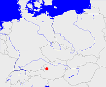
Diese Karte zeigt die Position oder den Umriss des Objekts. Haben Sie einen Fehler entdeckt? Dann würden wir uns über eine Nachricht freuen.
Übergeordnete Objekte
Legende
| | politische Verwaltung |
| | kirchliche Verwaltung |
| | gerichtliche Verwaltung |
| | Wohnplatz |
| | geographische Typen |
| | Verkehrswesen |
Übergeordnete Objekte
Übergeordnete Objekte
Untergeordnete Objekte
| Name |
Typ |
GOV-Kennung |
Zeitraum |
| Luckau |
Landkreis
Kreis
|
adm_142032 |
(- 1952-07-24) |
| Landsberg (Warthe), Landsberg |
Landkreis
|
object_190187 |
(1898) |
| Cottbus |
Landkreis
|
adm_142019 |
(1945 - 1952-07-24) |
| Crossen |
Landkreis
|
object_190093 |
(1816-03-25 - 1945) |
| Landsberg (Warthe), Landsberg a./W. |
Stadtkreis
|
object_190188 |
(1898) |
| Spremberg |
Landkreis
|
adm_142044 |
(- 1952-07-24) |
| Sternberg |
Kreis
|
object_257152 |
(1871) |
| Calau, Senftenberg |
Landkreis
|
object_292979 |
(1816-03-25 - 1952-07-24) |
| Schwerin (Warthe) |
Landkreis
|
object_190088 |
(1938 - 1945) |
| Friedeberg (Neumark) |
Landkreis
|
object_190096 |
(- 1938-09-30) |
| Kottbus, Cottbus, Chociebuż, Choćebuz, Chośebuz |
Stadtkreis
|
COTBUSJO71ES |
(1886-10-27 - 1950-06-30) |
| Meseritz |
Landkreis
|
object_190186 |
(1938-10-01 - 1945) |
| Cottbus, Kottbus, Choćebuz, Chociebuż, Chośebuz |
Stadt
Stadt
Kreisfreie Stadt
|
object_1194714 |
(- 1952-07-24) |
| Frankfurt (Oder) |
Landkreis
|
object_263384 |
(1950-07-01 - 1952-07-24) |
| Frankfurt (Oder) |
Stadtkreis
|
object_190199 |
(1827 - 1950-06-30) |
| Weststernberg |
Landkreis
|
object_190205 |
(1873-03-29 -) |
| Forst |
Stadtkreis
|
object_257993 |
(1945 - 1950-06-30) |
| Guben |
Landkreis
Landkreis
|
adm_142026 |
(1945 - 1950-06-30) |
| Guben |
Stadtkreis
|
object_190195 |
(1884-04-01 - 1950-06-30) |
| Sorau |
Landkreis
|
object_190183 |
(1816 - 1945) |
| Lübben, Wokrejs Lubin |
Landkreis
Kreis
|
adm_142031 |
(- 1952-07-24) |
| Königsberg (Neumark) |
Landkreis
|
object_190196 |
(1816 - 1945) |
| Lebus, Seelow |
Landkreis
|
adm_142042 |
(- 1952-07-24) |
| Züllichau, Züllichau-Schwiebus |
Kreis
Landkreis
|
object_190203 |
(1816 - 1945) |
| Küstrin |
Kreis
|
object_190200 |
(1816 - 1836-01-01) |
| Oststernberg |
Landkreis
|
object_190201 |
(1873-03-29 -) |
| Arnswalde, Choszczno |
Kreis
Landkreis
|
object_190091 |
(1815 - 1938-09-30) |
Bilder im GenWiki
Quicktext
adm_368489
	gehört bis 1952-07-24 zu object_1081716,
	hat 1880-12-01 Einwohner 1105493 sagt source_1343683 (Tab. II S. 16),
	hat 1880-12-01 Fläche 19195.44 sagt source_1343683 (Tab. III S. 26),
	hat 1890-12-01 Einwohner 1137157 sagt source_1343682 (Tab. II S. 18),
	hat 1890-12-01 Fläche 19195.81 sagt source_1343682 (Tab. III S. 24),
	hat 1900-12-01 Einwohner 1179250 sagt source_1343684 (Tab. I S. 2),
	hat 1900-12-01 Fläche 191918.18 sagt source_1343684 ((Tab. II S. 8),
	hat 1910-12-01 Einwohner 1233189 sagt source_1341051 (Tab. II S. 8),
	hat 1910-12-01 Fläche 19196.6 sagt source_1341051 (Tab. II S. 8),
	hat 1925-06-16 Einwohner 1292525 sagt source_1341056 (S. 44),
	hat 1925-06-16 Fläche 19200.02 sagt source_1341056 (S. 44),
	hat 1933-06-16 Einwohner 1310970 sagt source_1267338 (S. 6),
	hat 1935-10-01 Fläche 19207.91 sagt source_1267338 (S. 6),
	hat 1939-05-17 Einwohner 1316590 sagt source_298730 (S. 8),
	hat 1941-01-01 Fläche 18390.29 sagt source_298730 (S. 8),
	hat URL  https://de.wikipedia.org/wiki/Regierungsbezirk_Frankfurt,
	heißt bis 1952-07-24  (auf deu) Frankfurt (Oder),
	ist bis 1952-07-24 (auf deu) Regierungsbezirk;

