Zwickau

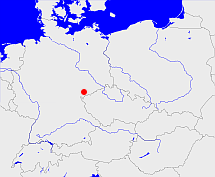
Diese Karte zeigt die Position oder den Umriss des Objekts. Haben Sie einen Fehler entdeckt? Dann würden wir uns über eine Nachricht freuen.
Übergeordnete Objekte
Legende
| | politische Verwaltung |
| | kirchliche Verwaltung |
| | gerichtliche Verwaltung |
| | Wohnplatz |
| | geographische Typen |
| | Verkehrswesen |
Übergeordnete Objekte
-
Sachsen, Saxony, Saksonia, Саксония, Sasko, Saksen
(HerzogtumKurfürstentumKönigreichFreistaatLandBundesland) (1874-10-15 - 1945)
-
Deutsches Reich, German Empire, Duitse Rijk
(Bundesstaat) (1871 - 1945)
-
Deutschland, Bundesrepublik Deutschland, Allemagne, Duitsland, Vokietija, Niemcy, Nemecká spolková republika, Federal Republic of Germany, Tyskland, Germany, Герма́ния
(Bundesstaat) (1990-10-03 -)
-
Europäische Wirtschaftsgemeinschaft, Europäische Gemeinschaft, Europäische Union, Comhphobal Eacnamaíochta na hEorpa, Euroopan talousyhteisö, Európske hospodárske spoločenstvo, Communauté économique européenne, Comunidad Económica Europea, European Economic Community, Comunità Economica Europea, Evropské hospodářské společenství, Europese Economische Gemeenschap, Európske spoločenstvo, Europese Gemeenschap, Euroopan Yhteisö, Comunidad Europea, European Community, Comunità Europea, Evropské společenství, Communauté européenne, Comhphobal Eorpach, Europese Unie, Aontais Eorpaigh, Unione Europea, European Union, Európska únia, Unión Europea, Euroopan Unioni, Evropská unie, Union européenne
(Staatenbund) (1958 -)
-
Vereinte Nationen, Verenigde Naties, Организация Объединённых Наций, Organización de las Naciones Unidas, Organisation des Nations unies, الأمم المتحدة, 联合国, Organizácia Spojených národov, United Nations
(Staatenbund) (1973-09-18 -)
-
Rheinbund, Confédération du Rhin
(Staatenbund) (1806 - 1813)
-
SBZ, Sowjetische Besatzungszone
(Besatzungszone) (1945 - 1949)
-
Norddeutscher Bund
(StaatenbundBundesstaat) (1867 - 1870)
-
Deutscher Bund, German Confederation
(Staatenbund) (1815 - 1866)
-
Obersächsischer Reichskreis
(Reichskreis) (1512 - 1806)
-
Deutsche Demokratische Republik, DDR, German Democratic Republic, République démocratique allemande, Duitse Democratische Republiek
(Staat) (1949 - 1952)
Übergeordnete Objekte
Untergeordnete Objekte
| Name |
Typ |
GOV-Kennung |
Zeitraum |
| Plauen |
Amtshauptmannschaft
Landkreis
Kreis
Landkreis
|
adm_144045 |
(1874-10-15 - 1945) |
| Plauen |
Stadt
Kreisfreie Stadt
Stadtkreis
Kreisfreie Stadt
Stadt
|
adm_144005 |
(1907-01-01 - 1945) |
| Werdau |
Amtshauptmannschaft
|
object_1342430 |
(1920-07-01 - 1933-02-28) |
| Werdau |
Stadt
Kreisfreie Stadt
Stadt
|
WERDAUJO60ER |
(1924-07-01 - 1946) |
| Glauchau |
Amtshauptmannschaft
Landkreis
Kreis
Landkreis
|
adm_144028 |
(1878 - 1900-09-30) |
| Annaberg |
Amtshauptmannschaft
Landkreis
Kreis
Landkreis
|
adm_144011 |
(1874-10-15 - 1900-09-30) |
| Reichenbach, Reichenbach/Vogtl., Reichenbach im Vogtland |
Kreisfreie Stadt
Stadtkreis
Stadt
|
REIACHJO60DP |
(1924-04-01 - 1945) |
| Aue |
Stadt
Kreisfreie Stadt
Stadt
|
AUEAUEJO60IO |
(1924-07-01 - 1946) |
| Flöha |
Amtshauptmannschaft
Landkreis
Kreis
Landkreis
|
adm_144024 |
(1874-10-15 - 1900-09-30) |
| Oelsnitz, Ölsnitz |
Amtshauptmannschaft
Landkreis
Kreis
Landkreis
|
adm_144042 |
(1874 - 1945) |
| Auerbach |
Amtshauptmannschaft
Landkreis
Kreis
Landkreis
|
adm_144013 |
(1874 - 1945) |
| Marienberg |
Amtshauptmannschaft
Landkreis
Kreis
Landkreis
|
adm_144039 |
(1874-10-15 - 1900-09-30) |
| Crimmitschau |
Stadt
Kreisfreie Stadt
Stadt
|
CRIHAUJO60ET |
(1924-07-01 - 1946) |
| Chemnitz |
Kreisfreie Stadt
Stadtkreis
Kreisfreie Stadt
|
adm_144001 |
(1874-10-15 - 1900-09-30) |
| Chemnitz |
Amtshauptmannschaft
Landkreis
Kreis
Landkreis
|
adm_144018 |
(1874-10-15 - 1900-09-30) |
| Zwickau |
Stadtkreis
Stadt
|
adm_144006 |
(1907 - 1945) |
| Zwickau |
Amtshauptmannschaft
Landkreis
Kreis
Landkreis
|
adm_144058 |
(1874-10-15 - 1945) |
| Schwarzenberg, Aue |
Herrschaft
Grafschaft
Kreis
Amtshauptmannschaft
Landkreis
|
adm_144049 |
(1874 - 1945) |
Bilder im GenWiki
Quicktext
object_264196
	gehört ab 1874-10-15 bis 1945 zu object_218149 sagt source_362665,
	hat 1880-12-01 Einwohner 1105141 sagt source_1343683 (Tab. II S. 18),
	hat 1880-12-01 Fläche 4619.0 sagt source_1343683 (Tab. III S. 27),
	hat 1890-12-01 Einwohner 1310283 sagt source_1343682 (Tab. II S. 20),
	hat 1890-12-01 Fläche 4619.0 sagt source_1343682 (Tab. III S. 26),
	hat 1900-12-01 Einwohner 727529 sagt source_1343684 (Tab. I S. 4),
	hat 1900-12-01 Fläche 2548.01 sagt source_1343684 (Tab. II S. 9),
	hat 1910-12-01 Einwohner 857659 sagt source_1341051 (Tab. II S. 9),
	hat 1910-12-01 Fläche 2546.81 sagt source_1341051 (Tab. II S. 9),
	hat 1925-06-16 Einwohner 854748 sagt source_1341056 (S. 44),
	hat 1925-06-16 Fläche 2546.81 sagt source_1341056 (S. 44),
	hat 1933-06-16 Einwohner 873579 sagt source_1267338 (S. 6),
	hat 1935-10-01 Fläche 2532.49 sagt source_1267338 (S. 6),
	hat 1939-05-17 Einwohner 858682 sagt source_298730 (S. 9),
	hat 1941-01-01 Fläche 2512.34 sagt source_298730 (S. 9),
	hat URL  https://de.wikipedia.org/wiki/Kreishauptmannschaft_Zwickau,
	heißt ab 1874-10-15 bis 1943-06-30  (auf deu) Zwickau,
	ist ab 1874-10-15 bis 1938-12-31 (auf deu) Kreishauptmannschaft sagt source_362665,
	ist ab 1939-01-01 bis 1943-06-30 (auf deu) Regierungsbezirk;

