Chemnitz
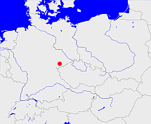
Diese Karte zeigt die Position oder den Umriss des Objekts. Haben Sie einen Fehler entdeckt? Dann würden wir uns über eine Nachricht freuen.
Übergeordnete Objekte
Legende
| | politische Verwaltung |
| | kirchliche Verwaltung |
| | gerichtliche Verwaltung |
| | Wohnplatz |
| | geographische Typen |
| | Verkehrswesen |
Übergeordnete Objekte
Übergeordnete Objekte
Untergeordnete Objekte
| Name |
Typ |
GOV-Kennung |
Zeitraum |
| Plauen |
Kirchenkreis
|
object_174107 |
|
| Glauchau |
Kirchenkreis
|
object_174091 |
|
| Annaberg |
Kirchenkreis
|
object_174079 |
|
| Aue |
Kirchenkreis
|
object_174080 |
|
| Auerbach |
Kirchenkreis
|
object_176006 |
|
| Marienberg |
Kirchenkreis
|
object_174100 |
|
| Chemnitz |
Kirchenkreis
|
object_174115 |
|
| Zwickau |
Kirchenkreis
|
object_176034 |
|
Bilder im GenWiki
Quicktext
object_333862
	gehört zu object_176004,
	heißt  (auf deu) Chemnitz,
	ist (auf deu) Regionalkirchenamt;

