Grabow bei Blumenthal
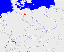
Diese Karte zeigt die Position oder den Umriss des Objekts. Haben Sie einen Fehler entdeckt? Dann würden wir uns über eine Nachricht freuen.
Übergeordnete Objekte
Legende
| | politische Verwaltung |
| | kirchliche Verwaltung |
| | gerichtliche Verwaltung |
| | Wohnplatz |
| | geographische Typen |
| | Verkehrswesen |
Übergeordnete Objekte
- Heiligengrabe/Blumenthal (Amt)
- Wittstock (Kreis)
- Potsdam (Bezirk)
- Brandenburg, Kraj Bramborska, Brandenburg (Bundesland)
- Deutschland, Bundesrepublik Deutschland, Tyskland, Germany, Allemagne, Vokietija, Герма́ния, Duitsland, Niemcy, Nemecká spolková republika, Federal Republic of Germany (Bundesstaat)
- Europäische Wirtschaftsgemeinschaft, Europäische Gemeinschaft, Europäische Union, Comhphobal Eacnamaíochta na hEorpa, Euroopan talousyhteisö, Európske hospodárske spoločenstvo, Communauté économique européenne, Comunidad Económica Europea, European Economic Community, Evropské hospodářské společenství, Europese Economische Gemeenschap, Comunità Economica Europea, Európske spoločenstvo, Europese Gemeenschap, Euroopan Yhteisö, European Community, Evropské společenství, Communauté européenne, Comhphobal Eorpach, Comunidad Europea, Comunità Europea, Európska únia, Europese Unie, Aontais Eorpaigh, European Union, Unión Europea, Euroopan Unioni, Evropská unie, Union européenne, Unione Europea (Staatenbund)
- Vereinte Nationen, Organización de las Naciones Unidas, Organisation des Nations unies, 联合国, Организация Объединённых Наций, الأمم المتحدة, United Nations, Verenigde Naties, Organizácia Spojených národov (Staatenbund)
- Alt-katholische Gemeinde Berlin (Kirchengemeinde)
- Ostprignitz-Ruppin (Landkreis)
- Brandenburg, Kraj Bramborska, Brandenburg (Bundesland)
- Deutschland, Bundesrepublik Deutschland, Tyskland, Germany, Allemagne, Vokietija, Герма́ния, Duitsland, Niemcy, Nemecká spolková republika, Federal Republic of Germany (Bundesstaat)
- Europäische Wirtschaftsgemeinschaft, Europäische Gemeinschaft, Europäische Union, Comhphobal Eacnamaíochta na hEorpa, Euroopan talousyhteisö, Európske hospodárske spoločenstvo, Communauté économique européenne, Comunidad Económica Europea, European Economic Community, Evropské hospodářské společenství, Europese Economische Gemeenschap, Comunità Economica Europea, Európske spoločenstvo, Europese Gemeenschap, Euroopan Yhteisö, European Community, Evropské společenství, Communauté européenne, Comhphobal Eorpach, Comunidad Europea, Comunità Europea, Európska únia, Europese Unie, Aontais Eorpaigh, European Union, Unión Europea, Euroopan Unioni, Evropská unie, Union européenne, Unione Europea (Staatenbund)
- Vereinte Nationen, Organización de las Naciones Unidas, Organisation des Nations unies, 联合国, Организация Объединённых Наций, الأمم المتحدة, United Nations, Verenigde Naties, Organizácia Spojených národov (Staatenbund)
- Alt-katholische Gemeinde Berlin (Kirchengemeinde)
- Pritzwalk (Kreis)
- Potsdam (Bezirk)
- Brandenburg, Kraj Bramborska, Brandenburg (Bundesland)
- Deutschland, Bundesrepublik Deutschland, Tyskland, Germany, Allemagne, Vokietija, Герма́ния, Duitsland, Niemcy, Nemecká spolková republika, Federal Republic of Germany (Bundesstaat)
- Europäische Wirtschaftsgemeinschaft, Europäische Gemeinschaft, Europäische Union, Comhphobal Eacnamaíochta na hEorpa, Euroopan talousyhteisö, Európske hospodárske spoločenstvo, Communauté économique européenne, Comunidad Económica Europea, European Economic Community, Evropské hospodářské společenství, Europese Economische Gemeenschap, Comunità Economica Europea, Európske spoločenstvo, Europese Gemeenschap, Euroopan Yhteisö, European Community, Evropské společenství, Communauté européenne, Comhphobal Eorpach, Comunidad Europea, Comunità Europea, Európska únia, Europese Unie, Aontais Eorpaigh, European Union, Unión Europea, Euroopan Unioni, Evropská unie, Union européenne, Unione Europea (Staatenbund)
- Vereinte Nationen, Organización de las Naciones Unidas, Organisation des Nations unies, 联合国, Организация Объединённых Наций, الأمم المتحدة, United Nations, Verenigde Naties, Organizácia Spojených národov (Staatenbund)
- Alt-katholische Gemeinde Berlin (Kirchengemeinde)
- Ostprignitz (Kreis Landkreis)
- Potsdam (Regierungsbezirk)
- Brandenburg, Mark Brandenburg, Brandenburg (Markgrafschaft Kurfürstentum Provinz Land)
- Preußen, Pruisen, Pruissen (Herzogtum Königreich Freistaat)
- Deutscher Bund, German Confederation (Staatenbund)
- Norddeutscher Bund (Staatenbund Bundesstaat)
- Deutsches Reich, German Empire, Duitse Rijk (Bundesstaat)
- Völkerbund, Société des Nations, League of Nations, Sociedad de Naciones, Folkeforbundet, 國際聯盟, Liga Narodów, Volkenbond, 国際連盟, Società delle Nazioni, Milletler Cemiyeti, Sociedade das Nações (Staatenbund)
- DDR, Deutsche Demokratische Republik, German Democratic Republic, République démocratique allemande, Duitse Democratische Republiek (Staat)
- SBZ, Sowjetische Besatzungszone (Besatzungszone)
- Obersächsischer Reichskreis (Reichskreis)
- Grabow (Amtsbezirk)
- Ostprignitz (Kreis Landkreis)
- Potsdam (Regierungsbezirk)
- Brandenburg, Mark Brandenburg, Brandenburg (Markgrafschaft Kurfürstentum Provinz Land)
- Preußen, Pruisen, Pruissen (Herzogtum Königreich Freistaat)
- Deutscher Bund, German Confederation (Staatenbund)
- Norddeutscher Bund (Staatenbund Bundesstaat)
- Deutsches Reich, German Empire, Duitse Rijk (Bundesstaat)
- Völkerbund, Société des Nations, League of Nations, Sociedad de Naciones, Folkeforbundet, 國際聯盟, Liga Narodów, Volkenbond, 国際連盟, Società delle Nazioni, Milletler Cemiyeti, Sociedade das Nações (Staatenbund)
- DDR, Deutsche Demokratische Republik, German Democratic Republic, République démocratique allemande, Duitse Democratische Republiek (Staat)
- SBZ, Sowjetische Besatzungszone (Besatzungszone)
- Obersächsischer Reichskreis (Reichskreis)
- Wittstock (Amtsgericht)
- Neuruppin (Landgericht)
- Berlin, Kammergericht (Oberstes Gericht Oberlandesgericht)
- Reichsgericht (Oberstes Gericht)
- Deutsches Reich, German Empire, Duitse Rijk (Bundesstaat)
- Völkerbund, Société des Nations, League of Nations, Sociedad de Naciones, Folkeforbundet, 國際聯盟, Liga Narodów, Volkenbond, 国際連盟, Società delle Nazioni, Milletler Cemiyeti, Sociedade das Nações (Staatenbund)
- Bundesgerichtshof (Oberstes Gericht)
- Deutschland, Bundesrepublik Deutschland, Tyskland, Germany, Allemagne, Vokietija, Герма́ния, Duitsland, Niemcy, Nemecká spolková republika, Federal Republic of Germany (Bundesstaat)
- Europäische Wirtschaftsgemeinschaft, Europäische Gemeinschaft, Europäische Union, Comhphobal Eacnamaíochta na hEorpa, Euroopan talousyhteisö, Európske hospodárske spoločenstvo, Communauté économique européenne, Comunidad Económica Europea, European Economic Community, Evropské hospodářské společenství, Europese Economische Gemeenschap, Comunità Economica Europea, Európske spoločenstvo, Europese Gemeenschap, Euroopan Yhteisö, European Community, Evropské společenství, Communauté européenne, Comhphobal Eorpach, Comunidad Europea, Comunità Europea, Európska únia, Europese Unie, Aontais Eorpaigh, European Union, Unión Europea, Euroopan Unioni, Evropská unie, Union européenne, Unione Europea (Staatenbund)
- Vereinte Nationen, Organización de las Naciones Unidas, Organisation des Nations unies, 联合国, Организация Объединённых Наций, الأمم المتحدة, United Nations, Verenigde Naties, Organizácia Spojených národov (Staatenbund)
- Preußisches Obertribunal (Oberstes Gericht)
- Preußen, Pruisen, Pruissen (Herzogtum Königreich Freistaat)
- Deutscher Bund, German Confederation (Staatenbund)
- Norddeutscher Bund (Staatenbund Bundesstaat)
- Deutsches Reich, German Empire, Duitse Rijk (Bundesstaat)
- Völkerbund, Société des Nations, League of Nations, Sociedad de Naciones, Folkeforbundet, 國際聯盟, Liga Narodów, Volkenbond, 国際連盟, Società delle Nazioni, Milletler Cemiyeti, Sociedade das Nações (Staatenbund)
- Potsdam (Oberlandesgericht)
- Brandenburg, Brandenburgische Oberlandesgericht (Oberlandesgericht)
- Bundesgerichtshof (Oberstes Gericht)
- Deutschland, Bundesrepublik Deutschland, Tyskland, Germany, Allemagne, Vokietija, Герма́ния, Duitsland, Niemcy, Nemecká spolková republika, Federal Republic of Germany (Bundesstaat)
- Europäische Wirtschaftsgemeinschaft, Europäische Gemeinschaft, Europäische Union, Comhphobal Eacnamaíochta na hEorpa, Euroopan talousyhteisö, Európske hospodárske spoločenstvo, Communauté économique européenne, Comunidad Económica Europea, European Economic Community, Evropské hospodářské společenství, Europese Economische Gemeenschap, Comunità Economica Europea, Európske spoločenstvo, Europese Gemeenschap, Euroopan Yhteisö, European Community, Evropské společenství, Communauté européenne, Comhphobal Eorpach, Comunidad Europea, Comunità Europea, Európska únia, Europese Unie, Aontais Eorpaigh, European Union, Unión Europea, Euroopan Unioni, Evropská unie, Union européenne, Unione Europea (Staatenbund)
- Vereinte Nationen, Organización de las Naciones Unidas, Organisation des Nations unies, 联合国, Организация Объединённых Наций, الأمم المتحدة, United Nations, Verenigde Naties, Organizácia Spojených národov (Staatenbund)
- Pritzwalk (Standesamt)
- Prignitz (Landkreis)
- Brandenburg, Kraj Bramborska, Brandenburg (Bundesland)
- Deutschland, Bundesrepublik Deutschland, Tyskland, Germany, Allemagne, Vokietija, Герма́ния, Duitsland, Niemcy, Nemecká spolková republika, Federal Republic of Germany (Bundesstaat)
- Europäische Wirtschaftsgemeinschaft, Europäische Gemeinschaft, Europäische Union, Comhphobal Eacnamaíochta na hEorpa, Euroopan talousyhteisö, Európske hospodárske spoločenstvo, Communauté économique européenne, Comunidad Económica Europea, European Economic Community, Evropské hospodářské společenství, Europese Economische Gemeenschap, Comunità Economica Europea, Európske spoločenstvo, Europese Gemeenschap, Euroopan Yhteisö, European Community, Evropské společenství, Communauté européenne, Comhphobal Eorpach, Comunidad Europea, Comunità Europea, Európska únia, Europese Unie, Aontais Eorpaigh, European Union, Unión Europea, Euroopan Unioni, Evropská unie, Union européenne, Unione Europea (Staatenbund)
- Vereinte Nationen, Organización de las Naciones Unidas, Organisation des Nations unies, 联合国, Организация Объединённых Наций, الأمم المتحدة, United Nations, Verenigde Naties, Organizácia Spojených národov (Staatenbund)
- Alt-katholische Gemeinde Berlin (Kirchengemeinde)
- Pritzwalk (Kreis)
- Potsdam (Bezirk)
- Brandenburg, Kraj Bramborska, Brandenburg (Bundesland)
- Deutschland, Bundesrepublik Deutschland, Tyskland, Germany, Allemagne, Vokietija, Герма́ния, Duitsland, Niemcy, Nemecká spolková republika, Federal Republic of Germany (Bundesstaat)
- Europäische Wirtschaftsgemeinschaft, Europäische Gemeinschaft, Europäische Union, Comhphobal Eacnamaíochta na hEorpa, Euroopan talousyhteisö, Európske hospodárske spoločenstvo, Communauté économique européenne, Comunidad Económica Europea, European Economic Community, Evropské hospodářské společenství, Europese Economische Gemeenschap, Comunità Economica Europea, Európske spoločenstvo, Europese Gemeenschap, Euroopan Yhteisö, European Community, Evropské společenství, Communauté européenne, Comhphobal Eorpach, Comunidad Europea, Comunità Europea, Európska únia, Europese Unie, Aontais Eorpaigh, European Union, Unión Europea, Euroopan Unioni, Evropská unie, Union européenne, Unione Europea (Staatenbund)
- Vereinte Nationen, Organización de las Naciones Unidas, Organisation des Nations unies, 联合国, Организация Объединённых Наций, الأمم المتحدة, United Nations, Verenigde Naties, Organizácia Spojených národov (Staatenbund)
- Alt-katholische Gemeinde Berlin (Kirchengemeinde)
- Ostprignitz (Kreis Landkreis)
- Potsdam (Regierungsbezirk)
- Brandenburg, Mark Brandenburg, Brandenburg (Markgrafschaft Kurfürstentum Provinz Land)
- Preußen, Pruisen, Pruissen (Herzogtum Königreich Freistaat)
- Deutscher Bund, German Confederation (Staatenbund)
- Norddeutscher Bund (Staatenbund Bundesstaat)
- Deutsches Reich, German Empire, Duitse Rijk (Bundesstaat)
- Völkerbund, Société des Nations, League of Nations, Sociedad de Naciones, Folkeforbundet, 國際聯盟, Liga Narodów, Volkenbond, 国際連盟, Società delle Nazioni, Milletler Cemiyeti, Sociedade das Nações (Staatenbund)
- DDR, Deutsche Demokratische Republik, German Democratic Republic, République démocratique allemande, Duitse Democratische Republiek (Staat)
- SBZ, Sowjetische Besatzungszone (Besatzungszone)
- Obersächsischer Reichskreis (Reichskreis)
- Grabow (Standesamt)
- Pritzwalk (Kreis)
- Potsdam (Bezirk)
- Brandenburg, Kraj Bramborska, Brandenburg (Bundesland)
- Deutschland, Bundesrepublik Deutschland, Tyskland, Germany, Allemagne, Vokietija, Герма́ния, Duitsland, Niemcy, Nemecká spolková republika, Federal Republic of Germany (Bundesstaat)
- Europäische Wirtschaftsgemeinschaft, Europäische Gemeinschaft, Europäische Union, Comhphobal Eacnamaíochta na hEorpa, Euroopan talousyhteisö, Európske hospodárske spoločenstvo, Communauté économique européenne, Comunidad Económica Europea, European Economic Community, Evropské hospodářské společenství, Europese Economische Gemeenschap, Comunità Economica Europea, Európske spoločenstvo, Europese Gemeenschap, Euroopan Yhteisö, European Community, Evropské společenství, Communauté européenne, Comhphobal Eorpach, Comunidad Europea, Comunità Europea, Európska únia, Europese Unie, Aontais Eorpaigh, European Union, Unión Europea, Euroopan Unioni, Evropská unie, Union européenne, Unione Europea (Staatenbund)
- Vereinte Nationen, Organización de las Naciones Unidas, Organisation des Nations unies, 联合国, Организация Объединённых Наций, الأمم المتحدة, United Nations, Verenigde Naties, Organizácia Spojených národov (Staatenbund)
- Alt-katholische Gemeinde Berlin (Kirchengemeinde)
- Ostprignitz (Kreis Landkreis)
- Potsdam (Regierungsbezirk)
- Brandenburg, Mark Brandenburg, Brandenburg (Markgrafschaft Kurfürstentum Provinz Land)
- Preußen, Pruisen, Pruissen (Herzogtum Königreich Freistaat)
- Deutscher Bund, German Confederation (Staatenbund)
- Norddeutscher Bund (Staatenbund Bundesstaat)
- Deutsches Reich, German Empire, Duitse Rijk (Bundesstaat)
- Völkerbund, Société des Nations, League of Nations, Sociedad de Naciones, Folkeforbundet, 國際聯盟, Liga Narodów, Volkenbond, 国際連盟, Società delle Nazioni, Milletler Cemiyeti, Sociedade das Nações (Staatenbund)
- DDR, Deutsche Demokratische Republik, German Democratic Republic, République démocratique allemande, Duitse Democratische Republiek (Staat)
- SBZ, Sowjetische Besatzungszone (Besatzungszone)
- Obersächsischer Reichskreis (Reichskreis)
Übergeordnete Objekte
Untergeordnete Objekte
Quicktext
GRABOWJO63EB
	gehört 1895-12-02 zu object_1165506 sagt source_1023281 (S. 122 / 123),
	gehört 1895-12-02 zu object_285705 sagt source_1023281 (S. 122 / 123),
	gehört 1992-12-31 zu object_1150565 sagt source_1331592,
	gehört ab 1874-10-02 zu object_1150787 sagt source_1023281 (S. 122 / 123) sagt source_1331590 sagt source_1331591 sagt source_1335057 (Beilage S. 18 Nr. 14),
	gehört ab 1952-07-25 bis 1993-12-05 zu adm_142040 sagt source_290784,
	gehört ab 1992-06-19 bis 2003-10-25 zu object_152343 sagt source_290784,
	gehört ab 1993-12-06 bis 2003-10-25 zu adm_142068 sagt source_290784,
	gehört bis 1952-07-24 zu object_263359 sagt source_1023281 (Seite 122 / 123) sagt source_190312 sagt source_265044 sagt source_284918,
	hat 1895-12-02 Einwohner 278 sagt source_1023281 (S. 122 / 123),
	hat 1895-12-02 Fläche 3.399 sagt source_1023281 (S. 122 / 123),
	hat 1895-12-02 Haushalte 68 sagt source_1023281 (S. 122 / 123),
	hat 1910-12-01 Einwohner 288 sagt source_265044,
	hat 1925 Einwohner 391 sagt source_284414,
	hat 1933 Einwohner 398 sagt source_190312 sagt source_284414,
	hat 1939 Einwohner 383 sagt source_190312,
	hat 1946 Einwohner 630 sagt source_284918,
	hat 1993 Einwohner 284 sagt source_284414,
	hat 1994 Einwohner 282 sagt source_284414,
	hat 1995 Einwohner 277 sagt source_284414,
	hat 1996 Einwohner 282 sagt source_284414,
	hat 1997 Einwohner 277 sagt source_284414,
	hat 1998 Einwohner 278 sagt source_284414,
	hat 1999 Einwohner 273 sagt source_284414,
	hat 2000 Einwohner 281 sagt source_284414,
	hat 2001 Einwohner 269 sagt source_284414,
	hat 2002 Einwohner 273 sagt source_284414,
	hat ab 1991-07-01 bis 1993-12-05 Gemeindekennzahl 12040130 sagt source_1077051,
	hat ab 1993-07-01 PLZ 16909,
	hat ab 1993-12-06 bis 2003-10-25 Gemeindekennzahl 12068164 sagt source_290784,
	hat bis 1993-06-30 PLZ O1921,
	heißt  (auf deu) Grabow bei Blumenthal sagt source_284414 sagt source_284734,
	ist ab 1935-04-01 bis 2003-10-25 (auf deu) Gemeinde sagt source_1077051 sagt source_190312 sagt source_284918 sagt source_290784,
	ist bis 1935-03-31 (auf deu) Landgemeinde sagt source_1023281 (Nr. 50 Seite 122 / 123) sagt source_265044;


