Kallkappen
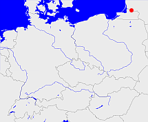
Diese Karte zeigt die Position oder den Umriss des Objekts. Haben Sie einen Fehler entdeckt? Dann würden wir uns über eine Nachricht freuen.
Übergeordnete Objekte
Legende
| | politische Verwaltung |
| | kirchliche Verwaltung |
| | gerichtliche Verwaltung |
| | Wohnplatz |
| | geographische Typen |
| | Verkehrswesen |
Übergeordnete Objekte
- Kallkappen (Landgemeinde)
- Tilsit (Kreis Landkreis)
- Gumbinnen (Regierungsbezirk)
- Preußen, Ostpreußen, Prusse orientale, East Prussia, Rytu Prusija, Восточная Пруссия, Prusy Zachodnie (Provinz)
- Preußen, Pruisen, Pruissen (Herzogtum Königreich Freistaat)
- Deutscher Bund, German Confederation (Staatenbund)
- Norddeutscher Bund (Staatenbund Bundesstaat)
- Deutsches Reich, German Empire, Duitse Rijk (Bundesstaat)
- Völkerbund, Société des Nations, League of Nations, Sociedad de Naciones, Folkeforbundet, 國際聯盟, Liga Narodów, Volkenbond, 国際連盟, Società delle Nazioni, Milletler Cemiyeti, Sociedade das Nações (Staatenbund)
- Preußen (Provinz)
- Preußen, Pruisen, Pruissen (Herzogtum Königreich Freistaat)
- Deutscher Bund, German Confederation (Staatenbund)
- Norddeutscher Bund (Staatenbund Bundesstaat)
- Deutsches Reich, German Empire, Duitse Rijk (Bundesstaat)
- Völkerbund, Société des Nations, League of Nations, Sociedad de Naciones, Folkeforbundet, 國際聯盟, Liga Narodów, Volkenbond, 国際連盟, Società delle Nazioni, Milletler Cemiyeti, Sociedade das Nações (Staatenbund)
- Kleinlitauen, Preußisch-Litauen, Prūsų Lietuva, Mažoji Lietuva (Landschaft)
- Preußen, Ostpreußen, Prusse orientale, East Prussia, Rytu Prusija, Восточная Пруссия, Prusy Zachodnie (Provinz)
- Preußen, Pruisen, Pruissen (Herzogtum Königreich Freistaat)
- Deutscher Bund, German Confederation (Staatenbund)
- Norddeutscher Bund (Staatenbund Bundesstaat)
- Deutsches Reich, German Empire, Duitse Rijk (Bundesstaat)
- Völkerbund, Société des Nations, League of Nations, Sociedad de Naciones, Folkeforbundet, 國際聯盟, Liga Narodów, Volkenbond, 国際連盟, Società delle Nazioni, Milletler Cemiyeti, Sociedade das Nações (Staatenbund)
- Preußen, Pruisen, Pruissen (Herzogtum Königreich Freistaat)
- Deutscher Bund, German Confederation (Staatenbund)
- Norddeutscher Bund (Staatenbund Bundesstaat)
- Deutsches Reich, German Empire, Duitse Rijk (Bundesstaat)
- Völkerbund, Société des Nations, League of Nations, Sociedad de Naciones, Folkeforbundet, 國際聯盟, Liga Narodów, Volkenbond, 国際連盟, Società delle Nazioni, Milletler Cemiyeti, Sociedade das Nações (Staatenbund)
- Sowetskij Stadtsowjet, Советский городской совет WEBER (Stadtrat)
- Kenigsbergskaja Oblast, Kaliningrader Oblast, Кёнигсбергская область, Калининградская область, Kaliningradskaja oblast (Oblast)
- Russische SFSR, Russische Föderation, Russland, Russie (la Féderation de), Russian Federation, Rusland, Russia, Российская Советская Федеративная Социалистическая Республика (РСФСР), Российская Федерация, Россия (Republik Unionsrepublik Republik)
- UdSSR, Union der Sozialistischen Sowjetrepubliken, Sowjetunion, Union of Soviet Socialist Republics, USSR, Союз Советских Социалистических Республик, СССР, Soviet Union, Советский Союз, USSR, Unie van Socialistische Sovjetrepublieken (Bundesstaat)
- Vereinte Nationen, Organización de las Naciones Unidas, Organisation des Nations unies, 联合国, Организация Объединённых Наций, الأمم المتحدة, United Nations, Verenigde Naties, Organizácia Spojených národov (Staatenbund)
- Tilsit (Stadtkreis)
- Gumbinnen (Regierungsbezirk)
- Preußen, Ostpreußen, Prusse orientale, East Prussia, Rytu Prusija, Восточная Пруссия, Prusy Zachodnie (Provinz)
- Preußen, Pruisen, Pruissen (Herzogtum Königreich Freistaat)
- Deutscher Bund, German Confederation (Staatenbund)
- Norddeutscher Bund (Staatenbund Bundesstaat)
- Deutsches Reich, German Empire, Duitse Rijk (Bundesstaat)
- Völkerbund, Société des Nations, League of Nations, Sociedad de Naciones, Folkeforbundet, 國際聯盟, Liga Narodów, Volkenbond, 国際連盟, Società delle Nazioni, Milletler Cemiyeti, Sociedade das Nações (Staatenbund)
- Preußen, Pruisen, Pruissen (Herzogtum Königreich Freistaat)
- Deutscher Bund, German Confederation (Staatenbund)
- Norddeutscher Bund (Staatenbund Bundesstaat)
- Deutsches Reich, German Empire, Duitse Rijk (Bundesstaat)
- Völkerbund, Société des Nations, League of Nations, Sociedad de Naciones, Folkeforbundet, 國際聯盟, Liga Narodów, Volkenbond, 国際連盟, Società delle Nazioni, Milletler Cemiyeti, Sociedade das Nações (Staatenbund)
- Preußen, Ostpreußen, Prusse orientale, East Prussia, Rytu Prusija, Восточная Пруссия, Prusy Zachodnie (Provinz)
- Preußen, Pruisen, Pruissen (Herzogtum Königreich Freistaat)
- Deutscher Bund, German Confederation (Staatenbund)
- Norddeutscher Bund (Staatenbund Bundesstaat)
- Deutsches Reich, German Empire, Duitse Rijk (Bundesstaat)
- Völkerbund, Société des Nations, League of Nations, Sociedad de Naciones, Folkeforbundet, 國際聯盟, Liga Narodów, Volkenbond, 国際連盟, Società delle Nazioni, Milletler Cemiyeti, Sociedade das Nações (Staatenbund)
- Preußen, Pruisen, Pruissen (Herzogtum Königreich Freistaat)
- Deutscher Bund, German Confederation (Staatenbund)
- Norddeutscher Bund (Staatenbund Bundesstaat)
- Deutsches Reich, German Empire, Duitse Rijk (Bundesstaat)
- Völkerbund, Société des Nations, League of Nations, Sociedad de Naciones, Folkeforbundet, 國際聯盟, Liga Narodów, Volkenbond, 国際連盟, Società delle Nazioni, Milletler Cemiyeti, Sociedade das Nações (Staatenbund)
- Preußen (Provinz)
- Preußen, Pruisen, Pruissen (Herzogtum Königreich Freistaat)
- Deutscher Bund, German Confederation (Staatenbund)
- Norddeutscher Bund (Staatenbund Bundesstaat)
- Deutsches Reich, German Empire, Duitse Rijk (Bundesstaat)
- Völkerbund, Société des Nations, League of Nations, Sociedad de Naciones, Folkeforbundet, 國際聯盟, Liga Narodów, Volkenbond, 国際連盟, Società delle Nazioni, Milletler Cemiyeti, Sociedade das Nações (Staatenbund)
- Tilsit (Maria Himmelfahrt), Tilsit (Pfarrei)
- Tilsit, Stadtkiche (Kirchspiel)
Übergeordnete Objekte
Quicktext
KALPENKO05WB
	 TEXT: kein russischer Name bekannt :TEXT,
	gehört 1907 zu object_164609 sagt source_190237 (S.294/295),
	gehört 1907 zu object_292765 sagt source_190237 (S.294/295),
	gehört 1992 zu object_214262 sagt source_190262 (Eingemeindung nach Sovetsk),
	gehört ab 1919-04-01 bis 1945 zu object_190261 sagt source_290143,
	gehört bis 1919-03-31 zu object_1043193 sagt source_190237 sagt source_290143,
	hat w-Nummer 50212,
	heißt  (auf deu) Kallkappen sagt source_190237 (Wohnplatz 37.53),
	ist (auf deu) Wohnplatz,
	liegt bei 55.0636°N 21.8833°O;


